
Business Details
48 Years
experience
Expert Land Surveying Services in Aiken, SC
Established in 1978, Tripp Land Surveying has dedicated itself to delivering precise, efficient, and cost-effective land surveying solutions. Licensed in both South Carolina and Georgia, our team combines decades of experience with cutting-edge technology, including robotic systems, GPS, and advanced software like Carlson Survey and Civil 3D 2018. We serve private and governmental clients across the Central Savannah River Area, prioritizing accuracy and client satisfaction. Our commitment to innovation ensures seamless project execution without unnecessary conversions or delays.With consistent positive feedback from clients, we emphasize professionalism, transparency, and timely service. As a locally owned business, we pride ourselves on fostering trust through reliable communication and high-quality results. Our expertise spans boundary surveys, topographic mapping, and construction staking, tailored to meet diverse project requirements. This enduring focus on excellence has solidified our reputation as a trusted partner in the surveying industry.
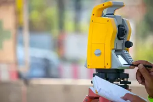


Services
Land Surveying
Boundary Surveys
Topographic Mapping
Construction Staking
ALTA/NSPS Surveys
Details
- Year established: 1978
Highlights and features
- We offer over 45 years of experience in professional land surveying.
- We utilize advanced GPS and robotic technology for maximum accuracy.
- Our team is licensed in both South Carolina and Georgia.
- We provide seamless project execution with Carlson Survey and Civil 3D software.
- Our clients consistently praise our timely, professional, and cost-effective service.
What people say
Timely fashion
Incredibly kind
Exceptional quality
Highly recommend
Friendly competent staff
Services
Land Surveying
Tripp Land Surveying delivers precise land surveying services using GPS and robotic technology. Our expertise ensures accurate boundary determination and mapping for residential, commercial, and governmental projects. With over 45 years of experience, we provide reliable data to support construction, legal, and development needs.
Topographic Mapping
We create detailed topographic maps using advanced surveying tools and Civil 3D software. These maps document natural and man-made features, aiding in land development and engineering projects. Our focus on accuracy ensures clients receive actionable data for site planning and design.
Construction Staking
Our construction staking services guide infrastructure projects with precise field markings. Using digital models and robotic systems, we ensure alignment with design plans. This service supports efficient grading, utilities installation, and building layout for contractors and developers.
Questions
What services does Tripp Land Surveying offer?
We provide land surveying, boundary determination, topographic mapping, construction staking, and ALTA/NSPS surveys using advanced GPS and robotic technology.
In which areas do you operate?
We serve the Central Savannah River Area, including Aiken, South Carolina, and Augusta, Georgia, with licensed operations in both states.
How long has your company been in business?
Tripp Land Surveying has provided professional surveying services since 1978, with over 45 years of experience in the industry.
What technology do you use for surveys?
We utilize GPS systems, robotic total stations, Carlson Survey software, and Civil 3D 2018 to ensure accurate and efficient project execution.
Are your surveyors licensed?
Yes, our team is licensed to practice in both South Carolina and Georgia, ensuring compliance with state-specific regulations and standards.