Business Details
22 Years
experience
Your Trusted Land Surveying Partner in Savannah, SC
Atlas Surveying was founded in 2004 with a clear mission: to become the premier land surveying company in the Southeastern United States. Our commitment to precision, professionalism, and client satisfaction has driven our growth from a single office to a 100+ person firm with locations in Savannah/Hilton Head, Charleston, Charlotte, and Greenville/Spartanburg. We prioritize continuous advancement opportunities for our team, ensuring our professionals remain at the forefront of industry innovation. Our expertise spans ALTA/NSPS surveys, subsurface utility engineering, drone mapping, and GPS support, serving diverse industries with cutting-edge technology. We deliver accurate data critical for infrastructure development, emphasizing timely execution and competitive pricing.Client relationships are foundational to our success, built on trust and demonstrated through projects like the Savannah-Hilton Head Airport Runway 28 Improvements and Clemson University collaborations. Our use of ground-penetrating radar and machine control systems underscores our technological leadership. With 43 field crews and 76 trucks, we combine operational scale with meticulous attention to detail. Our growth strategy includes expanding into new markets such as Columbia, Raleigh, and Atlanta while maintaining our core values. We measure success through client testimonials highlighting our responsiveness, site restoration practices, and error-free data delivery.
Services
ALTA/NSPS Surveys
Bathymetric Survey
Borrow Pit Survey
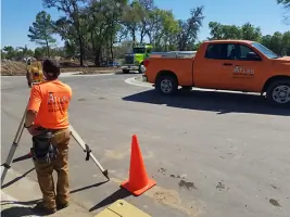
Construction Staking
Drone Mapping
FEMA Flood Certificates
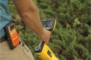
Subsurface Utility Engineering
Tree Surveys
Topographic Surveys
GPS Support
Details
- Year established: 2004
Highlights and features
- We deliver error-free data critical for infrastructure development
- Our 100+ team members use cutting-edge GPS and GPR technology
- 43 field crews ensure rapid response across multiple states
- Proven track record with major projects like Clemson University collaborations
- We restore job sites to better condition than found
What people say
Excellent to work with
Job well done
Accurate data
Responsive
Competitive fee schedule
Services
Subsurface Utility Engineering
Our SUE services combine civil engineering and ground-penetrating radar to locate underground utilities with quality levels B, C, & D. We provide precise CAD drawings for accurate project planning. This service helps prevent costly construction errors while maintaining compliance with industry standards.
Drone Mapping
We utilize advanced drone technology for high-resolution topographic mapping and construction monitoring. Our UAV surveys cover large areas quickly while maintaining sub-inch accuracy. This technology enhances data collection efficiency for projects like highway improvements and land development.
ALTA/NSPS Surveys
Our ALTA-certified surveys meet strict industry standards for commercial property transactions. We deliver detailed boundary analysis with easement documentation and title report integration. These surveys are essential for real estate deals and development projects requiring precise legal descriptions.
Construction Staking
We provide precise field layout for infrastructure projects using robotic total stations and GPS systems. Our staking ensures accurate placement of buildings, roads, and utilities. This service supports major projects like the I-95 Safety Improvements and SC Ports Authority developments.
FEMA Flood Certificates
Our certified professionals prepare flood elevation certificates for property compliance. We analyze flood risk data and create documentation required for insurance and permitting. This service helps clients navigate floodplain management regulations efficiently.
Questions
What surveying services does Atlas offer?
We provide ALTA/NSPS surveys, subsurface utility engineering, drone mapping, construction staking, FEMA flood certificates, and topographic surveys using advanced GPS and GPR technology.
Which areas do you serve?
We operate in Savannah/Hilton Head, Charleston, Charlotte, Greenville/Spartanburg, and expanding markets including Raleigh, Jacksonville, and Atlanta.
How do you ensure survey accuracy?
We use ground-penetrating radar, robotic total stations, and GPS systems with quality control processes that maintain sub-inch precision across all projects.
Can you handle large infrastructure projects?
Yes, our 43 field crews and 76 trucks support complex projects like highway improvements and airport runway developments with proven execution capabilities.
What industries do you work with?
We serve construction firms, government agencies, and developers on commercial, residential, and public works projects requiring precise survey data.