Business Details
49 Years
experience
Professional Land Surveying Services in Milford, OH
Established in 1977 by Jimmy Lansdale, our company has been a trusted provider of land surveying services in the Greater Cincinnati and Northern Kentucky areas. In 1995, Jay Olberding, Mr. Lansdale's original employee, acquired the business and continued its legacy of excellence. We specialize in boundary surveys, lot splits, ALTA/ACSM surveys, topographic surveys, construction staking, and more, utilizing the latest high-tech tools to ensure precision and reliability. Our team maintains active memberships with leading industry organizations, including the Professional Land Surveyors of Ohio and the National Society of Professional Surveyors.Licensed in both Ohio and Kentucky, we pride ourselves on delivering efficient, accurate, and affordable solutions tailored to residential and commercial needs. With decades of combined experience, our skilled professionals ensure every project adheres to evolving planning laws and client expectations. We prioritize transparency, client satisfaction, and technical expertise, establishing ourselves as a reputable leader in the surveying industry. Our commitment to quality and competitive pricing has earned us a loyal clientele and positive recognition in the communities we serve.

Services
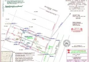
Boundary Surveys
Lot Splits
ALTA/ACSM Surveys
Topographic Surveys
Construction Staking
Flood Elevation Certificates
Site Plans
Legal Descriptions
Details
- Year established: 1977
Highlights and features
- We are licensed in Ohio and Kentucky.
- We use the latest high-tech tools for quality service.
- Our team stays updated with planning laws for accurate advice.
- We offer affordable services with skilled surveyors.
- We are members of PLSO, KAPS, NSPS, and NFIB.
What people say
Highest quality
Return customer
Free boundary markers
Price below estimate
Highly recommend
Services
Boundary Surveys
We conduct comprehensive boundary surveys to define property lines with precision. Our services ensure legal compliance and clarity for residential and commercial landowners. Utilizing advanced technology, we deliver reliable results tailored to your development or purchase needs.
Construction Staking
Our construction staking services guide accurate project execution by marking physical locations for buildings and infrastructure. We ensure alignment with design plans, supporting efficient construction processes for commercial and residential developments.
ALTA/ACSM Surveys
We provide ALTA/ACSM surveys to meet stringent title insurance requirements. These detailed assessments identify property boundaries, easements, and improvements, ensuring transparency for commercial real estate transactions and legal documentation.
Topographic Surveys
Our topographic surveys map natural and man-made features to support land development. These surveys provide critical elevation data for engineering and architectural planning, ensuring informed decision-making for complex projects.
Flood Elevation Certificates
We issue flood elevation certificates to determine flood risk and insurance requirements. These documents verify compliance with FEMA regulations, offering property owners accurate data to secure appropriate coverage and mitigate potential hazards.
People
Jay Olberding
President
President and owner since 1995, Jay brings decades of surveying expertise to lead our team in delivering precise and reliable land surveying solutions for residential and commercial clients.
Mark Harding
Vice President
Vice President Mark Harding oversees daily operations, ensuring efficient project execution. With extensive experience in land development, he provides strategic guidance to maintain our high standards of accuracy and client satisfaction.
Jeff Houchin
Surveyor
Surveyor Jeff Houchin specializes in field data collection and boundary analysis. His technical proficiency and attention to detail ensure every project meets regulatory requirements and client expectations with exceptional precision.
Questions
What services do you offer?
We specialize in boundary surveys, construction staking, ALTA/ACSM surveys, topographic surveys, flood elevation certificates, and legal descriptions for residential and commercial clients.
Do you serve areas outside Cincinnati?
While we primarily serve Greater Cincinnati and Northern Kentucky, we can travel to other locations. Contact us at 513-831-9970 to discuss your specific needs.
Are your surveyors licensed?
Yes, our team is fully licensed in Ohio and Kentucky, ensuring compliance with state regulations and industry standards for all surveying projects.
How do you ensure accuracy?
We use advanced technology and stay updated with planning laws to guarantee precise measurements and legally compliant results for every surveying task.
What makes your services affordable?
Our skilled surveyors complete projects efficiently, minimizing costs while maintaining high-quality standards. We focus on delivering value without compromising accuracy or reliability.
How can I get a free estimate?
Contact us at 513-831-9970 or via email to request a free estimate. Our team will assess your project requirements and provide a detailed cost overview.