Business Details
21 Years
experience
Your Trusted Partner for Engineering & Surveying Solutions
Founded in 2005, Willis Engineering & Surveying brings over 25 years of combined expertise in civil engineering and land surveying to Central Ohio. Our team, led by Professional Engineer and Surveyor Todd Willis, delivers precise boundary surveys, site development plans, and floodplain analysis for residential, commercial, and public infrastructure projects. With a track record of successful developments like Linnridge Meadows Estates and Fixari Family Dental, we prioritize accuracy, client collaboration, and timely execution. Our clientsranging from real estate developers to municipal administratorsrely on our technical proficiency and commitment to solving complex challenges.We maintain transparency in all communications, ensuring clients understand project scopes, timelines, and deliverables. Our competitive pricing and focus on quality have earned us repeat business and referrals from satisfied partners like Terry Tackett Real Estate and Heritage Title. By staying current with industry standards and FEMA regulations, we provide solutions that meet evolving regulatory requirements while safeguarding client interests. Our dedication to excellence has solidified our reputation as a trusted partner in Central Ohio's development landscape.
Services
Boundary Surveys
Property Line Staking
Site Development
Subdivisions
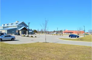
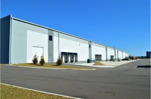
Commercial Development
Floodplain Studies
Elevation Certificates
Public Infrastructure Engineering
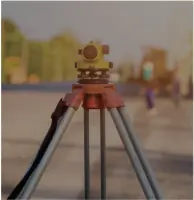
Topographic Surveys
Storm Water Management
Details
- Year established: 2005
Highlights and features
- We offer 25+ years of combined experience in civil engineering and land surveying.
- Our team includes licensed Professional Engineers and Surveyors on every project.
- We provide accurate FEMA floodplain analysis and documentation.
- Our clients consistently praise our on-time delivery and problem-solving skills.
- We serve both public and private sectors with tailored infrastructure solutions.
What people say
Most dependable company
Top-notch expertise
On time and on budget
Excellent problem-solving
Accurate documentation
Services
Boundary Surveys
Our boundary surveys establish precise property lines using advanced geospatial technology. We analyze historical records and conduct field measurements to resolve disputes, support real estate transactions, and ensure compliance with local regulations. Clients receive detailed documentation for legal and development purposes.
Site Development
We design comprehensive site development plans for residential and commercial projects. Services include stormwater management, utility layout, and road design. Our solutions balance regulatory requirements with functional infrastructure to optimize land use and long-term viability.
FEMA Floodplain Analysis
Our FEMA-certified floodplain analysis identifies risk zones and elevation requirements. We prepare documentation for LOMA/LOMR applications and design mitigation systems like stormwater ponds. This service helps clients reduce insurance costs and meet building code requirements.
Subdivisions
We manage subdivision projects from concept to final plat approval. Our work includes lot layout, roadway design, and utility infrastructure planning. We coordinate with municipalities to ensure compliance with zoning laws and environmental standards.
Elevation Certificates
We provide FEMA elevation certificates to determine flood risk for insurance purposes. Our surveys measure building elevations relative to floodplains, enabling accurate risk assessment and potential flood insurance savings for property owners.
People
Todd Willis
Owner/Professional Engineer & Surveyor
Todd Willis, a licensed Professional Engineer and Surveyor, founded the company in 2005 after working with Columbus engineering firms. He holds a BS in Civil Engineering from Ohio State University and has over 30 years of experience in municipal and transportation projects.
Questions
What services does Willis Engineering and Surveying offer?
We provide boundary surveys, site development plans, FEMA floodplain analysis, subdivisions, elevation certificates, and public infrastructure engineering for residential, commercial, and municipal clients.
How long has the company been in business?
Willis Engineering and Surveying was founded in 2005, though our team has over 25 years of combined experience in civil engineering and land surveying.
Do you handle both residential and commercial projects?
Yes, we serve both sectors with projects ranging from dental offices to industrial warehouses and residential subdivisions like Heritage Ponds.
What areas do you serve?
We primarily work in Central Ohio counties including Licking, Delaware, Franklin, and Pickaway, with projects from Millersport to Canal Winchester.
How do you handle complex regulatory requirements?
Our team specializes in FEMA compliance and municipal coordination, ensuring projects meet all regulatory standards while minimizing delays for clients.
Can you assist with flood insurance requirements?
Yes, we provide FEMA elevation certificates and floodplain analysis to help clients reduce insurance costs and meet building code requirements.