Business Details
12 Years
experience
Professional Surveying and Mapping Services for Energy & Construction
Established in 2014 by industry veterans Kent Dyson, James Kantola, and Ron Nelson, Open Range Field Services has built a reputation for delivering precise geospatial solutions to the energy and construction sectors. Headquartered in Pampa, Texas, our team combines decades of collective experience with cutting-edge technology to provide responsive, innovative surveying services. We specialize in pipeline routing, construction staking, land surveying, and unmanned aerial systems (UAS) to support infrastructure development across multiple states. Our licensed professionals operate in 19 states, offering tailored solutions for midstream, upstream, and renewable energy projects. With FAA-certified drone operators and expertise in volumetric calculations, we ensure accuracy in every phase of your project.Our commitment to quality is reflected in our client testimonials, which highlight our technical excellence and dedication to meeting deadlines. From boundary surveys to tree preservation plans, we prioritize client collaboration and technical precision. Our teams extensive experiencespanning over 40 years in some casesensures reliable execution of complex surveying challenges. We maintain rigorous standards through continuous training and investment in advanced mapping technologies. By focusing on clear communication and meticulous data collection, we help clients avoid costly errors and project delays.

Services
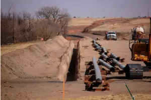
Pipeline Routing
Construction Staking
Land Surveying
UAS Services
Tree Surveys
Volumetric Surveying
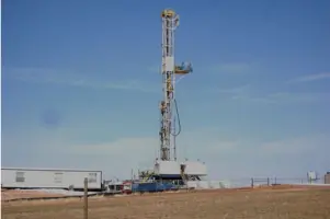
Well Staking
Telecom Surveying
Renewable Energy Surveying
As-Built Surveying
Details
- Year established: 2014
Highlights and features
- We offer 11+ years of specialized experience in energy infrastructure surveying
- Our team holds licenses in 19 U.S. states for nationwide project coverage
- We utilize FAA-certified UAS technology for aerial mapping solutions
- We guarantee precise volumetric calculations for containment structures
- Our client-focused approach ensures responsive support throughout projects
What people say
Fantastic team
Best there is
Hands down the best
Great job explaining
Responsive and innovative
Services
Pipeline Routing
Our pipeline routing service ensures optimal alignment for midstream projects. We create detailed route maps, crossing permits, and HDD profiles to prevent costly delays. With expertise in transmission systems, we deliver efficient routing solutions that meet regulatory requirements while maintaining project timelines.
UAS Services
Our FAA-certified UAS services provide high-resolution aerial mapping. Using drone technology, we create digital surface models and progress imagery for construction monitoring. We offer cost-effective solutions even in restricted flight zones through manned aircraft alternatives for large-scale projects.
Land Surveying
We conduct precise land surveys for commercial development and title verification. Our services include ALTA/NSPS standards, FEMA elevation certificates, and ranch boundary mapping. With extensive experience in property plats, we ensure accurate data for land investments and development projects.
Tree Surveys
Our tree surveys comply with Texas Hill Country ordinances. We create Tree Preservation Plans that meet local regulations, helping clients maintain project timelines. Our experts document tree locations and develop preservation strategies for planners and landscape architects.
Volumetric Surveying
We calculate material volumes for containment structures and stockpiles. Using 3D modeling from terrestrial and aerial data, we determine capacities for frac-ponds, landfills, and excavation projects. Our precise measurements support construction monitoring and resource management.
People
Kent Dyson
Vice President/General Operations Manager
With 44 years of industry experience, Kent Dyson co-founded Open Range Field Services. He oversees general operations and ensures technical excellence across all projects while maintaining client relationships.
James Kantola
CFO/Field Operations Manager
James Kantola brings 35 years of surveying expertise as CFO and field operations manager. He manages financial operations while ensuring field crews maintain quality standards during construction staking and pipeline projects.
W. Andrew McLaughlin
Senior Project Manager/RPLS
Senior Project Manager Andrew McLaughlin has 27 years of experience and holds RPLS certifications in eight states. He leads complex surveying projects with expertise in regulatory compliance and technical execution.
Janssen Robichaux
Project Manager/RPLS
Project Manager Janssen Robichaux manages survey operations with RPLS certifications in nine states. His 13 years of experience focus on delivering accurate data solutions for energy infrastructure projects.
Codi Lamberson
HR/Office Manager
HR/Office Manager Codi Lamberson oversees personnel and administrative operations. With 33 years of experience, she ensures smooth organizational functioning while supporting field operations from the corporate office.
Questions
What surveying services do you offer for energy projects?
We provide pipeline routing, well staking, and as-built surveying for midstream and upstream energy projects.
Do you operate outside Texas?
Yes, we hold licenses in 19 U.S. states including Oklahoma, New Mexico, and Louisiana.
Can you perform aerial mapping with drones?
Our FAA-certified UAS services offer drone mapping and aerial imagery for construction monitoring.
How do you handle tree ordinance compliance?
We create Tree Preservation Plans that meet Texas Hill Country regulations and local agency requirements.
What construction staking services are available?
We provide commercial, pipeline, and utility staking with precise layout for roadways and infrastructure projects.
Do you offer volumetric calculations for containment structures?
Yes, we calculate capacities for frac-ponds, landfills, and containment berms using 3D modeling technology.