Business Details
50+ Years
experience
Expert Surveying and Mapping Services in the Southeast U.S.
Founded in 1972, Southeastern Surveying Corporation (SSMC) is an independent, employee-owned firm specializing in surveying, mapping, subsurface utility engineering (SUE), and geographic information systems (GIS). With over five decades of experience, we have grown into Floridas largest surveying firm and a leader in responsiveness, service, and quality. Our commitment to cutting-edge technology ensures precision, safety, and efficiency in every project. As a 100% employee-owned company, we foster a culture of accountability and innovation, delivering tailored solutions for clients across the Southeastern United States. Our expertise spans construction support, asset management, transportation, utilities, and land development, supported by a disciplined approach to quality assurance and client collaboration.Recognized as a Silver Partner in the Esri Partner Network, we integrate advanced tools like LiDAR, mobile imaging, and GIS to transform data into actionable insights. Our teams dedication to excellence is reflected in long-standing client relationships and a track record of completing complex projects ahead of schedule. We prioritize transparency, ethical standards, and community engagement, ensuring trust and reliability in every interaction. With offices across Florida, Alabama, and North Carolina, we provide rapid response times and localized expertise to meet diverse industry needs.
Services
Construction Support
Subsurface Utility Engineering
GIS Services
Remote Sensing/LiDAR
Hydrographic Surveys
Asset Management
Transportation Projects
Municipal Services
Land Development
Water Management
Details
- Year established: 1972
Highlights and features
- We have over 50 years of experience in geospatial services.
- Our 100% employee-owned structure ensures accountability and innovation.
- We utilize state-of-the-art technology like LiDAR and GIS.
- We provide rapid response times across the Southeast U.S.
- Our team holds industry certifications in surveying and mapping.
What people say
Professional and can-do attitudes
Completed task ahead of schedule
No underground utilities damaged
Tireless diligence in data preparation
Great and trustworthy professionals
Services
Construction Support
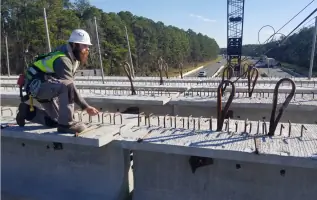
Our construction support services include land surveys, GPS control, utility location, and as-built surveys. We utilize advanced technologies to ensure precision, reduce budgets, and streamline project timelines. Our team provides quality assurance through standardized procedures, serving contractors and developers across the Southeast U.S.
Subsurface Utility Engineering
Subsurface Utility Engineering (SUE) involves locating and mapping underground utilities using ground-penetrating radar and vacuum excavation. We adhere to ASCE 38-02 standards to ensure accuracy and safety. Our services minimize risks for infrastructure projects in urban and rural environments.
GIS Services
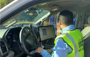
GIS services include data collection, database design, and asset inventory projects. We integrate mobile imaging and 3D survey data to create actionable geospatial solutions. Our Silver Partner status with Esri ensures access to industry-leading software and tools.
Remote Sensing/LiDAR
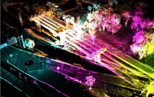
LiDAR mapping generates high-definition 3D data for design and modeling. We process point clouds using TopoDOT software to deliver Revit models and terrain analyses. Applications include power line surveys, volumetric stockpile scans, and corridor improvements.
Hydrographic Surveys
Hydrographic surveys map underwater infrastructure and terrain using sonar and GPS. We support water management districts and coastal projects with bathymetric data. Our methods ensure accuracy for dredging, floodplain mapping, and environmental monitoring.
Questions
What services does Southeastern Surveying and Mapping offer?
We provide construction support, GIS, SUE, LiDAR mapping, and hydrographic surveys for infrastructure and development projects.
Which areas do you serve?
We operate across Florida, Alabama, Georgia, Louisiana, and North Carolina, with offices in Orlando, Jacksonville, Dothan, and Salisbury.
Are your team members certified?
Yes, our professionals hold industry certifications in surveying, GIS, and subsurface utility engineering.
How long has your company been in business?
We were founded in 1972 and have over 50 years of experience in geospatial services.
What sets you apart from competitors?
As a 100% employee-owned firm, we combine advanced technology with personalized service and rapid response times.