
Business Details
4 Years
experience
Your Trusted Land Surveying Partner in Shorewood, IL
JLH Land Surveying has consistently delivered high-quality land surveying services to clients across Illinois, Indiana, Wisconsin, and Arizona. Our commitment to professional excellence and cost-effective solutions ensures that every project meets both client expectations and regulatory standards. Utilizing cutting-edge surveying and drafting technology, we produce precise surveys and maps tailored to individual client needs. Our team conducts thorough research and analysis using advanced software to generate certifiable documents and drawings.Whether you're a commercial property owner, engineer, or lender, our expertise helps protect your interests through accurate land assessments. We prioritize building long-term relationships with clients by maintaining integrity, exceptional service, and timely execution. Our staff works diligently to provide reliable surveying solutions for residential homeowners and industry professionals alike.
Services
ALTA/NSPS Surveys
Boundary Surveys
Topographic Surveys
Subdivision Plats
Aerial Mapping
As-Built Surveys
Details
- Year established: 2022
Highlights and features
- We utilize the latest surveying technology for precise results.
- Our team provides cost-effective solutions tailored to client needs.
- We serve Illinois, Indiana, Wisconsin, and Arizona with local expertise.
- Our staff conducts thorough research using current software for certifiable documents.
- We maintain long-term relationships through timely and reliable service.
Services
ALTA/NSPS Surveys
ALTA/NSPS Land Title Surveys identify property boundaries, easements, and encroachments to protect commercial property investments. These surveys are required by lenders and title companies for mortgage insurance. Our team ensures compliance with industry standards to prevent legal disputes during property transactions.
Boundary Surveys
Boundary Surveys establish property lines and onsite improvements like fences or buildings. We research deeds and easements to verify legal boundaries, helping clients avoid disputes when buying, dividing, or developing land. This service meets regulatory requirements for real estate transactions.
Topographic Surveys
Topographic Surveys document natural and manmade features, including elevation changes and structures. These surveys aid engineers and architects in planning construction projects. We use digital tools to create interactive maps that support grading, drainage, and regulatory compliance for development projects.
Subdivision Plats
Subdivision Plats divide large parcels into smaller lots for residential or commercial development. We consolidate adjacent properties or create new lots while adhering to local zoning laws. This service streamlines land transactions and development projects for individual and commercial clients.
Aerial Mapping
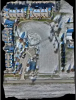
Aerial Mapping uses drones and satellites to capture high-resolution topographic data. This technology enables efficient large-area surveys with precise 3D models and orthophotos. We integrate GIS software for land management, environmental monitoring, and infrastructure planning, reducing fieldwork time and costs.
Questions
What services does JLH Land Surveying offer?
We provide ALTA/NSPS surveys, boundary assessments, topographic mapping, subdivision plats, aerial mapping, and as-built surveys for commercial and residential clients.
Which states do you serve?
Our services cover Illinois, Indiana, Wisconsin, and Arizona for land surveying and mapping needs.
What technology do you use?
We employ the latest surveying equipment, drafting software, and aerial mapping drones for accurate results.
Why choose JLH Land Surveying?
Our team combines technical expertise with timely service to deliver cost-effective, regulatory-compliant land survey solutions.