
Business Details
50+ Years
experience
Your Trusted Land Surveying Partner in New Jersey
Founded in 1975 by Steven R. Kelly, a licensed Professional Land Surveyor and Planner, our firm has dedicated over five decades to delivering precise and reliable surveying solutions. We specialize in residential, commercial, and industrial land surveying, including ALTA/ACSM surveys, FEMA elevation certificates, and drone-based photogrammetry. Our expertise extends to boundary analysis, subdivisions, zoning assessments, and construction layout services, supported by state-of-the-art Trimble GPS and robotic equipment.With licenses in New Jersey and Pennsylvania, we serve a diverse clientele ranging from real estate professionals and legal firms to major industrial developers. Our commitment to technological innovation, combined with personalized service, ensures accurate results tailored to each project's unique demands. Recognized for excellence by the New Jersey Society of Professional Land Surveyors, we maintain a legacy of trust and precision in every survey conducted.
Services
ALTA/ACSM Land Surveys
FEMA Elevation Certificates
Drone Land Surveying
Boundary Analysis
Subdivisions
Zoning Analysis
Topographic Surveys
Construction Plans
Accident Scene Surveys
GPS & Robotic Surveys
Details
- Year established: 1975
Highlights and features
- We have over 50 years of experience in land surveying across NJ and PA.
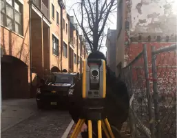
- We use Trimble GPS and robotic equipment for high-precision results.
- Our team includes licensed professionals with expertise in complex projects.
- We serve both large-scale developers and individual real estate clients.
- We guarantee accurate, timely delivery of surveying documentation.
What people say
Fast and efficiently
Very professional
Response time was great
Excellent service
Highly recommend
Services
FEMA Elevation Certificates
FEMA Elevation Certificates determine flood risk for insurance purposes by measuring building elevations against floodplain data. We provide accurate documentation to help clients lower or eliminate flood insurance premiums. Our team has completed thousands of certificates, saving clients substantial costs through precise floodplain analysis.
Drone Land Surveying
Drone-based photogrammetry captures high-resolution topographic data using registered, licensed pilots and insured operations. This technology enables efficient large-area surveys with precision points at 26,600 per second. Ideal for boundary analysis, construction monitoring, and utility inventory projects requiring rapid data collection.
Boundary Analysis
Boundary analysis establishes property lines through historical record research and field measurements. We mark corners and encroachments using GPS and robotic equipment, providing legally compliant documentation for real estate transactions, legal disputes, or development planning with rapid turnaround times.
Topographic Surveys
Topographic surveys create detailed elevation models of land surfaces using laser scanning and GPS technology. These surveys support construction planning, drainage analysis, and environmental assessments by documenting natural and man-made features with high accuracy for engineering and development projects.
Construction Layout
Construction layout services translate architectural plans into physical site markers using robotic total stations and GPS. We ensure precise placement of buildings, utilities, and infrastructure for commercial and industrial developments, maintaining alignment with design specifications throughout the building process.
People
Steven R. Kelly
Founder
Licensed Professional Land Surveyor in NJ (1975) and PA (1976), with over 50 years of experience. Served on multiple professional boards and received presidential citations for industry contributions.
Questions
What is a FEMA Elevation Certificate?
A FEMA Elevation Certificate documents a building's elevation relative to flood levels, determining flood insurance premiums and potential risk mitigation strategies.
How quickly can you complete a survey?
Most residential surveys take 3-5 business days, with emergency services available for urgent requests depending on project complexity and location.
Do you work outside New Jersey?
While based in New Jersey, we serve Pennsylvania and surrounding regions for large-scale projects requiring specialized surveying expertise.
What equipment do you use?
We utilize Trimble GPS and robotic total stations, Auto-Cad/Civil 3D software, and high-precision drones for accurate data collection and mapping.
Can you handle commercial projects?
Yes, we've worked on major developments including airport infrastructure, industrial parks, and large subdivisions with complex surveying requirements.