
Business Details
50+ Years
experience
Trusted Land Surveying & Civil Engineering Services in Vernal, UT
Founded in 1964, Uintah Engineering & Land Surveying (UELS) has established itself as a leader in providing comprehensive land surveying, civil engineering design, permitting, and GIS/mapping services. Our team of dedicated professionals brings decades of combined experience to deliver tailored solutions for clients in the energy, infrastructure, and development sectors. With expertise in oil and gas, renewables, power transmission, and land development markets, we prioritize precision, compliance, and client satisfaction. Our commitment to innovation is reflected in our use of UAV technology and advanced digital mapping tools.We maintain strong relationships with regulatory agencies to streamline permitting processes and ensure projects meet all compliance standards. Our client-centric approach ensures customized solutions, while our competitive pricing model maintains quality without unnecessary costs. With over 60 years of service, we have built lasting partnerships with clients across 22 states, supported by a safety-first culture and continuous staff training. Our mission is to provide reliable, high-quality services that meet the unique demands of each project, leveraging our deep industry knowledge and technical expertise.
Services
Land Surveying
Civil Engineering Design
Permitting
UAV and Drones
GIS and Mapping
Details
- Year established: 1964
Highlights and features
- We offer over 60 years of experience in land surveying and civil engineering.
- Our team includes FAA-licensed drone operators for advanced data collection.
- We provide comprehensive services across 22 states, including permitting and GIS.
- Our client-centric approach ensures tailored solutions for energy and infrastructure projects.
- We maintain a proven safety record and continuous staff training programs.
Associations and certifications
- FAA (Federal Aviation Administration)
Services
Land Surveying
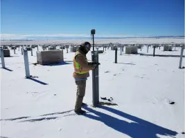
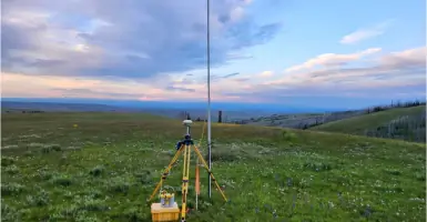
Our land surveying teams are fully equipped and trained to handle projects of all scales, from small residential lots to large industrial sites. Using advanced UAV technology and traditional methods, we deliver precise measurements and boundary determinations. Our services ensure compliance with regulatory standards and support accurate project planning for clients in energy, infrastructure, and development sectors.
Civil Engineering Design
We provide comprehensive civil engineering design for grading, roads, stormwater systems, and structural plans. Our engineers specialize in creating efficient solutions for oil and gas, renewable energy, and municipal projects. Our designs integrate with permitting requirements and prioritize sustainability, ensuring projects meet technical specifications while adhering to budget and timeline constraints.
Permitting
Our permitting experts streamline regulatory compliance for clients across the Rocky Mountain Region. We manage applications for permits, coordinate with agencies, and ensure adherence to federal and state regulations. Services include site assessments, variance requests, and project management to facilitate timely approvals for energy, industrial, and infrastructure developments.
UAV and Drones
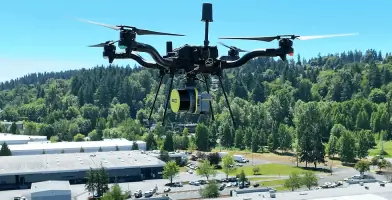
We utilize FAA-licensed drone operations to capture high-resolution aerial data for mapping and inspections. Our UAV services include LiDAR, orthomosaic imaging, and stockpile measurements, offering cost-effective alternatives to traditional surveying. These technologies enhance accuracy and efficiency for projects in construction, energy, and environmental monitoring.
GIS and Mapping
Our GIS consultants create detailed geospatial data and digital maps tailored to client needs. Services include geodatabase management, asset tracking, and custom feature code libraries. We deliver shapefiles, KMZ files, and web-based tools to support permitting, planning, and infrastructure management for energy and civil projects.
People
Tracy Henline
CEO/President
Tracy Henline leads Uintah Engineering & Land Surveying with a focus on strategic growth and client relationships. With decades of industry experience, she ensures the company maintains its reputation for quality and innovation while expanding its service offerings and market reach.
Harold Marshall
EVP/HSE/Engineering VP
Harold Marshall oversees health, safety, and engineering operations at Uintah Engineering. His leadership ensures compliance with safety standards and regulatory requirements, while driving technical excellence across projects in energy and infrastructure sectors.
Zack Herbert
Director of Business Development
Zack Herbert drives business growth and client acquisition for Uintah Engineering. He leverages industry connections and market insights to expand the company's footprint in energy and civil engineering markets across the Intermountain West.
Brandon Bowthorpe
Western/Southern Regional Manager
Brandon Bowthorpe manages regional operations for Uintah Engineering, ensuring project success in Western and Southern markets. His expertise in field logistics and client coordination supports efficient execution of surveying and engineering projects.
Dallas Nielsen
Colorado Area Manager
Dallas Nielsen leads Uintah Engineering's operations in Colorado, focusing on client satisfaction and project delivery. His technical knowledge and regional expertise ensure seamless execution of surveying, permitting, and engineering services in the state.
Questions
What services does Uintah Engineering & Land Surveying offer?
We provide land surveying, civil engineering design, permitting, UAV/drone services, and GIS/mapping for energy, infrastructure, and development projects.
How long has Uintah Engineering been in business?
Founded in 1964, we have over 60 years of experience serving clients across the Intermountain West and beyond.
Which states do you operate in?
We serve 22 states including Arizona, Utah, Wyoming, Colorado, Texas, and New Mexico, with offices in multiple locations.
Do you offer UAV/drone services?
Yes, our FAA-licensed pilots use drone technology for aerial inspections, mapping, and data collection to enhance project accuracy.
How do you ensure project safety?
We maintain a strict safety program with daily check-ins, equipment inspections, and compliance training for all field personnel.