
Business Details
29 Years
experience
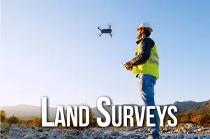
Professional Land Surveying Services Nationwide
GeoLine Surveying has been a trusted leader in the land surveying industry since 1997. Our team of registered land surveyors and experienced professionals brings over 80 years of combined expertise to every project. We specialize in ALTA/ACSM land title surveys, FAA communication tower certifications, and due diligence surveys for commercial, retail, and industrial real estate. Our nationwide network of licensed surveyors ensures seamless service across all 50 U.S. states and Puerto Rico. Clients benefit from a single point of contact throughout each project, managed by seasoned professionals with decades of industry experience.We prioritize strict adherence to project schedules and deadlines, ensuring timely delivery without compromising quality. Every survey undergoes rigorous review by our expert staff to guarantee accuracy and completeness. Our long-standing relationships with trusted subcontractors enable efficient, reliable service for complex projects. From wind farms to solar energy sites, our comprehensive capabilities address diverse surveying needs. Backed by a relentless commitment to excellence, GeoLine Surveying delivers precision and reliability that clients have come to expect over our decades in business.

Services
ALTA/ACSM Surveys
FAA Certifications
Wind Farm Surveys
Solar Farm Surveys
Communication Tower Surveys
Elevation Certificates
Boundary Surveys
Topographic Surveys
As-Built Surveys
Details
- Year established: 1997
Highlights and features
- We provide nationwide surveying coverage across all 50 states and Puerto Rico
- Our team has over 80 years of combined experience in land surveying
- Single point of contact ensures seamless project management from start to finish
- We maintain strict adherence to project schedules and deadlines
- All surveys undergo rigorous review by experienced professional staff
Services
ALTA/ACSM Surveys
Our ALTA/ACSM land title surveys meet the highest industry standards for commercial real estate transactions. These comprehensive boundary surveys include easements, encroachments, and improvements documentation. Clients receive detailed maps and reports that satisfy lender requirements and minimize title insurance risks for property acquisitions and developments.
FAA Certifications
We provide FAA communication tower certification services for new and existing structures. Our surveys verify tower height, location, and obstruction lighting compliance with federal aviation regulations. Clients receive official certification letters required for tower registration and maintenance documentation.
Wind Farm Surveys
Our wind farm surveying services include site boundary determination, turbine location verification, and access road mapping. We support renewable energy developers with precise measurements for project planning and regulatory compliance. Surveys ensure accurate land use documentation for large-scale wind energy installations.
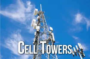
Communication Tower Surveys
We conduct comprehensive surveys for cellular and communication towers including new build, co-location, and as-built documentation. Our services cover site layout, structural verification, and FAA compliance measurements. Clients receive accurate data for tower modifications and network expansion projects.
Elevation Certificates
Our elevation certificates document building elevations relative to flood zones for insurance and compliance purposes. These FEMA-approved surveys help property owners determine flood risk and secure appropriate insurance coverage. We provide detailed elevation data for residential and commercial structures.
People
David Short
President
David Short, President of GeoLine Surveying, has over 30 years of surveying experience. Licensed since 1991, he co-founded the company in 1997 and leads its strategic direction while maintaining active involvement in key projects.
John Brewer
Vice President
John Brewer, Vice President, brings decades of surveying expertise to GeoLine Surveying. With 30+ years in the industry, he co-founded the company in 1997 and oversees technical operations and quality control for all surveying projects.
Questions
What surveying services does GeoLine offer?
We provide ALTA/ACSM land surveys, FAA tower certifications, wind/solar farm surveys, elevation certificates, boundary surveys, and communication tower surveys across all 50 states.
How long has GeoLine Surveying been in business?
GeoLine Surveying has operated since 1997, with our founding partners bringing over 70 combined years of industry experience to the company.
Do you handle nationwide surveying projects?
Yes, we coordinate surveys in all 50 U.S. states and Puerto Rico through our network of licensed surveyors while maintaining centralized project management.
How do you ensure survey accuracy?
All surveys undergo multiple quality checks by our experienced staff, including field verification and office review, to ensure complete accuracy before final delivery.
What makes GeoLine different from other surveyors?
We offer a single point of contact for project management, nationwide coverage with local expertise, and over 80 years of combined experience in complex surveying projects.