Business Details
41 Years
experience
Expert Land Surveying Services in Billings, MT
Kehl Survey Solutions has been a trusted name in land surveying for over four decades, delivering precise and reliable services across Montana and neighboring states. Founded on the expertise of Joe Kehl, who began his career in 1951 with the California State Division of Highways, our company combines decades of hands-on experience with cutting-edge GPS GNSS technology. We specialize in residential, commercial, industrial, oil & gas, telecommunications, and wind farm surveying, offering full turn-key solutions from boundary identification to topographic mapping. Our team, led by Randy Kehl, continues Joe's legacy of integrity and technical excellence, ensuring every project meets the highest standards of accuracy. With a deep understanding of local terrain and regulatory requirements, we provide tailored solutions that address the unique challenges of each client.Our commitment to quality is reflected in our long-standing relationships with clients who return for our thoroughness and dependability. From small residential plots to large-scale industrial projects, we prioritize clear communication and meticulous attention to detail. Our safety-first approach ensures every project is completed efficiently while minimizing risks for both our team and clients. This dedication to professionalism has solidified our reputation as a leader in Montana's surveying industry. Today, we continue to uphold the values established by our founder, combining traditional craftsmanship with modern technological advancements to serve our community's evolving needs.
Services
Residential Surveys
Commercial Surveys
Industrial Surveys
Oil & Gas Surveys
Telecommunications Surveys
Wind Farm Surveys
Mining Staking
Boundary Surveys
Topographic Mapping
Elevation Certificates
Details
- Year established: 1985
Highlights and features
- We offer 65+ years of combined surveying expertise from our founding family.
- Our team uses advanced GPS GNSS technology for maximum accuracy.
- We provide full turn-key survey solutions from start to finish.
- Our family legacy ensures commitment to ethical business practices.
- We maintain strong relationships with repeat clients across multiple industries.
Services
Residential Surveys
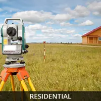
We provide comprehensive residential land surveying services including property corner searches, boundary staking, elevation certificates, and subdivision plats. Our team ensures accurate documentation for home buyers, sellers, and developers while meeting all regulatory requirements. With specialized expertise in flood plain certifications and legal descriptions, we protect property investments through precise measurements and detailed reporting.
Commercial Surveys
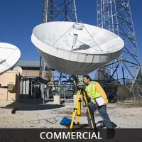
Our commercial surveying solutions include boundary surveys, ALTA/ACSM standards surveys, and elevation certificates for commercial property transactions. We conduct thorough research of title documents and historical records to verify boundary lines while meeting requirements from title companies and lending institutions. Our services ensure accurate property documentation for commercial real estate developments and acquisitions.
Oil & Gas Surveys
We specialize in oil and gas surveying services including well location staking, pad layout surveys, pipeline mapping, and as-built documentation. Our team supports drilling operations with precise measurements for permits, boundary surveys, and unit designations. Using advanced GPS technology, we deliver accurate data for pipeline routes, access roads, and environmental protection areas across challenging terrains.
Telecommunications Surveys
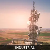
Our telecommunications surveying services include site location analysis, FAA compliance surveys, and 3D laser scanning for cellular tower installations. We provide geodetic control, topographic mapping, and construction staking for new tower sites while ensuring adherence to zoning regulations. Our team supports co-location projects and network expansion with precise measurements and detailed documentation.
Wind Farm Surveys
We offer specialized surveying for wind farm developments including turbine location mapping, access road planning, and environmental protection area delineation. Our team ensures precise positioning of infrastructure while maintaining compliance with regulatory requirements. Using GPS technology, we support quality control for turbine foundations and prepare as-constructed documentation for lease agreements and easement mapping.
People
Joe Kehl
Founder
Joe Kehl began his surveying career in 1951 with CALTRANS, becoming a respected industry leader. He established his own company in the 1980s, combining traditional methods with modern technology. His dedication to precision and client satisfaction formed the foundation of our company's values.
Randy Kehl
President
Randy Kehl joined the family business after studying geology at Montana State University. With experience from US Silica and other companies, he continues his father's legacy through precise surveying and client-focused solutions. He has led the company since 2005 with the same commitment to excellence.
Questions
What surveying services do you offer?
We provide residential, commercial, industrial, oil & gas, telecommunications, wind farm, and mining surveys using advanced GPS technology for precise measurements.
Which areas do you serve?
We operate throughout Montana with experience in Wyoming, North Dakota, and Colorado for various land surveying projects.
How long have you been in business?
Our company has over 65 years of combined surveying experience from our founding family, with formal establishment in the 1980s.
What technology do you use?
We utilize GPS GNSS equipment, high-fidelity total stations, and 3D laser scanning for accurate data collection and mapping.
Do you handle complex surveying projects?
Yes, we specialize in challenging projects including oil & gas infrastructure, wind farms, and large-scale boundary surveys across diverse terrains.