
Business Details
We have been providing professional land surveying services in Virginia for over 30 years. Our expertise spans a wide range of surveying disciplines, ensuring precise and reliable results for every project. With decades of experience, we understand the unique challenges of land surveying in Culpeper and surrounding counties. Our team combines advanced technology with meticulous fieldwork to deliver accurate documentation and stakeouts. We prioritize client satisfaction by maintaining transparent communication and adhering to strict professional standards. Our services are designed to support residential, commercial, and agricultural clients with equal diligence.
We take pride in resolving complex boundary issues and ensuring compliance with state and federal regulations. Our commitment to excellence is reflected in our detailed reports and timely project completion. We continuously invest in professional development to stay current with industry advancements. Our goal is to provide peace of mind by eliminating uncertainties related to land ownership and development. We stand by our work, offering guarantees for accuracy and reliability in every survey we conduct.
We take pride in resolving complex boundary issues and ensuring compliance with state and federal regulations. Our commitment to excellence is reflected in our detailed reports and timely project completion. We continuously invest in professional development to stay current with industry advancements. Our goal is to provide peace of mind by eliminating uncertainties related to land ownership and development. We stand by our work, offering guarantees for accuracy and reliability in every survey we conduct.
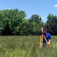
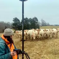

Highlights and features
- We offer 30+ years of land surveying experience in Virginia.
- Our team provides highly accurate and legally defensible survey documentation.
- We specialize in diverse survey types, including ALTA/ACSM and FEMA flood certifications.
- Our services cover Culpeper County and all surrounding jurisdictions.
- We guarantee professional, timely, and transparent surveying solutions.
Services
Boundary Surveys
Our boundary surveys precisely define property lines using advanced GPS and total station technology. This service benefits homeowners, developers, and attorneys resolving property disputes. Clients receive legally binding documentation that prevents future conflicts and ensures compliance with local ordinances.
ALTA/ACSM Surveys
We conduct ALTA/ACSM surveys to meet national standards for commercial property transactions. These surveys detail all physical improvements and encumbrances. Lenders and attorneys rely on our reports for due diligence in real estate acquisitions and refinancing.
FEMA Flood Certifications
Our flood certifications determine properties' flood zone status using FEMA's official data. This service is essential for homeowners and lenders to determine insurance requirements. We provide legally recognized documentation for floodplain management compliance.
Topographic Surveys
We create detailed topographic maps showing elevations, drainage patterns, and natural features. These surveys support engineers and architects in site design and development projects. Clients receive precise data for infrastructure planning and environmental assessments.
Construction Stakeout
Our construction stakeouts mark precise locations for proposed structures using survey control networks. Contractors and developers use these stakes to ensure compliance with design plans. We deliver accurate field markings that prevent costly construction errors.