Business Details
24 Years
experience
Professional Surveying & Mapping Services in Bradenton, FL
Hyatt Survey Services, Inc. has been a trusted leader in professional surveying and mapping for over two decades. Our team combines more than 70 years of collective expertise, delivering precise solutions for boundary, topographic, hydrographic, and geodetic projects across Florida. Certified as a woman-owned business by the State of Florida Office of Supplier Diversity and the Florida Department of Transportation, we serve federal, state, and municipal clients including the US Army Corps of Engineers and South Florida Water Management District. With headquarters in Manatee County, our strategic location enables efficient service delivery throughout Southwest Florida and beyond. Our commitment to technical excellence and client satisfaction has solidified our reputation as a reliable partner for complex surveying challenges.We invest in cutting-edge technology, including UAV/drone capabilities and multibeam sonar systems, to ensure superior data accuracy. Our staff's extensive experience in construction, coastal development, and geospatial analysis supports tailored solutions for engineering and infrastructure projects. As a certified W/MBE and DBE firm, we prioritize diversity while maintaining the highest industry standards. Our 22-year track record reflects our dedication to precision, compliance, and timely project completion. Clients benefit from our comprehensive approach, which integrates fieldwork, data processing, and mapping into seamless service packages.


Services
Boundary Surveys
Topographic Surveys
Construction Surveys
Hydrographic Surveys
Geodetic Control
Multibeam Capabilities
Side Scan Surveys
UAV/Drone Surveys
Equipment Rental
Details
- Year established: 2002
Highlights and features
- Certified woman-owned business with Florida Office of Supplier Diversity
- 22 years of specialized surveying experience across Florida
- Handles complex geodetic, hydrographic, and construction surveys
- Trusted by US Army Corps of Engineers and FDOT
- Strategic Manatee County location for regional accessibility
Associations and certifications
- Florida WBE Certified
- FDOT DBE Certified
- SFWMD SBE Certified
- HC BOCC WBE Certification
Services
Boundary Surveys
Our boundary surveys establish precise property lines using advanced geodetic techniques. This service ensures legal compliance, resolves land disputes, and provides accurate documentation for real estate transactions. Clients receive detailed maps and documentation meeting Florida state standards.
Hydrographic Surveys
We conduct comprehensive hydrographic surveys to map underwater topography for coastal development. Using multibeam sonar technology, we create detailed bathymetric charts essential for marine construction, dredging projects, and environmental monitoring across Florida's waterways.
UAV/Drone Surveys
Our UAV/drone capabilities deliver high-resolution aerial surveys for large-scale projects. This technology enables efficient data collection over difficult terrain, supporting topographic mapping, construction monitoring, and environmental assessments with centimeter-level accuracy.
Geodetic Control
We establish precise geodetic control networks for large infrastructure projects. This service creates accurate reference frameworks that ensure consistency across multiple survey phases, supporting transportation corridors, utility networks, and regional mapping initiatives.
Construction Surveys
Our construction surveys provide exact layout and staking for building projects. Using robotic total stations and GPS technology, we ensure structures align perfectly with design plans, minimizing errors and reducing rework during development projects.
People
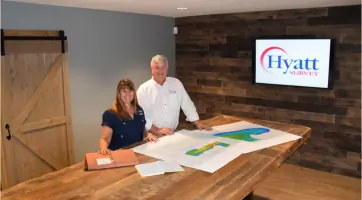
Pamela A. Hyatt
President
President Pamela A. Hyatt leads Hyatt Survey with over 25 years of surveying experience. As a Professional Surveyor and Mapper, she oversees project execution and maintains technical excellence across all services.
Russell P. Hyatt
Vice President
Vice President Russell P. Hyatt manages field operations with extensive expertise in hydrographic and construction surveys. His 20+ years of experience ensure efficient project delivery while maintaining strict adherence to industry standards.
Questions
What surveying services do you offer?
We provide boundary, topographic, hydrographic, geodetic, and construction surveys, along with UAV/drone mapping and multibeam sonar capabilities.
Are you certified for government projects?
Yes, we're Florida WBE certified, FDOT DBE certified, and SFWMD SBE certified to work on state and federal infrastructure projects.
How long have you served Florida clients?
We've delivered surveying solutions across Florida for over 22 years with our Manatee County headquarters supporting regional projects.
What technology do you use?
We employ robotic total stations, GPS systems, multibeam sonar, UAV/drone platforms, and advanced GIS software for accurate data collection.
Can you handle large-scale projects?
Our team's 70+ combined years of experience and equipment fleet enable us to manage complex, multi-phase surveys for major infrastructure developments.