Business Details
20 Years
experience
Professional Land Surveying Services Charleston SC
Atlantic Surveying has been delivering comprehensive land surveying solutions in the Low Country since 1980. Our expertise spans subdivision planning, topographic surveys, boundary adjustments, and construction staking for residential, commercial, and industrial projects. With advanced equipment and a team of licensed professionals, we ensure precision from field data collection to CAD drafting. Our staff includes two South Carolina-licensed Professional Land Surveyors supported by experienced coordinators, combining over 38 years of collective expertise. We specialize in military facilities, road projects, and complex subdivisions while maintaining a commitment to timely, high-quality service.Our team's engineering background enables tailored solutions for roadway systems, utilities, and floodplain management. Active memberships in national surveying societies underscore our dedication to industry standards. Client-focused innovation drives our approach to challenges like flood zone datum transitions and regulatory permitting. Transparency in operations and technical excellence remain central to our client relationships. This enduring focus has solidified our reputation as a trusted partner in land surveying solutions.

Services
Land Surveying
Construction Staking
Flood Zone Analysis
Boundary Surveys
Topographic Mapping
Subdivision Plats
Elevation Certificates
Utility Staking
Wetland Surveys
Regulatory Permitting
Details
- Year established: 2006
Highlights and features
- Licensed surveyors with 38+ years combined experience in South Carolina
- Specialized expertise in military facility and infrastructure projects
- Advanced GPS and CAD technology for precise measurements
- Comprehensive flood zone analysis and elevation certificate services
- Proven track record with 2000+ completed projects since 2006
Services
Land Surveying
Our comprehensive land surveying services cover boundary determination, topographic mapping, and property line adjustments. Using advanced GPS technology, we deliver precise measurements for residential properties, commercial developments, and infrastructure projects. Clients benefit from our expertise in legal descriptions and adherence to South Carolina surveying standards.
Construction Staking
We provide accurate construction staking services for buildings, roads, and utility systems. Our team establishes precise reference points using total stations and GPS equipment. This ensures proper alignment and elevation for projects ranging from single-family homes to large industrial facilities across the Low Country region.
Flood Zone Analysis
Specializing in floodplain determinations and elevation certificates, we help clients navigate FEMA regulations. Our services include LOMA applications and datum conversion analysis during Charleston County's transition to NAVD88 standards. This expertise reduces insurance costs through accurate flood zone documentation.
Subdivision Plats
We create detailed subdivision plats for residential and commercial developments. Our process includes boundary analysis, easement mapping, and regulatory compliance checks. Clients receive engineered plans ready for municipal approval, supported by 40+ years of combined experience in South Carolina land development.
Wetland Surveys
Our wetland survey services identify jurisdictional boundaries and ecological features. Using specialized equipment and regulatory knowledge, we support permitting applications for coastal developments. Clients receive detailed documentation meeting SC DHEC and federal environmental compliance requirements.
People
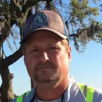
James Kelly Davis
Registered Land Surveyor/Owner
Licensed in SC, GA, and FL with 2000+ completed projects. Specializes in military facility surveys and infrastructure engineering. Graduate of The Citadel with BS in Civil Engineering. Active in multiple national surveying societies.
Sonya deTournillon
Managing Director
27-year management expert with FEMA certifications. Oversees business strategy and client relationships. Holds BS in Education from University of Maryland. Active in Charleston Home Builders Association and sustainability organizations.
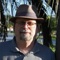
Covert B. Nelson
Registered Land Surveyor
40+ years experience in roadway and utility surveys. Certified in Trimble GPS systems. Notable projects include Walgreens developments and military facility layouts. Active member of professional surveying societies.
Lauren Caughill
Admin and Assistant Researcher
Charleston native with 15 years customer service experience. Assists with property research and FEMA training. Holds associates degree in Hospitality Management. Active in local Jewish community.
Bob Willson
Drafter / Construction Layout Assistant
Carlson/AutoCAD specialist with experience in as-builts and route surveys. Graduate of James Island Charter High School. Combines IT skills with field surveying expertise for diverse project support.
Questions
What surveying services do you offer for residential properties?
We provide boundary surveys, elevation certificates, and construction staking for home builders. Our services support mortgage closings and flood insurance rate reductions through accurate flood zone documentation.
How do you handle commercial development projects?
We offer subdivision plats, topographic mapping, and utility staking for commercial developments. Our team manages regulatory permitting and provides engineered solutions for large-scale infrastructure projects.
What experience do you have with government projects?
We've completed surveys for Navy facilities, Air Force bases, and county road projects. Our team has specific expertise in federal compliance standards for military and public infrastructure developments.
How does the new Charleston County flood map affect property owners?
The transition to NAVD88 datum requires new elevation certificates for all properties. Our team helps clients update documentation to qualify for improved flood insurance rates under the revised mapping system.
What technology do you use for accurate surveying?
We utilize GPS systems, total stations, and Trimble equipment combined with CAD software. This technology ensures precision in boundary determination, construction layout, and topographic mapping across all project types.