Business Details
32 Years
experience
Professional Land Surveying Services in Chesapeake, VA
Since 1995, Alphatec Surveyors has delivered professional surveying support to real estate developers, mortgage title entities, engineers, and homeowners across Southeast Virginia and nearby North Carolina counties. Our commitment to advanced technology, including GPS and unmanned aerial systems, ensures precise 3D terrain modeling and aerial mapping for clients. We specialize in diverse survey types, from mortgage-related assessments to topographic and machine control surveys, prioritizing accuracy and efficiency. Our team combines decades of experience with cutting-edge tools to address complex land and water topography challenges. We serve both large-scale construction projects and individual property needs, maintaining consistent dedication to quality regardless of project scope.Our services streamline site preparation, grading, and drainage planning while adhering to regional regulatory requirements. By integrating digital data delivery systems, we provide faster turnaround times without compromising precision. As a locally rooted firm, we maintain deep familiarity with Virginia and North Carolina land development practices. Our professional affiliations reflect industry-standard expertise in surveying methodologies and technological applications. We offer 24/7 emergency contact options for urgent surveying needs while maintaining regular business hours for standard consultations.
Services
Topographic Surveying
Machine Control Surveys
Mortgage Related Surveys
ALTA/ACSM Surveys
FEMA Elevation Certificates
Hydrographic Surveys
CBPA Plan Surveys
As-Built Surveys
Construction Stakeout
Volumetric Surveys
Details
- Year established: 1994
Highlights and features
- We utilize the latest GPS and UAS technology for accurate 3D terrain modeling
- Our team has over 25 years of regional surveying experience
- We offer comprehensive survey solutions from mortgage assessments to construction stakeout
- Our machine control integration reduces project costs and timelines
- We maintain active professional affiliations demonstrating industry standards compliance
Services
Topographic Surveying
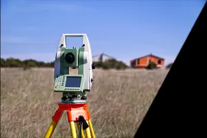
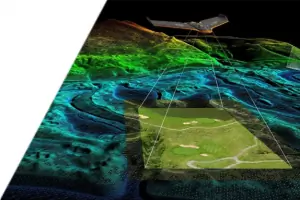
Our topographic surveys create detailed 3D terrain models using GPS and drone technology. This service supports engineering and construction planning by documenting elevation changes and natural features. Clients receive accurate digital deliverables for site analysis and development projects.
Machine Control Surveys
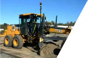
We implement GPS-integrated machine control systems for construction equipment. This technology enables precise grading and excavation control points. Contractors benefit from reduced material waste, faster project timelines, and improved site preparation accuracy for drainage and infrastructure projects.
Mortgage Related Surveys
Our mortgage-related surveys meet lending requirements through ALTA/ACSM standards and FEMA elevation certifications. We address Virginia's unique coastal topography challenges while providing flood risk assessments. Services include boundary verification and property condition documentation for real estate transactions.
Hydrographic Surveys
We conduct in-shore hydrographic surveys for coastal and inland waterway projects. Our methods document underwater terrain and shoreline features using specialized sonar equipment. This service supports environmental assessments, dredging projects, and waterfront development planning in Virginia's tidal regions.
CBPA Plan Surveys
Our CBPA-compliant surveys assess properties within Chesapeake Bay preservation zones. We document sensitive environmental features and buffer areas to meet regulatory requirements. Developers receive detailed plans for sustainable land use while maintaining compliance with Virginia's coastal protection standards.
Questions
What survey services do you offer for mortgage transactions?
We provide ALTA/ACSM land title surveys, FEMA flood elevation certificates, and boundary verification services specifically for mortgage lending requirements in Virginia and North Carolina.
Do you handle large-scale construction projects?
Yes, our machine control integration supports large area grading and earthwork projects with GPS-guided equipment for precise site preparation and drainage planning.
How do you handle coastal area surveys?
We specialize in Virginia's coastal topography challenges using hydrographic survey methods and elevation certifications for waterfront properties and floodplain management.
What technology do you use for surveying?
We employ GPS systems, unmanned aerial vehicles, and machine control technology to deliver 3D terrain models, aerial imagery, and precise construction layout data.
Do you serve areas outside Virginia?
Yes, we provide surveying services throughout Southeast Virginia and extend our coverage to Northeast North Carolina counties.