
Business Details
38 Years
experience
Professional Land Surveying Services in Kodiak, AK
Kodiak Land Surveying has been the longest-running surveying business in Kodiak since 1988. Owned by James Purdy, a lifelong Alaskan with decades of experience, we combine specialized expertise, advanced technology, and a team of seasoned professionals to deliver high-quality land surveying services across Alaska. Our approach emphasizes collaboration with clients, proactive project management, and cost-effective solutions tailored to complex development challenges. With statewide experience in ANCSA allotments, rectangular surveying, and hydrographic projects, we maintain a reputation for on-time, on-budget execution. Our team includes licensed professionals with expertise in geodetic, cadastral, and construction surveying, supported by cutting-edge tools like GPS, robotic instruments, and side-scan sonar.We prioritize client confidentiality, data ownership, and long-term relationships, evidenced by repeat engagements from government entities and construction firms. As a locally rooted business, we offer deep knowledge of Alaskan logistics and regulatory frameworks while maintaining competitive pricing. Our commitment to excellence has earned us recognition as a trusted partner for both public and private sector clients throughout the region.
Services
Construction Surveying
Civil Design Surveying
Hydrographic Surveying
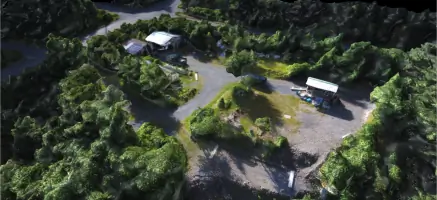
Drone Services
GPS Surveying
Details
- Year established: 1988
Highlights and features
- We offer 25+ years of specialized Alaskan surveying experience
- Our team includes licensed professionals with geodetic and cadastral expertise
- We utilize GPS, robotic instruments, and hydrographic vessel technology
- We maintain competitive pricing with transparent project cost estimates
- Our clients receive direct access to senior surveyors for all projects
What people say
Outstanding product quality
On-time delivery
Deep local expertise
Reliable professionals
Cost-effective solutions
Services
Construction Surveying
Our construction surveying services provide precise measurements and layout guidance for infrastructure projects. Using robotic instruments and GPS technology, we ensure accurate grading, utility placement, and structural alignment. Clients benefit from reduced rework costs and improved project timelines through our proactive field verification processes.
Hydrographic Surveying
We conduct detailed underwater terrain mapping using side-scan sonar and remotely operated vehicles. This service supports coastal engineering, dredging operations, and marine infrastructure projects. Our full hydrographic vessel setup ensures comprehensive data collection for navigation safety and environmental assessments in Alaskan waters.
GPS Surveying
Our GPS surveying solutions deliver high-precision positioning for large-scale land development projects. Utilizing geodetic control networks, we establish accurate reference systems for cadastral boundaries and infrastructure corridors. Clients receive reliable data for regulatory compliance and long-term asset management across remote Alaskan locations.
Drone Services
Our drone division provides aerial photography, 3D mapping, and construction progress monitoring. This technology enables rapid data acquisition for topographic surveys and site inspections. Clients gain cost-effective access to high-resolution visual data for project documentation and stakeholder communication.
Cadastral Surveying
We specialize in legal boundary determinations for ANCSA allotments and public land parcels. Our cadastral experts resolve property disputes and establish defensible land records. Clients benefit from our deep understanding of Alaskan land claims history and regulatory requirements.
People
James Purdy
Principal Surveyor
Licensed since 1988, James has 35+ years of Alaskan surveying experience. He specializes in riparian boundaries and cadastral systems, having worked across six states and Caribbean territories. A graduate of land surveying programs, he brings technical expertise and industry leadership.
David Klein
Sub-Contractor
PLS 9335 with expertise in topographic surveys and GPS geodetic work. Former BLM lead surveyor, David contributes specialized knowledge of Alaskan terrain mapping and cadastral boundary resolution for complex projects.
Charles Akin
Cadastral Specialist
PLS 5131 and partner in Crazy Mountain Joint Venture, Alaska's leading cadastral firm. With deep expertise in Public Land Survey System standards, he provides authoritative boundary determinations for remote properties.
James Mitchell
Geodetic Specialist
PLS 7045 and GPS expert with experience in geodetic control networks. As a Crazy Mountain partner, he delivers high-precision positioning solutions for infrastructure projects requiring millimeter-level accuracy across vast Alaskan landscapes.
Brad Watts
Project Surveyor
PLS 12319 with extensive field experience in boundary surveys and construction staking. Brad manages remote projects requiring specialized logistics planning and delivers practical solutions for challenging terrain conditions.
Questions
What areas do you serve?
We operate statewide in Alaska with specialized expertise in Kodiak, Anchorage, and remote regions requiring advanced logistical capabilities.
What surveying technologies do you use?
Our tools include GPS systems, robotic total stations, digital leveling equipment, side-scan sonar, and drone-based mapping systems for comprehensive data collection.
How do you handle complex boundary disputes?
Our licensed cadastral experts apply Public Land Survey System standards and historical records analysis to resolve disputes with defensible documentation and court-admissible evidence.
Can you support large infrastructure projects?
Yes, we provide geodetic control networks, construction staking, and progress monitoring for transportation, energy, and municipal projects across Alaska's challenging terrain.
Do you offer hydrographic survey capabilities?
Our full hydrographic vessel setup includes remotely operated vehicles and multibeam sonar for underwater mapping, port inspections, and marine construction projects.
How do you ensure project accuracy?
We implement multi-stage verification processes using redundant measurement systems and peer-reviewed calculations to maintain sub-centimeter precision standards.