Business Details
42 Years
experience
Your Trusted Land Surveying Partner in Mt. Pleasant, IA
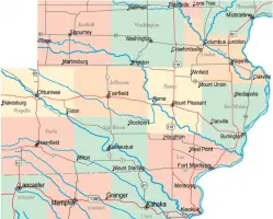
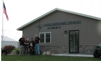
Established in 1984, Lance Surveying Services has built a reputation for precision and reliability in land surveying across Southeast Iowa. Our father-son team combines decades of experience with advanced methodologies to deliver comprehensive solutions for property boundaries, subdivisions, and construction projects. We specialize in ALTA/NSPS surveys, elevation certificates, topographic mapping, and construction staking, ensuring compliance with local regulations and client-specific needs. Our process begins with meticulous research into property history, providing a foundation for accurate boundary determinations. We collaborate closely with realtors, attorneys, and local authorities to streamline real estate transactions and development projects.With licensed professionals in both Iowa and Missouri, we offer expertise that spans multiple jurisdictions. Our commitment to transparency and client education ensures that every project receives tailored attention, from initial research to final documentation. We maintain modern office facilities in Mt. Pleasant while serving both urban and rural properties throughout the region. Our team's deep understanding of evolving zoning laws and subdivision requirements positions us to guide clients through complex regulatory landscapes. For over 40 years, we have prioritized accuracy, ethical standards, and clear communication, establishing trust with generations of clients.
Services
ALTA/NSPS Surveys
Elevation Certificates
Topographic Mapping
Construction Staking
Property Subdivisions
Boundary Retracement
Plat Preparation
Zoning Compliance
Details
- Year established: 1984
Highlights and features
- Family-owned business with 40+ years of combined surveying experience
- Licensed professionals in both Iowa and Missouri jurisdictions
- Specialize in ALTA/NSPS surveys meeting national standards
- Thorough research process prevents boundary disputes and encroachments
- Direct collaboration with local realtors and legal professionals
What people say
40+ years experience
Accurate boundary determination
Professional documentation
Licensed experts
Reliable service
Services
ALTA/NSPS Surveys
Our ALTA/NSPS surveys meet national standards for commercial property transactions. We combine historical research with field measurements to identify boundary lines, easements, and encroachments. This service provides title companies and lenders with detailed documentation for risk assessment.
Elevation Certificates
We prepare elevation certificates for properties in flood-prone areas. Our licensed surveyors measure building elevations relative to flood levels, helping clients obtain accurate flood insurance rates. This service meets FEMA requirements for floodplain management compliance.
Construction Staking
Our construction staking services guide infrastructure projects with precise layout measurements. We mark building corners, utilities, and grading elevations to ensure proper alignment. This service supports residential, commercial, and municipal construction projects across Southeast Iowa.
Property Subdivisions
We create legal property subdivisions through detailed plat preparation. Our process includes boundary determination, topographic mapping, and regulatory compliance. This service enables landowners to divide properties for sale or development while meeting local zoning requirements.
Boundary Retracement
Our boundary retracement services identify existing property lines through historical records and field evidence. We locate original monuments and resolve discrepancies between legal descriptions and physical markers. This service prevents disputes during property transactions or improvements.
People
John H. Lance
Owner
Licensed surveyor with 40+ years experience in Iowa and Missouri. Founded company in 1984 after extensive field work. Specializes in boundary law and historical property research.
Rob Lance
Professional Land Surveyor
Licensed in Iowa since 2010. Joined firm in 2008, continuing family surveying tradition. Focuses on modern surveying technology and client relations.
Ralyn Seberg
Office Manager
Manages administrative operations since joining in 2008. Coordinates project scheduling and client communications. Ensures efficient office workflow for surveying services delivery.
Questions
What types of surveys do you specialize in?
We specialize in ALTA/NSPS surveys, elevation certificates, construction staking, property subdivisions, and boundary retracement for residential and commercial clients.
How are survey costs determined?
Most projects are billed on time-and-materials basis. Costs depend on property size, terrain complexity, and required research. We provide estimates after initial project review.
Do you work outside Southeast Iowa?
While our office serves Southeast Iowa primarily, we have experience working across the state and in Missouri. Travel fees may apply for distant locations.
How long does a typical survey take?
Simple boundary surveys take 1-2 weeks. Complex projects involving subdivisions or construction staking may require several weeks depending on scope and weather conditions.
Are your surveyors licensed?
Yes, both John Lance and Rob Lance hold Iowa professional land surveyor licenses. John also maintains Missouri licensure for multi-state projects.