
Business Details
Your Trusted Land Surveying Partner in Evergreen, CO
At Survey Systems, we have dedicated ourselves to delivering professional land surveying services with an unwavering commitment to quality performance and customer satisfaction. For over 25 years, our team has combined advanced technology with proven project management techniques to execute complex surveying tasks across diverse industries. Our expertise spans high-definition 3D laser scanning, hydrographic surveying, and construction development, ensuring precision and reliability in every project. We prioritize innovation, ethical practices, and employee development, fostering an environment where technical excellence and client partnerships thrive.Our integrated workflow, utilizing state-of-the-art Trimble and Teledyne equipment, enables us to meet strict deadlines while maintaining adherence to USACE, NOAA, and IHO standards. Through critical milestone tracking and proactive problem-solving, we consistently deliver accurate documentation and cost-effective solutions tailored to client needs.

Services
Land Surveying
Hydrographic Surveying
Construction Support
ALTA/NSPS Surveys
3D Laser Scanning
GIS Data Services
Mining Survey Support
FEMA Flood Determinations
Subsurface Utility Engineering
Dam Monitoring
Highlights and features
- We offer 25+ years of specialized surveying expertise across civil, hydrographic, and construction projects.
- Our integrated workflow uses Trimble robotic systems, GPS receivers, and multi-beam sonar for precision.
- Certified surveyors and experienced project managers ensure technical accuracy and timely delivery.
- We adhere to USACE, NOAA, and IHO standards for hydrographic and land surveying practices.
- Proven project management approach guarantees milestone tracking and cost-effective solutions.
Associations and certifications
- SDVOSB Verified
- SBE Certified
- MSHA Trained
Services
Land Surveying
Our land surveying services provide precise boundary determinations and topographic mapping using robotic total stations and GPS technology. We support residential, commercial, and infrastructure projects with accurate control networks and property line monumenting. Our team ensures compliance with state plane coordinate systems and federal surveying standards.
Hydrographic Surveying
Specializing in single-beam and multi-beam sonar systems, our hydrographic surveys assess reservoir volumes, channel clearances, and underwater structures. We deploy specialized vessels and Z-Boats for shallow water access, delivering stage capacity tables and dredge quantity verifications to meet USACE and IHO standards.
Construction Support
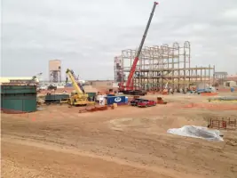
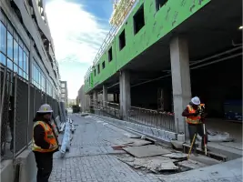
We provide construction layout services for foundations, utilities, and infrastructure projects using 3D laser scanning and digital data collection. Our team ensures dimensional accuracy for steel control, elevation verification, and as-built documentation across commercial and civil engineering developments.
ALTA/NSPS Surveys
Our ALTA/NSPS land title surveys meet banking and insurance requirements for property transactions. We deliver detailed improvement plats, easement descriptions, and FEMA floodplain determinations with certified boundary research and monumentation.
3D Laser Scanning
Using Leica RTC360 and Trimble systems, we capture detailed 3D models of structures and sites for as-built documentation. Our high-definition surveying supports BIM integration, deformation monitoring, and complex CAD design translation with millimeter-level accuracy.
Questions
What surveying technologies does Survey Systems use?
We utilize Trimble robotic total stations, GPS receivers, Teledyne multi-beam sonar, and 3D laser scanners for precise data collection across land and hydrographic projects.
Do you provide services outside Colorado?
Yes, we've completed projects in Arizona, Nevada, New Mexico, and other states for federal agencies and private clients.
Are your surveyors certified?
Our team includes certified surveyors and MSHA-trained personnel for underground mining projects, ensuring compliance with industry standards.
How does your project management approach work?
We implement milestone tracking, proactive problem-solving, and digital documentation to maintain project timelines and budgets while ensuring technical accuracy.
What safety protocols do you follow?
We prioritize OSHA-compliant safety practices, including PPE requirements, hazard mitigation training, and MSHA-certified underground safety procedures for field crews.
Videos