Business Details
Professional Land Surveying Services in California
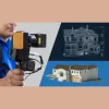
As local land surveyors, we've built trust with property owners, architects, engineers, and legal professionals over 25 years of delivering precise land surveying solutions across California. Our firm specializes in boundary, ALTA, construction staking, and topographic surveys while maintaining small business certifications that demonstrate our commitment to public works projects. Equipped with traditional methods and cutting-edge geomatics technology, we serve residential, commercial, and public sector clients across diverse terrains from desert landscapes to urban environments. Our SB-PW and SB-Micro certifications affirm our status as a trusted partner for California infrastructure projects requiring professional land surveying expertise. Services
Boundary Surveys
ALTA Surveys
Construction Staking
Topographic Mapping
UAV/UAS Mapping
Structural Monitoring
CAD Drafting
LiDAR Scanning
Forensic Mapping
Highlights and features
- We offer 25 years of California land surveying expertise
- We are Small Business Public Works Certified
- Our team handles projects in diverse California terrains
- We combine traditional surveying with modern geomatics technology
- We serve residential, commercial, and public sector clients
Associations and certifications
- Small Business - Public Works Certified (SB-PW)
- Certified Micro Small Business (SB-Micro)
Services
Boundary Surveys
We establish property boundary lines using precise measurement techniques and historical records. Our surveys help resolve property disputes, support real estate transactions, and ensure accurate land development. Our experts specialize in Public Lands (PLSS) retracement for accurate boundary determination.
ALTA Surveys
Our ALTA/NSPS mapping services provide comprehensive land information for mortgage title companies and lenders. We document easements, ingress/egress routes, and other property encumbrances to support commercial property transactions with American Land Title Association-compliant surveys.
Construction Staking
We provide precise construction staking services to guide infrastructure development according to engineering plans. Our team marks locations for buildings, roads, and other improvements to ensure projects stay on schedule, on budget, and meet design specifications.
Topographic Mapping
We create detailed topographic surveys showing natural and man-made features with elevation contours. These maps assist architects and engineers in development planning by providing accurate representations of terrain features including buildings, utilities, and water bodies.
UAV/UAS Mapping
Our drone mapping services capture high-resolution aerial data for land surveying applications. This technology enables efficient data collection for large areas, construction monitoring, and 3D modeling while maintaining the precision of traditional surveying methods.
Questions
What ALTA survey services do you provide?
We deliver comprehensive ALTA/NSPS mapping services that document property boundaries, easements, and physical features for commercial real estate transactions and title insurance purposes.
Can you handle boundary surveys in different terrains?
Yes, our experienced team conducts boundary surveys in diverse California environments including urban areas, desert landscapes, and forested regions using advanced geomatics technology.
Do you offer construction staking services?
We provide precise construction staking services to ensure infrastructure projects follow engineering plans, including marking building locations, road alignments, and utility placements for successful project execution.
What areas do you serve in California?
We serve clients throughout Southern California, Northern California, and Central California, providing land surveying expertise for residential, commercial, and public sector projects.
Are you certified for public works projects?
Yes, we hold Small Business Public Works (SB-PW) and Certified Micro Small Business (SB-Micro) certifications for California public infrastructure projects.
What modern surveying technologies do you use?
We combine traditional surveying methods with modern geomatics solutions including UAV/drone mapping, LiDAR scanning, and digital terrain modeling to enhance accuracy and efficiency.