Business Details
We are Gluckler & Den Bleyker, a professional land surveying firm with over 55 years of experience serving clients in Northern New Jersey. Our expertise combines state-of-the-art technology with historical records dating back to the 1950s, ensuring unparalleled accuracy in property line verification and surveying. We specialize in residential and commercial land surveying, maintaining detailed records across Bergen, Essex, Hudson, and Passaic counties. Our team, led by licensed professionals, handles all fieldwork personally, guaranteeing that no unlicensed personnel create or certify surveys. We prioritize timely delivery, providing surveys with detailed property information to expedite real estate closings and construction schedules. Our commitment to quality, accuracy, and professionalism has been the cornerstone of our business since 1958.
We offer a comprehensive range of services, including title surveys, flood elevation certificates, and municipal compliance surveys, tailored to meet the unique needs of each client. Our historical archives, including records from Lemuel Loziers firm, enable us to resolve complex property disputes with precision. We provide expert testimony and documentation for municipal planning and zoning boards when required. Our dedication to client satisfaction is reflected in our transparent processes and adherence to the highest industry standards. We continuously invest in advanced surveying equipment and methodologies to maintain our reputation as trusted leaders in the field.
We offer a comprehensive range of services, including title surveys, flood elevation certificates, and municipal compliance surveys, tailored to meet the unique needs of each client. Our historical archives, including records from Lemuel Loziers firm, enable us to resolve complex property disputes with precision. We provide expert testimony and documentation for municipal planning and zoning boards when required. Our dedication to client satisfaction is reflected in our transparent processes and adherence to the highest industry standards. We continuously invest in advanced surveying equipment and methodologies to maintain our reputation as trusted leaders in the field.

Highlights and features
- We have over 55 years of operational experience in land surveying.
- We utilize historical records dating back to the 1950s for precise property line verification.
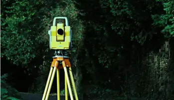
- We employ state-of-the-art surveying technology to ensure accuracy.
- We guarantee that all fieldwork and certifications are performed by licensed professionals.
- We maintain transparent processes and adhere to the highest industry standards.
Services
Title Surveys
A title survey maps all buildings, fences, and structures on a property, including adjacent improvements, to identify boundary issues during real estate transactions. This service is critical for purchasers to verify property lines and ensure compliance with New Jersey law, which mandates corner markers unless waived in writing. Our surveys provide detailed documentation to facilitate smooth real estate closings.
Flood Elevation Certificates
Flood elevation certificates determine a propertys risk level in flood zones as defined by FEMA, helping owners assess insurance requirements. This service is essential for buildings in or near flood-prone areas, providing precise elevation data to establish coverage needs and potential mitigation strategies. Our certifications ensure compliance and clarity for homeowners and businesses alike.
Municipal Compliance Surveys
These surveys provide updated property data for municipal planning and zoning boards, supporting applications for permits or approvals. We deliver detailed maps and expert testimony when required, ensuring clients meet local regulations efficiently. Our documentation helps residents and businesses navigate complex municipal processes with confidence.
Property Corner Markouts
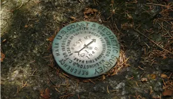
This service physically establishes property corners using durable markers, clarifying boundaries for owners. It is often required during transactions or disputes, providing tangible reference points. New Jersey law includes corner marking in title surveys unless explicitly waived, and we ensure all markers meet legal standards for permanence and accuracy.
Site Planning & Subdivisions
We create detailed maps for property subdivisions, dividing land into new lots as per municipal requirements. These plans are submitted to planning boards for approval, ensuring compliance with local ordinances. Our site planning services streamline the development process, enabling clients to proceed with construction or sales confidently.