Business Details
19 Years
experience
Your Trusted Land Surveying Partner in Arcata, CA
Points West Surveying was founded in 2007 to meet the specialized needs of land surveying clients across Northern California. Our team of three licensed surveyors and five skilled professionals combines over 75 years of collective experience with cutting-edge technology like robotic total stations and GPS systems. We serve public agencies and private firms, delivering boundary surveys, topographic mapping, construction staking, and ALTA surveys with precision.Our reputation for quality work has sustained us through economic challenges, and we maintain compliance with state and federal project requirements. With offices in Arcata, we prioritize timely delivery, exceeding client expectations, and leveraging local expertise to support grant-funded and infrastructure projects.
Services
Boundary Surveys
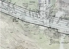
Topographic Mapping
Construction Staking
Subdivisions
Lot Line Adjustments
ALTA Surveys
Control Surveys
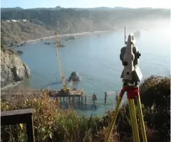
Hydrographic Surveys
Aerial Control
Expert Testimony
Details
- Year established: 2007
Highlights and features
- We offer 27+ years of combined experience in land surveying.
- Our team utilizes state-of-the-art robotic total stations and GPS equipment.
- Three licensed surveyors ensure compliance with complex project requirements.
- We specialize in timely delivery for grant-funded and infrastructure projects.
- Local expertise in Northern California's unique terrain and regulations.
Services
Boundary Surveys
We conduct precise boundary surveys to define property lines using historical records and modern GPS technology. Our work ensures legal compliance and resolves disputes. Clients rely on our expertise for subdivisions, easements, and land development projects.
Topographic Mapping
Our topographic surveys capture terrain features and elevations for engineering and construction planning. Using robotic total stations and GPS, we produce detailed maps. These support infrastructure projects, environmental assessments, and site development across Northern California.
Construction Staking
We provide accurate staking for roads, buildings, and utilities using digital data and field equipment. Our work ensures projects align with design plans. Contractors depend on our real-time guidance to minimize errors and delays during construction.
ALTA Surveys
Our ALTA surveys meet national standards for commercial property transactions. We identify easements, encroachments, and legal boundaries to support title insurance. Clients trust our detailed reports for risk mitigation in real estate deals.
Hydrographic Surveys
We map underwater terrain for coastal and riverine projects using specialized sonar equipment. Our data supports floodplain analysis, dredging, and environmental monitoring. This service aids infrastructure planning in sensitive aquatic habitats.
People
Michael Pulley
President
With 27+ years of experience, Michael leads boundary and construction surveys. He specializes in historical research for legal disputes and serves as a CLSA representative. A Rice University graduate, he ensures quality control for all projects.
Jesse Buffington
Vice-President
Jesse manages complex boundary surveys and has 16 years of experience. He oversees Humboldt County projects and holds a University of Arizona degree. His local knowledge enhances project efficiency in Northern California's challenging terrain.
David Crivelli
Co-Founder
David has 37 years of surveying expertise, including infrastructure projects for airports and hospitals. He led the Mad River Pipeline survey and remains a technical advisor. His career spans highway, utility, and subdivision surveys across Northern California.
Bill Pool
CAD Drafter
Bill creates clear survey maps with 25 years of drafting experience. He uses Civil 3D software to produce accurate DTMs for construction. His work ensures seamless data integration between field surveys and engineering designs.
Ryan Baxter
Surveyor
Ryan performs field and office surveys with 16 years of experience. He operates robotic total stations and GPS equipment. His skills in construction staking ensure precise data delivery for contractors and engineers.
Questions
What services does Points West Surveying offer?
We provide boundary surveys, topographic mapping, construction staking, ALTA surveys, hydrographic surveys, and expert testimony for public and private clients.
Which areas do you serve?
We operate throughout Northern California, including Humboldt, Del Norte, Shasta, Trinity, Siskiyou, and Mendocino Counties.
How experienced is your team?
Our three licensed surveyors have over 75 years of combined experience, with expertise in complex boundary disputes and infrastructure projects.
What technology do you use?
We employ robotic total stations, GPS systems, and CAD software to ensure accurate data collection and seamless integration with GIS databases.
Can you handle federally funded projects?
Yes, we comply with Davis-Bacon requirements, prevailing wage regulations, and labor compliance forms for state and federal projects.