
Business Details
47 Years
experience
Expert Land Surveying Services in Fairmont, MN
Madsen Land Surveying has been delivering precise land surveying solutions since 1979, combining decades of expertise with cutting-edge technology. Our team of licensed professionals brings extensive experience in lot surveys, farm surveys, and topographic assessments, serving clients across Southern Minnesota and Northern Iowa. We prioritize accuracy and efficiency, utilizing advanced tools like Trimble GPS systems and drones to ensure reliable results. With a legacy of trust built over 45 years, we remain committed to providing free estimates within 48 hours and maintaining transparent communication throughout every project. 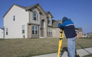
Services
Lot Surveys
Farm Surveys
Topographic Surveys
Subdivision Platting
ALTA Surveying
Details
- Year established: 1979
Highlights and features
- We utilize Trimble GPS systems and drones for high-accuracy surveys.
- Our team includes FAA-certified remote pilots with decades of experience.
- We provide free estimates within 24-48 hours for all services.
- Licensed to practice in Minnesota and Iowa with local expertise.
- We maintain transparent communication and no hidden fees.
What people say
Very professional
Responsive to emails
Easy to work with
Services
Lot Surveys
Lot surveys determine property boundaries for new construction or home improvements. Our licensed surveyors use advanced GPS technology to ensure precise measurements and compliance with local regulations. Clients receive detailed reports that facilitate smooth permitting and development processes.
Farm Surveys
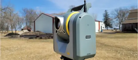
Farm surveys establish boundaries for farmland or separate building sites from agricultural areas. We employ modern equipment like robotic total stations to deliver accurate data, helping farmers manage land use efficiently and resolve boundary disputes.
Topographic Surveys
Topographic surveys map natural and man-made features, including elevations and utilities. Using drones and CAD software, we create detailed 3D models that assist in site planning, drainage analysis, and infrastructure development for residential and commercial projects.
Subdivision Platting
Subdivision platting divides large parcels into smaller lots with precise legal descriptions. Our team prepares compliant plats for municipal approval, ensuring adherence to zoning laws and infrastructure requirements while maintaining land value and usability.
ALTA Surveying
ALTA surveys meet national standards for commercial property transactions. We identify easements, encroachments, and improvements to satisfy title insurance requirements, providing lenders and buyers with critical data for risk assessment and property acquisition.
People
Ben Madsen
Owner and President
Ben Madsen, a licensed surveyor in Minnesota and Iowa, leads the company with expertise in land surveying and FAA-certified drone operations. He has managed complex projects since 2000 and holds advanced degrees in surveying and cartography.
Travis Warner
Licensed Land Surveyor
Travis Warner specializes in boundary and construction surveys, combining technical precision with FAA-certified drone proficiency. His experience spans diverse projects, ensuring clients receive accurate data and tailored solutions for their land development needs.
Stuart Smart
Office Manager
Stuart Smart oversees drafting and survey computations, leveraging over 35 years of experience in office operations and site planning. His expertise in CAD software ensures efficient processing of complex survey data for client deliverables.
Karl Vlieger
Lead Survey Tech
Karl Vlieger manages field operations and drafting, drawing on decades of experience in surveying and construction project management. His technical skills and attention to detail ensure high-quality results for boundary and topographic surveys.
Heather Madsen
Office Staff
Heather Madsen supports drafting and administrative tasks, combining technical proficiency with accounting expertise. Her role ensures seamless project coordination and client communication for efficient service delivery.
Questions
What areas do you serve?
We serve Southern Minnesota, including Martin and Nobles Counties, and Northern Iowa. Our team provides surveys for both rural and urban properties across these regions.
What types of surveys do you offer?
We specialize in lot surveys, farm surveys, topographic surveys, subdivision platting, and ALTA surveys. Each service is tailored to meet residential, agricultural, and commercial needs.
How quickly can I get a free estimate?
We provide free estimates within 24-48 hours of your request. Contact us via phone or email to discuss your project details and receive a prompt quote.
What technology do you use?
We use Trimble GPS systems, drones, robotic total stations, and CAD software like Civil 3D to ensure high-accuracy surveys and efficient data processing for all projects.
Are your surveyors licensed?
Yes, our team includes licensed professionals in Minnesota and Iowa. We maintain certifications and adhere to state-specific standards for all surveying activities.
Do you handle commercial survey projects?
Yes, we provide ALTA surveys and subdivision platting for commercial properties, ensuring compliance with legal and title insurance requirements for developers and lenders.