Business Details
24 Years
experience
Expert Land Surveying Services in Roseburg, OR
Founded in 2002, Neil Hibbs Land Surveying has established itself as a trusted provider of comprehensive surveying solutions across Oregon. With nearly four decades of combined industry experience, our team specializes in boundary line adjustments, land partitions, subdivisions, topographic surveys, and hydrographic assessments. We serve both private clients and government agencies, leveraging advanced Trimble RTK GPS technology alongside conventional equipment to deliver precise, reliable results. Our deep familiarity with local regulations and extensive work with municipalities ensures streamlined project execution.Based in Roseburg, we extend our services throughout Oregon, including Eugene, Grants Pass, and multiple counties. Our commitment to personalized service and technical excellence has earned us a reputation for accuracy and client satisfaction. We prioritize clear communication and problem-solving, as evidenced by our track record of correcting critical errors for clients. Whether navigating complex historical property data or conducting elevation certifications for flood insurance, our team combines expertise with practical, client-focused solutions.


Services
Boundary Surveys
Land Partitions
Subdivisions
Topographic Surveys
Elevation Certificates
Hydrographic Surveys
Legal Descriptions
Construction Staking
Details
- Year established: 2002
Highlights and features
- We have nearly 40+ years of experience in the surveying industry.
- We have worked with multiple municipalities across Oregon.
- We have a boat for remote water access surveys.
- We use high-quality Trimble RTK GPS equipment.
- We serve clients throughout Oregon's 11 counties.
What people say
Most capable and experienced
Great experience
Quick responsive
Knowledgeable
Excellent communication
Services
Boundary Surveys
Boundary surveys determine exact property lines and regulatory limitations. Our team uses advanced GPS technology to ensure accuracy for residential and commercial clients. With decades of experience, we resolve disputes and clarify land ownership across Oregon.
Topographic Surveys
Topographic surveys analyze ground features including elevation, vegetation, and utilities. We create detailed maps for construction and land development projects. Our equipment captures precise data to support engineering and planning needs statewide.
Hydrographic Surveys
Hydrographic surveys measure underwater features for marine construction and floodplain management. Our boat-based equipment enables access to remote river and lake locations. This service supports infrastructure projects and environmental assessments in Oregon's waterways.
Questions
What surveying services do you offer?
We provide boundary surveys, topographic mapping, hydrographic assessments, elevation certificates, and legal description writing for Oregon properties.
How long have you served Oregon clients?
Our team has delivered surveying solutions since 2002, with nearly 40 years of combined industry experience across the state.
Do you work with government agencies?
Yes, we collaborate with cities, counties, and state departments on surveying projects throughout Oregon's 11 counties.
What equipment do you use?
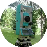
We utilize Trimble RTK GPS technology and conventional surveying tools for precise measurements in all terrain types.