Business Details
45 Years
experience
Your Trusted Surveying and Mapping Experts in Oviedo, FL
Established in 1981, PEC Surveying & Mapping has built a legacy of precision and reliability in land surveying and mapping services. Our team comprises seasoned Professional Surveyors and Mappers, along with certified field technicians, who bring decades of collective experience to every project. We leverage state-of-the-art technology to deliver accurate, cost-effective solutions for both governmental and private clients across Florida. Our principals remain actively involved in daily operations, ensuring hands-on expertise and accountability. Over 40 years, weve cultivated strong relationships with Floridas regulatory agencies, enabling us to navigate complex projects with efficiency and foresight.From residential developments to interstate highways, our work forms the foundation for critical infrastructure. Our commitment to quality is underscored by a rigorous Quality Assurance/Quality Control Program, featuring direct principal oversight, equipment calibration, and peer review. We specialize in Geographic Information System (GIS) development, supporting large-scale projects for water management districts and municipalities. Whether its a small home survey or a regional mall platting, we prioritize client satisfaction through timeliness and technical excellence. Our ALTA-certified surveys and engineering design services reflect our dedication to industry-leading standards.
Services
Land Development Surveying
ALTA Surveys
GIS Mapping
Transportation Surveying
Engineering Design Surveys
Right-of-Way Mapping
Expert Witness Services
Details
- Year established: 1981
Highlights and features
- We have over 40 years of experience in Florida land surveying.
- Our principals provide direct, hands-on involvement in every project.
- We utilize state-of-the-art equipment for superior accuracy.
- Our GIS team has 15+ years of continuous Florida-specific experience.
- We maintain strict quality control with peer-reviewed processes.
Services
Land Development Surveying
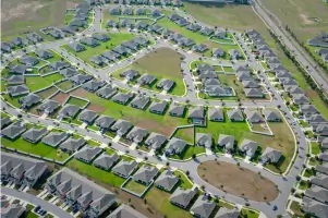
We conduct precise land surveys for residential and commercial developments, including platting, boundary determination, and topographic mapping. Our team has successfully completed tens of thousands of residential lot plats and regional mall surveys. Using advanced technology, we ensure compliance with local regulations while maintaining project timelines and budgets.
ALTA Surveys
Our ALTA-certified surveys meet the highest industry standards for commercial property transactions. We provide detailed boundary analysis, easement identification, and title report integration. These surveys are essential for real estate acquisitions and financing, ensuring legal compliance and minimizing future disputes through comprehensive documentation.
GIS Mapping
We develop and maintain Geographic Information Systems for large-scale infrastructure projects. Our GIS solutions support water management districts, municipalities, and private clients with spatial data analysis, asset management, and regulatory reporting. Our team has created systems covering thousands of square miles across Florida's diverse ecosystems.
Transportation Surveying
We provide surveying services for highway design, right-of-way mapping, and transportation infrastructure projects. Our work includes interstate highway alignments, city roadway improvements, and pipeline corridor surveys. We collaborate with engineering teams to ensure accurate data for construction documentation and regulatory approvals.
Engineering Design Surveys
We deliver precise survey data for engineering projects, including topographic mapping, utility location, and construction staking. Our surveys support pipeline construction, drainage systems, and commercial developments. We work closely with design teams to ensure field data accuracy and compatibility with engineering plans.
People
David A. White
Principal
David White is a licensed Professional Surveyor and Mapper with decades of experience in Florida land surveying. He leads PEC's technical operations, ensuring quality control and regulatory compliance across all projects.
Questions
What geographic areas do you serve?
We provide surveying services throughout Florida, Alabama, and Georgia, with specialized expertise in Florida's regulatory landscape.
What types of projects do you handle?
Our portfolio includes residential developments, highway projects, regional malls, water management systems, and ALTA-certified land surveys.
How does your quality control process work?
We implement a five-point QA/QC program featuring principal involvement, equipment calibration, formal production controls, and peer-reviewed deliverables.
Can you handle large-scale infrastructure projects?
Yes, we've completed surveys for major interstate highways and projects covering up to one-third of Florida's land area.
What GIS capabilities do you offer?
Our Florida-licensed GIS team develops comprehensive mapping systems with 15+ years of experience supporting water districts and municipalities.