
Business Details
45 Years
experience
Professional Land Surveying Services in West End, NC
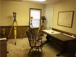
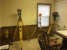
Located in West End, NC, Central Carolina Surveyors is a small, family-owned and operated land surveying business with over 40 years of experience serving central North Carolina. Founded in 1981 by Ronald O. Graham, a licensed surveyor since 1978, the company has built a legacy of precision and reliability in land surveying and planning. Our team combines decades of hands-on expertise with modern technology, including robotic total stations and GPS/GIS systems, to deliver accurate and timely results. We specialize in residential land surveys, boundary surveys, topographic surveys, and construction layout services, supporting projects like Seven Lakes, Tillery Tradition, and Pinewild Country Club.As a second-generation business, we continue to honor our founder's commitment to quality while adapting to evolving industry standards. Our services cater to property owners, developers, and real estate professionals requiring precise land documentation for purchases, development, or legal clarity. We prioritize client communication and transparency, encouraging clients to provide property details in advance to ensure accurate estimates and efficient project timelines. With deep roots in Moore County and surrounding areas, we remain dedicated to serving local communities while maintaining the highest professional standards.
Services
Residential land surveys
Boundary surveys
Topographic surveys
Construction layout
GPS/GIS surveys
ALTA surveys
Estate divisions
Land planning
Subdivisions
Drafting services
Details
- Year established: 1981
Highlights and features
- We have 40+ years of experience in North Carolina land surveying.
- Our team uses advanced GPS/GIS and robotic total station technology.
- We specialize in complex projects like Seven Lakes and Pinewild Country Club.
- Our second-generation family business prioritizes personalized client service.
- We provide accurate property documentation to prevent costly legal disputes.
Services
Residential land surveys
We conduct precise residential land surveys to establish property boundaries for real estate transactions or development. Our surveys help prevent encroachments and legal disputes by clearly marking property lines. Clients receive detailed documentation to protect their property investments.
Boundary surveys
Our boundary surveys determine exact property lines using historical records and modern measurement tools. This service helps resolve disputes, plan improvements, and ensure compliance with local regulations. We provide clear markers and official documentation for legal certainty.
Topographic surveys
We create detailed topographic surveys showing natural and man-made features for development planning. These surveys guide construction projects by mapping elevation changes, vegetation, and structures. Our data supports accurate site design and engineering.
Construction layout
Our construction layout services mark precise locations for buildings and infrastructure. We ensure projects follow approved plans using advanced positioning technology. This service helps contractors maintain alignment and avoid costly errors during development.
GPS/GIS surveys
We utilize GPS and GIS technology for high-accuracy land data collection and spatial analysis. This service supports large-scale mapping projects and infrastructure planning. Our digital mapping capabilities improve decision-making for complex land management needs.
People
Ronald O. Graham
Founder
Licensed surveyor since 1978 with 40+ years of NC land surveying experience. Developed expertise in traditional and modern surveying methods while working on major projects like Seven Lakes and Pinewild Country Club.
Devon Graham
Professional Land Surveyor
Second-generation surveyor trained by his father, with experience in automotive industry and family business. Completed professional licensing requirements and continues legacy of accurate, client-focused land surveying services.
Questions
Why do I need a land survey when buying property?
A land survey verifies property boundaries to prevent disputes, confirms improvements match legal descriptions, and identifies potential encroachments that could cause legal or financial issues.
What information should I provide before a survey?
Please share the property owner's name, address, existing maps/deeds, and county tax ID number to help us complete accurate estimates and reduce project timelines.
How long does a typical survey take?
Most residential surveys take 1-3 days depending on property size and complexity, with additional time required for research and documentation to ensure legal compliance.
Do you serve areas outside Moore County?
While based in Moore County, we serve central North Carolina including Raleigh, Greensboro, and western mountain regions for both small and large-scale projects.
What technology do you use for surveys?
We combine traditional methods with modern tools like robotic total stations, GPS/GIS systems, and digital mapping software to ensure high accuracy and efficiency.