Business Details
16 Years
experience
Expert Land Surveying Services in Maine
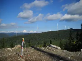
Acme Land Surveying has been serving the state of Maine since 2010, building upon a legacy of expertise that spans over four decades. Our team of seasoned professionals brings more than 100 years of combined experience in land surveying and forest management, ensuring precise and efficient solutions for every project. We specialize in survey grade GPS and Total Station property surveys, mortgage loan inspections, elevation certificates, and subdivision plans, leveraging our extensive private archive of Franklin County maps dating back 40 years. Our commitment to professionalism is reflected in our memberships with the National Society of Professional Land Surveyors, Maine Society of Land Surveyors, and American Congress of Surveying and Mapping. We serve clients across all of Maine's regions, from the Canadian border to the coast, delivering cost-effective services tailored to meet individual project needs.Our reputation for excellence is evidenced by long-standing client relationships and testimonials highlighting our dedication to accuracy, timeliness, and exceptional customer service. With offices in Farmington, we maintain a client-centric approach that prioritizes clear communication and technical expertise. Our proven track record in complex projects like the Kibby Wind Power Project and Sugarloaf Development demonstrates our capability to handle large-scale assignments with precision. We remain committed to advancing our field through continuous investment in cutting-edge technology and professional development. This combination of experience, resources, and client focus makes us the preferred choice for land surveying needs throughout Maine.


Services
Land Surveying
Deed Research
Mapping
Forest Management
Mortgage Inspections
Elevation Certificates
Subdivision Plans
Details
- Year established: 2010
Highlights and features
- We offer over 100 years of combined experience in land surveying and forest management.
- Our team maintains the largest private map archive in Franklin County dating back 40 years.
- We utilize advanced survey grade GPS and Total Station technology for precise measurements.
- Our services cover all regions of Maine from the Canadian border to the Atlantic coast.
- We have successfully completed complex projects like the Kibby Wind Power Project.
What people say
Efficient, professional way
Excellent professional efforts
Great job
Timely manner
Credit to your profession
Services
Land Surveying
Our land surveying services utilize advanced GPS and Total Station technology to deliver precise property boundary determinations. We provide comprehensive mapping solutions for residential, commercial, and industrial clients throughout Maine. Our team's extensive experience ensures accurate measurements and documentation for legal and development purposes.
Deed Research
We conduct thorough deed research using our extensive private archive of Franklin County records dating back 40 years. Our detailed title investigations help resolve boundary disputes and establish clear property ownership histories. This service supports legal proceedings and real estate transactions with documented evidence.
Forest Management
Our forest management services combine surveying expertise with sustainable resource planning. We develop customized management plans for timberland owners across Maine. These plans balance ecological considerations with economic objectives while maintaining compliance with environmental regulations.
Elevation Certificates
We provide official elevation certificates and LOMAs (Letters of Map Amendment) for floodplain determination. These documents meet FEMA requirements for insurance and regulatory purposes. Our precise elevation measurements help property owners reduce flood insurance costs.
Subdivision Plans
We create detailed subdivision plans for residential and commercial developments. Our plans meet municipal requirements and include boundary calculations, topographic features, and infrastructure layouts. We coordinate with local authorities to ensure smooth approval processes for developers.
People
Erik Lochmann
Owner/Professional Land Surveyor
With decades of experience in land surveying, Erik leads our team in delivering precise mapping solutions. His expertise in boundary determination and legal documentation has been instrumental in resolving complex property disputes across Maine.
Randy Oakley
Owner/Professional Land Surveyor
Randy brings extensive field experience to our surveying operations. His technical proficiency with GPS and Total Station equipment ensures accurate data collection for projects ranging from residential lots to large-scale developments.
Peter Cook
Owner/Professional Land Surveyor
Peter specializes in historical map analysis and deed research. His meticulous approach to title investigations helps clients establish clear property boundaries using our comprehensive archive of Franklin County records.
Questions
What areas do you serve?
We serve all regions of Maine, from the Canadian border to the coast, covering Franklin, Somerset, Kennebec, Oxford, and Androscoggin Counties.
What surveying technologies do you use?
We utilize survey grade GPS and Total Station equipment for precise measurements, ensuring accurate boundary determinations and mapping solutions.
How long have you been in business?
Acme Land Surveying, LLC has operated since July 2010, continuing the legacy of Acme Engineering and Design with over 40 years of combined experience.
What services do you offer?
We provide land surveying, deed research, elevation certificates, subdivision plans, and forest management services tailored to Maine's diverse terrain.
Can you handle large-scale projects?
Yes, our team has completed major projects like the Kibby Wind Power Project and Sugarloaf Development, demonstrating our capability for complex assignments.