
Business Details
39 Years
experience
Professional Land Surveying Services in Canandaigua
Established in 1987, Venezia & Associates Land Surveyors has built a reputation as a trusted provider of comprehensive land surveying services in New York State. Our team combines over 30 years of collective experience with state-of-the-art technology to deliver precise and reliable surveying solutions for diverse clients. We serve landowners, attorneys, developers, municipalities, and engineering firms across Ontario, Yates, Livingston, Steuben, Seneca, and Monroe counties. Our expertise spans boundary determination, topographic mapping, facility line surveys, and subdivision planning, supporting critical decisions for property transactions, development projects, and infrastructure planning. With two fully equipped survey crews, we maintain rigorous quality standards while adapting to the unique requirements of each project.Our commitment to technical excellence and client collaboration ensures accurate data collection, detailed documentation, and timely delivery of survey results. By maintaining continuous professional development and investing in advanced equipment, we remain at the forefront of surveying technology and methodologies. Our dual focus on precision and practicality enables clients to navigate complex land use challenges with confidence. Through decades of service, we have cultivated trusted partnerships with professionals across multiple industries, reinforcing our position as a regional leader in land surveying services. This enduring dedication to quality and client satisfaction continues to drive our approach to every surveying project we undertake.
Services
Property Surveys
Facility Line Surveys
Topographic Surveys
Site Plan Surveys
Lot Surveys
Subdivision Surveys
Details
- Year established: 1987
Highlights and features
- We have over 30 years of combined experience in land surveying
- Our crews use state-of-the-art surveying technology
- We serve six New York State counties with local expertise
- Our team includes licensed professionals with specialized certifications
- We provide comprehensive surveying solutions for complex projects
Services
Property Survey
Our property surveys precisely define land boundaries using advanced equipment and legal records research. This service supports real estate transactions, development planning, and dispute resolution. Clients receive detailed documentation meeting state standards for mortgage requirements and legal documentation.
Topographic Survey
We create detailed topographic maps showing natural and man-made features for engineering and development projects. Our surveys capture elevation changes, vegetation, and structures to support site planning. Clients receive accurate base maps for construction and environmental assessments.
Facility Line Survey
This service identifies permitted water access areas for dock construction along state water boundaries. We provide precise measurements and documentation required for permit applications. Our surveys ensure compliance with regulatory requirements for waterfront property development.
Subdivision Survey
We assist with parcel division through boundary determination and plat preparation. Our surveys meet municipal requirements for legal land subdivision. Clients receive documentation for new lot creation and property line adjustments.
Site Plan Survey
We create detailed site plans for construction projects showing existing conditions and proposed improvements. Our surveys support building permits and development approvals. Clients receive engineering-ready documentation for residential and commercial projects.
People
Anthony A. Venezia
Owner/CEO
Licensed surveyor with 15+ years in civil engineering and land surveying. Specializes in government and commercial site development projects. Leads survey teams in complex boundary determinations and mapping projects.
Rocco A. Venezia
Senior Consultant
Founder with 30+ years of experience in land surveying and civil engineering. Provides expert consultation for municipal projects and large-scale utility mapping. Maintains active field involvement in critical surveying projects.
Questions
What surveying services do you offer?
We provide property surveys, topographic surveys, facility line surveys, subdivision surveys, and site plan surveys for residential, commercial, and municipal clients.
Which areas do you serve?
We operate throughout Ontario, Yates, Livingston, Steuben, Seneca, and Monroe counties in New York State.
How long has your company been in business?
Venezia & Associates has provided surveying services since 1987, with over 30 years of combined experience from our licensed professionals.
What technology do you use?
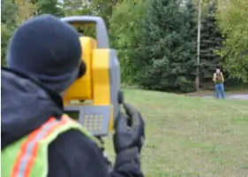
Our survey crews utilize state-of-the-art equipment including GPS systems, total stations, and digital mapping software for precise data collection.
Can you handle complex surveying projects?
Yes, we manage complex projects including large-scale utility mapping, control surveys, and regulatory compliance surveys for development projects.