
Business Details
28 Years
experience
Professional Land Surveying Services in Derry, NH
Promised Land Survey was founded in 1998 with a commitment to delivering professional land surveying services across New Hampshire and beyond. Our team of licensed land surveyors, subsurface designers, and CAD technicians brings decades of combined experience to every project. We specialize in boundary surveys, topographic mapping, and GPS/GIS work, serving residential, commercial, and institutional clients. Our dedication to precision, ethical practices, and client satisfaction has earned us a trusted reputation in the industry. We utilize cutting-edge technology to ensure accurate results while maintaining competitive pricing.Our staff actively collaborates with engineering and environmental firms to provide comprehensive solutions. With over 25 years of experience, we prioritize transparency, timely delivery, and personalized service. Our founder, Timothy A. Peloquin, remains deeply involved in daily operations, ensuring adherence to professional standards. We serve every county in New Hampshire and all New England states, with international GPS/GIS capabilities. Client testimonials consistently highlight our integrity, technical expertise, and exceptional customer service.

Services
Boundary Surveys
Subdivision Design
Topographic Mapping
FEMA Elevation Certificates
Construction Layout
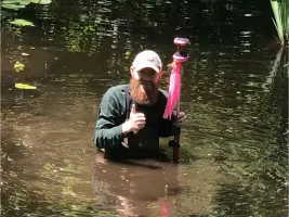
Wetland Delineation
ALTA Surveys
Septic System Design
GIS Services
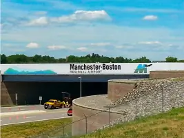
Airport Surveys
Details
- Year established: 1998
Highlights and features
- We have over 25 years of experience in professional land surveying.
- Our team includes licensed land surveyors and certified technicians.
- We utilize the latest GPS/GIS technology for accurate results.
- We provide personalized service with transparent pricing.
- We maintain strong partnerships with environmental and engineering firms.
What people say
Exceptional job
Timely manner
Integrity and customer service
Professional and detailed
Worth every penny
Services
Boundary Surveys
We conduct precise boundary surveys to establish property lines using advanced GPS technology and historical deed research. Our surveys meet legal requirements for real estate transactions, construction projects, and dispute resolution. Clients receive detailed documentation that ensures compliance with local regulations and provides clear property definitions.
Subdivision Design
Our subdivision design services include creating detailed plans for parcel division that comply with zoning laws and environmental regulations. We manage the entire permitting process from initial concept to final approval. Clients benefit from our expertise in navigating municipal requirements and creating functional land use layouts.
Topographic Mapping
We produce detailed topographic maps showing natural and man-made features using advanced surveying equipment. These maps support construction planning, environmental assessments, and infrastructure development. Our deliverables include elevation data, contour lines, and digital terrain models for accurate project visualization.
FEMA Elevation Certificates
We provide FEMA elevation certificates for flood insurance requirements and floodplain management compliance. Our surveys determine building elevations relative to flood risk zones. Clients receive official documentation needed for insurance rate determination and flood mitigation planning.
Construction Layout
Our construction layout services ensure accurate implementation of design plans through precise stakeout of building footprints and infrastructure. We work with contractors to maintain dimensional control throughout the building process. Clients benefit from reduced rework and adherence to project specifications.
People
Timothy A. Peloquin
Founder & Owner
Licensed Land Surveyor with over 30 years of experience in New England. Served as Past President of NH Land Surveyors Association and appointed to NH State Board of Land Surveyors. Adjunct professor at University of New Hampshire.
Neal M. McCarthy
Survey Manager
Licensed Land Surveyor with 20+ years of experience managing field operations and project workflows. Specializes in construction layout, boundary surveys, and client relations. Holds multiple professional certifications in surveying and subsurface design.
Brandon J. Wing
Senior Survey Technician
Certified technician with 20 years of experience in field surveying and office drafting. Expertise in septic design, ALTA surveys, and wetland permitting. Holds NH subsurface designer license and pursuing Certified Wetland Scientist designation.
Andrew R. Glines
Field Crew Chief
Mathematics graduate with 12 years of experience in boundary surveys, topographic mapping, and construction layout. Actively pursuing land surveyor licensure while managing field operations and client communications.
Kevin Stanhope
Crew Chief
Licensed Surveyor in Training with University of Maine degree in Surveying Engineering. Specializes in boundary surveys, construction layout, and GIS data collection. Actively working toward full land surveyor licensure in New Hampshire.
Questions
What types of land surveys are available for homeowners in New Hampshire?
We offer boundary surveys, certified plot plans, topographic plans, FEMA elevation certificates, and septic system designs for residential properties.
How can I determine if my property requires a FEMA elevation certificate?
Properties in designated flood zones require FEMA elevation certificates for insurance purposes. We assess flood zone status and provide official certification.
What is involved in the subdivision design and permitting process in New Hampshire?
Our process includes creating compliant plans, securing municipal approvals, and managing environmental regulations for efficient land division.
Do you provide construction layout services for residential and commercial projects?
Yes, we offer precise staking services for building footprints, utility lines, and infrastructure in both residential and commercial sectors.
Can you assist with topographic surveys for land development projects?
We provide detailed topographic surveys showing terrain features essential for grading, drainage, and site development planning.
How can I get a free estimate for land surveying services?
Contact us at 603-432-2112 or through our website to discuss your project and receive a customized quote.