
Business Details
Expert Land Surveying Services in Appleton, WI
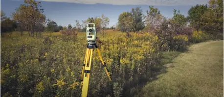
Fox Valley Land Surveying has been serving clients across Wisconsin for over 25 years, with 20 years of licensed expertise in property surveying. Our team utilizes cutting-edge GPS and Total Station equipment to deliver precise and reliable surveying solutions tailored to residential, commercial, and municipal needs. We specialize in boundary determination, floodplain analysis, and subdivision planning, ensuring compliance with local regulations and client-specific requirements. Our commitment to accuracy and professionalism has established us as a trusted partner for property owners, lenders, and construction professionals.We prioritize clear communication and technical excellence, offering services such as Certified Survey Maps, ALTA Surveys, and topographic mapping. Clients can request customized estimates by providing property details via email, and our office in Appleton operates by appointment to ensure focused, personalized service. With extensive experience in both fieldwork and regulatory processes, we streamline complex surveying projects to meet deadlines efficiently. Our dedication to innovation and client satisfaction underscores every project, from minor lot adjustments to large-scale subdivisions.
Services
Certified Survey Maps
Boundary Surveys
ALTA Surveys
Floodplain Analysis
Topographic Mapping
Subdivision Planning
Elevation Certificates
Condo Plats
Highlights and features
- We have over 25 years of experience in Wisconsin land surveying.
- Our team uses advanced GPS and Total Station equipment for accuracy.
- We specialize in boundary determination and subdivision planning.
- Our licensed professionals ensure compliance with local regulations.
- We provide timely, client-focused solutions for complex surveying needs.
Services
Certified Survey Maps
Certified Survey Maps (CSMs) divide or combine land parcels, ensuring compliance with local regulations. Our surveys identify encroachments and require municipal approval. We handle the entire process, from fieldwork to documentation, for up to four lots.
Boundary Surveys
Boundary surveys establish precise property lines to resolve disputes or prepare for purchases. We document encroachments and provide legal documentation without requiring municipal approval, ensuring clarity for property owners.
ALTA Surveys
ALTA Surveys meet lender requirements by identifying title exceptions through detailed fieldwork. We adhere to national standards, documenting features and easements to ensure title insurance accuracy for commercial property transactions.
Floodplain Analysis
Floodplain analysis determines flood risk using FEMA guidelines. We prepare Elevation Certificates and Letters of Map Amendment to help clients secure insurance or modify flood zone designations for structures and land.
Topographic Mapping
Topographic surveys create detailed elevation models for construction planning. We collect data on natural and man-made features, providing engineers with accurate benchmarks for infrastructure and development projects.
Questions
What types of surveys do you offer?
We provide Certified Survey Maps, boundary surveys, ALTA Surveys, floodplain analysis, topographic mapping, and subdivision plats tailored to residential and commercial needs.
How long does a typical survey take?
Timelines vary by project complexity, but most residential surveys are completed within 1-2 weeks. Subdivisions may take longer due to municipal review processes.
Do you serve areas outside Appleton?
Yes, we serve Oshkosh, Fond du Lac, Green Bay, and surrounding Wisconsin regions for all surveying needs.
Are your surveys legally recognized?
Yes, our licensed professionals ensure all surveys comply with Wisconsin regulations and municipal requirements for legal validity.