Business Details
13 Years
experience
Your Trusted Coastal Engineering Partner
Founded in 2013, TI Coastal is a specialized engineering firm dedicated to coastal engineering, professional land surveying, near-shore hydrographic surveying, and coastal geology/geomorphology. Our team combines over 50 years of collective experience and has successfully completed more than 100 coastal construction projects. We pride ourselves on delivering personalized service to dredging, coastal, and beach communities, leveraging advanced technologies like LIDAR, multi-beam bathymetric surveys, and drone imaging. Our professionals include licensed engineers, geologists, and land surveyors committed to precision and innovation. We support engineering, dredging, and monitoring projects through topographic and hydrographic surveys, geotechnical analysis, and disposal island modeling.Our expertise extends to sidescan sonar, magnetometer use, and dual-frequency surveys for comprehensive data collection. With a focus on quality and client collaboration, we serve coastal regions along the East Coast and the Atlantic Intracoastal Waterway. Our USACE-certified sediment analysis lab and AASHTO certification underscore our technical excellence. We maintain a balance of senior leadership and emerging talent to ensure continuity and fresh perspectives in every project. Our mission is to provide reliable, data-driven solutions that protect and enhance coastal environments.
Services
Beach Monitoring
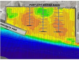
Marina Surveys
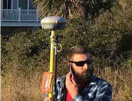
Topographic Surveys
Multi-Beam Surveys
Dredge Surveys
Sidescan Sonar
Geotechnical Analysis
LIDAR Surveys
Drone Inspections
Details
- Year established: 2013
Highlights and features
- We have 50+ years of combined experience in coastal engineering.
- Our team includes licensed engineers, geologists, and surveyors.
- We utilize advanced LIDAR and multi-beam bathymetric technologies.
- Award-winning service with 100+ completed coastal projects.
- Personalized solutions tailored to coastal and dredging communities.
Associations and certifications
- USACE-certified
- AASHTO
Services
Beach Monitoring
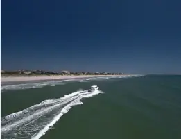
We conduct annual coastline surveys to assess beach health and erosion patterns. Our data supports coastal management decisions for communities. Advanced tools ensure accurate, actionable insights for long-term shoreline preservation.
Multi-Beam Surveys
Using multibeam bathymetric technology, we create high-resolution seafloor images with 100% coverage. This method detects subtle environmental changes. Clients rely on our detailed data for dredging and habitat assessments.
Dredge Surveys
We provide real-time surveying to guide dredge operations, ensuring precision and compliance. Our team collaborates with contractors to optimize project efficiency. Accurate volume calculations minimize costs and environmental impact.
LIDAR Surveys
High-resolution LIDAR captures above-water topography for coastal projects. This technology integrates with hydrographic data to model complex environments. Clients use our LIDAR outputs for floodplain analysis and infrastructure planning.
Geotechnical Analysis
Our USACE-certified lab analyzes sediment samples to inform coastal projects. Results determine soil stability and suitability for construction. This data supports dredge material disposal and habitat restoration efforts.
Questions
What coastal engineering services does TI Coastal offer?
We specialize in beach monitoring, dredge surveys, hydrographic mapping, and geotechnical analysis using advanced technologies like LIDAR and multi-beam sonar.
Do you work on freshwater projects?
Yes, we survey lakes, rivers, and dams using the same precision tools applied in coastal environments.
Are your professionals licensed?
Our team includes licensed Professional Engineers, Geologists, and Land Surveyors with industry certifications.
How do you support dredging projects?
We act as the 'eyes' of dredge operations, providing real-time surveying for accuracy and compliance throughout the project lifecycle.
What areas do you serve?
We focus on coastal regions along the East Coast, barrier islands, and the Atlantic Intracoastal Waterway (AIWW).