Business Details
We founded White Land Survey in October 2002 to serve property owners throughout Missouri with professional land surveying expertise. Our principal, Michael White, has held a Missouri Professional Land Surveyor license since 1994 and brings over 35 years of personal experience to every project. We combine that deep background with 20-plus years of project management experience gained at local private firms. Our team utilizes current electronic surveying instruments including Robotic Total Stations, GPS equipment, and CAD drafting to deliver precise results. We protect the health, safety, and welfare of the public by adhering to all applicable state and local regulations. We understand that your property represents your largest investment, so we provide sound, honest advice tailored to your specific needs.
Our process begins with personal client consultation and in-depth project analysis before we agree on service scope, cost, and schedule. We strive to complete every survey in a timely and affordable manner without compromising quality or integrity. As active members of our community and the Ozark Chapter of MARLS, we uphold ethical and fair business practices with both the public and our peers. We are committed to satisfactory completion and delivery of the final product that meets your expectations. We welcome the opportunity to discuss your surveying needs and develop a customized solution for your property.
Our process begins with personal client consultation and in-depth project analysis before we agree on service scope, cost, and schedule. We strive to complete every survey in a timely and affordable manner without compromising quality or integrity. As active members of our community and the Ozark Chapter of MARLS, we uphold ethical and fair business practices with both the public and our peers. We are committed to satisfactory completion and delivery of the final product that meets your expectations. We welcome the opportunity to discuss your surveying needs and develop a customized solution for your property.
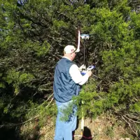
Highlights and features
- We provide over 35 years of licensed surveying expertise.
- We utilize Robotic Total Stations, GPS, and CAD drafting.
- We protect public health, safety, and welfare always.
- We deliver timely, affordable surveys with ethical practices.
- We offer personal consultation and in-depth project analysis.
Services
Property Purchase Surveys
We perform detailed boundary surveys for property buyers to confirm legal descriptions and identify potential discrepancies before closing. Our licensed surveyors use Robotic Total Stations and GPS technology to deliver accurate plat maps that satisfy lender and title company requirements. This service protects your investment by revealing encroachments or easements that could affect ownership rights.
Construction Improvement Surveys
We provide precise construction staking and site layout surveys for contractors and owners preparing to build new improvements. Our team utilizes CAD drafting and robotic instruments to translate design plans into accurate field markers that guide excavation and foundation work. This ensures compliance with setback regulations and prevents costly construction errors or boundary disputes.
Subdivision Surveys
We manage comprehensive subdivision surveys for developers dividing land into smaller lots or parcels in accordance with Missouri statutes. Our process includes preliminary research, boundary retracement, and creation of final subdivision plats that meet local planning and zoning requirements. Clients receive legally defensible documents that facilitate lot sales and future property transfers.
Area Verification Surveys
We conduct area verification surveys for property owners needing accurate acreage calculations for tax assessments or insurance valuations. Using GPS survey equipment and CAD analysis, we determine precise land measurements that support fair taxation and adequate coverage. This service eliminates guesswork and provides documented evidence for appeals or policy adjustments.
Encroachment Surveys
We perform encroachment detection surveys when property owners suspect unauthorized intrusion onto their land by neighboring structures or improvements. Our licensed surveyors retrace original boundaries and compare current occupations to recorded plats, delivering clear exhibits that document any overlaps. The resulting survey provides the factual basis for legal resolution or neighbor negotiations.