Business Details
Trusted Land Surveying Services in Wall, NJ
InSite Surveying has established itself as a trusted provider of comprehensive land surveying solutions for corporate, private, and government clients across residential, commercial, industrial, and institutional markets. Our team of licensed professionals is selected for their expertise and educational backgrounds, ensuring high-quality results tailored to each project's unique requirements. We specialize in boundary and property surveys, topographic mapping, construction stakeout, and specialized services like FEMA elevation certificates and ALTA/ACSM surveys. Our commitment to accuracy is supported by continuous investment in cutting-edge technology and ongoing professional education. With experience dating back to 2005 in heavy highway and bridge construction layout, we apply a construction-focused mindset to every project.Our approach emphasizes direct client collaboration from project inception to delivery, ensuring alignment with client goals. We serve a diverse clientele including developers, architects, construction firms, and homeowners, maintaining a reputation for timely and cost-effective solutions. Our quality assurance processes guarantee precision in every survey, whether for small residential properties or large-scale infrastructure projects. This dedication to excellence has solidified our position as New Jersey's premier surveying firm. Through technological innovation and expert execution, we consistently deliver surveying solutions that meet evolving industry standards.
Services
Boundary Surveys
Topographic Surveys
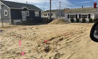
Construction Stakeout
ALTA/ACSM Surveys
Hydrographic Surveys
Wetland Surveys
Utility Surveys
FEMA Elevation Certificates
Subdivision Plats
As-Built Surveys
Highlights and features
- Our team includes licensed professionals with 20+ years of construction layout experience
- We utilize the latest surveying technology for maximum accuracy
- We guarantee precise boundary resolution and elevation certifications
- We deliver projects on schedule for construction and development timelines
- We offer comprehensive services from boundary surveys to hydrographic mapping
Services
Boundary Surveys
Our boundary surveys precisely define property lines using advanced technology and historical records. This service helps resolve disputes, supports real estate transactions, and ensures compliance with local regulations. Our licensed professionals deliver accurate documentation for residential and commercial properties.
Topographic Surveys
We create detailed topographic maps showing natural and man-made features. These surveys support construction planning, environmental assessments, and land development projects. Our digital mapping technology ensures precise elevation data and terrain modeling for engineering applications.
Construction Stakeout
Our construction stakeout services guide building projects with exact positioning of structures and utilities. We work closely with contractors to maintain alignment with design plans. This service ensures accurate implementation of engineering specifications for infrastructure and site development projects.
FEMA Elevation Certificates
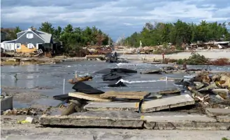
We provide FEMA-compliant elevation certificates for flood insurance requirements. This service includes precise elevation measurements relative to flood zones. Our documentation helps property owners obtain accurate insurance rates and meet regulatory requirements for buildings in flood-prone areas.
Hydrographic Surveys
Our hydrographic surveys map underwater terrain for coastal and inland water projects. This service supports dredging operations, bridge construction, and environmental monitoring. We use specialized equipment to collect accurate depth measurements and underwater feature data.
People
Justin J. Hedges
Partner
Licensed Professional Land Surveyor with 20+ years of experience in boundary resolution and construction layout. Specializes in utility surveys and topographic mapping. Holds BS in Surveying Engineering Technology from NJIT. Focuses on client collaboration and technological innovation.
Questions
What types of surveying services do you offer?
We provide boundary surveys, topographic mapping, construction stakeout, FEMA elevation certificates, hydrographic surveys, wetland assessments, and specialized services for residential and commercial clients.
Do you work with both residential and commercial clients?
Yes, we serve homeowners, developers, construction companies, and government agencies with surveying solutions tailored to each project's specific needs.
What areas do you service?
While based in Wall, NJ, we provide surveying services throughout New Jersey for projects of all sizes and complexity levels.
How do you ensure survey accuracy?
We use advanced surveying technology combined with licensed professionals' expertise. Our quality control processes include multiple verification steps to guarantee precise measurements and documentation.
Can you handle large infrastructure projects?
Yes, our team has extensive experience with major projects including highway reconstruction, bridge construction, and large-scale land development initiatives.