Business Details
19 Years
experience
Professional Land Surveying Services in North Carolina
Origin Land Surveying and Mapping Land Surveying and Mapping, Inc. has been a trusted provider of professional land surveying services across all 100 counties of North Carolina since 2007. Our team of licensed Professional Land Surveyors (PLS) and North Carolina Professional Land Surveyors (NCPLS) specializes in delivering precise and reliable surveying solutions for residential, commercial, industrial, and environmental projects. With expertise in advanced technologies like 3D laser scanning, GIS/GPS, and ground-penetrating radar (GPR), we address complex challenges with accuracy and efficiency. Our commitment to excellence is reflected in our adherence to North Carolina General Statutes and our ability to meet tight deadlines for critical infrastructure projects.Trusted by attorneys, engineers, municipalities, and private clients, we prioritize transparency, integrity, and client satisfaction. Our decades of experience in boundary litigation, topographic mapping, and forensic analysis ensure tailored solutions that meet the highest industry standards. Clients consistently praise our professionalism, responsiveness, and ability to deliver comprehensive surveys that exceed expectations.
Services
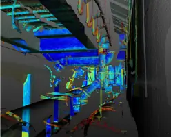
3D Laser Scanning
Commercial Land Surveying
Construction Layout Services
Environmental Land Surveying
GIS/GPS Control
GPR / Ground Penetrating Radar
Industrial Land Surveying
Residential Land Surveying
ALTA/ACSM Surveys
FEMA Elevation Certificates
Details
- Year established: 2007
Highlights and features
- We are licensed by the North Carolina Board of Examiners for Engineers and Surveyors.
- We utilize advanced 3D laser scanning and GPR technology for precise results.
- We serve all 100 counties of North Carolina, from the mountains to the coast.
- Our team has over 15 years of experience in complex surveying projects.
- We deliver timely, accurate surveys with a client-centric approach.
What people say
Professionalism and high quality
Excellent to work with
Promptly answered questions
Accurate and detailed surveys
Highly recommend
Services
3D Laser Scanning
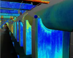
Our 3D laser scanning services capture millions of data points for complex projects, including mining, roadway design, and historical preservation. Using long-distance time-of-flight and phase-shift technology, we generate georeferenced 3D models and orthophotos for volumetric calculations, bridge inspections, and as-built mapping. Clients benefit from precise, scalable data that streamlines design and analysis for industrial, civil, and environmental applications.
Construction Layout Services
We provide accurate staking and as-built documentation for construction projects, ensuring compliance with North Carolina statutes. Our services include topographic surveys, wall and device stakeout, and engineering design surveys. By using GPS machine control systems and RTK GPS, we ensure precision in new construction, renovations, and infrastructure projects, reducing errors and delays for contractors and developers.
Environmental Land Surveying
Our environmental surveying services support wetlands mapping, FEMA floodplain analysis, and Brownsfield remediation projects. We collaborate with agencies like the Army Corps of Engineers to delineate Waters of the US and monitor well locations. These surveys aid in regulatory compliance, land development, and environmental protection efforts across North Carolina's diverse ecosystems.
GPR / Ground Penetrating Radar
Using ground-penetrating radar, we locate buried utilities, underground storage tanks, and voids with high accuracy. This non-invasive technology identifies gas, electric, and sewer lines, as well as tree roots and structural anomalies, ensuring safe excavation and infrastructure planning. Clients rely on our GPR data for utility mapping, septic system assessments, and forensic investigations.
Industrial Land Surveying
We specialize in surveys for wastewater treatment plants, pump stations, and commercial airports, including safety compliance and forensic mapping. Our team performs elevation monitoring, right-of-way verification, and 3D scanning of stockpiles to support industrial operations. Clients benefit from precise data for facility maintenance, expansion, and regulatory reporting.
People
David J. Skiba, Jr.
Professional Land Surveyor
David J. Skiba, Jr., PLS, leads all fieldwork and is responsible for Origin Land Surveying and Mapping Land Surveying and Mapping Land Surveying's services. With decades of experience in boundary litigation, water line mapping, and complex infrastructure projects, he is trusted by attorneys, engineers, and municipalities for accurate, court-ready surveys.
Questions
What services does Origin Land Surveying and Mapping Land Surveying and Mapping Land Surveying offer?
We provide 3D laser scanning, construction layout, environmental surveys, GIS/GPS, GPR, and industrial land surveying. Our expertise includes boundary mapping, FEMA elevation certificates, and forensic analysis.
Which areas do you serve?
We operate statewide in North Carolina, covering all 100 counties from the mountains to the coast, including Charlotte, Raleigh, and Wilmington.
Are your surveyors licensed?
Yes, all services are performed by licensed Professional Land Surveyors (PLS) and North Carolina Professional Land Surveyors (NCPLS).
Can you handle urgent projects?
We prioritize time-sensitive surveys for critical infrastructure but do not offer 24/7 emergency services. Contact us for project-specific timelines.
What technology do you use?
We utilize 3D laser scanning, ground-penetrating radar (GPR), RTK GPS, and GIS to ensure precision in complex projects like bridge inspections and underground utility mapping.