
Business Details
40 Years
experience
Professional Land Surveying Services in Santa Clara, CA
Wilson Land Surveys has been delivering precise and reliable land surveying services since 1986. With over 8,000 completed projects and nearly 2,000 recorded boundary surveys, we specialize in boundary surveys, topographic mapping, subdivision planning, and building location analysis. Our team of licensed professionals prioritizes accuracy, affordability, and timely execution while adhering to California's strict surveying standards. Headquartered in southern Santa Clara County since 2007, we serve clients across Santa Clara and San Mateo Counties. Our mission emphasizes not only technical excellence but also exceptional customer service, ensuring clients receive clear guidance throughout their surveying projects.With decades of combined experience, our surveyors utilize advanced tools like GPS and total stations to meet modern development needs. We maintain transparency in all processes, from initial consultations to final map filings with local jurisdictions. Our commitment to quality is reflected in our meticulous attention to legal descriptions, monument placement, and compliance with municipal requirements. As a family-owned business with three generations of surveying expertise, we blend tradition with innovation to serve residential and commercial clients. Our dedication to continuous improvement ensures clients benefit from both proven methodologies and cutting-edge technological advancements.
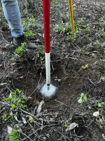
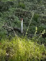
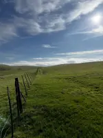
Services
Boundary Survey
Topographic Survey
Subdivision Planning
Building Location Analysis
Legal Descriptions
Details
- Year established: 1986
Highlights and features
- We have completed over 8,000 land surveying projects since 1986
- Our team includes licensed land surveyors with decades of combined experience
- We specialize in California-specific regulatory compliance for surveying projects
- We utilize advanced GPS and CAD technologies for precise measurements
- Our family-owned business combines generational expertise with modern methodologies
Services
Boundary Survey
Our boundary surveys precisely determine property lines using state-mandated procedures. Licensed surveyors locate existing monuments, set new markers, and create official records required for building permits or property disputes. We ensure compliance with California's strict surveying standards while providing clear documentation for homeowners and developers.
Topographic Survey
We create detailed topographic maps showing natural and man-made features. Our surveys include elevations, utilities, trees, and structures to support construction planning. These comprehensive site analyses help architects and engineers design projects that align with existing terrain conditions and regulatory requirements.
Subdivision Planning
Our team prepares subdivision maps meeting local jurisdiction standards. We handle SB9 lot splits and other complex parcel divisions, ensuring compliance with municipal codes. From initial design to final map filing, we guide clients through the entire subdivision approval process.
Building Location Analysis
We accurately map existing structures relative to property boundaries for new construction projects. This critical service ensures proper placement of additions, ADUs, and new buildings while meeting local zoning requirements and preventing future encroachment issues.
Legal Descriptions
Our licensed surveyors create precise legal descriptions required for property transfers and development. We prepare detailed exhibits that meet county recorder standards, ensuring clear documentation for real estate transactions and boundary determinations.
People
Kenneth D. Wilson
Land Surveyor
Licensed since 1985 with over 35 years of California surveying experience. Specializes in boundary determination and regulatory compliance. Leads project execution and quality control.
Koen T. Wilson
Land Surveyor
Licensed since 2017, focusing on modern surveying technologies and subdivision planning. Provides technical expertise for GPS mapping and CAD documentation.
Erich T. Wilson
Chief Financial Officer
JD-qualified financial strategist managing business operations. Ensures fiscal responsibility while maintaining high service standards and client satisfaction.
Mizrain Martinez
Survey Technician
Experienced field technician supporting survey execution. Specializes in data collection and monument placement for boundary and topographic surveys.
Albert Chen
Survey Technician
Technical specialist in field data acquisition. Assists with GPS measurements and site feature documentation for comprehensive survey projects.
Questions
What types of surveys do you specialize in?
We specialize in boundary surveys, topographic mapping, subdivision planning, building location analysis, and legal descriptions for residential and commercial properties.
How long have you been serving California clients?
We've completed over 8,000 projects since 1986, with our current Santa Clara County office established in 2007.
Are your surveyors licensed in California?
Yes, our lead surveyors hold active California licenses #5571 and #9440 with decades of combined experience.
What areas do you cover?
We primarily serve Santa Clara and San Mateo Counties, handling projects from simple boundary determinations to complex subdivisions.
How do you handle regulatory compliance?
We ensure all surveys meet California standards and local jurisdiction requirements, including proper monument placement and official map filings.
What information is needed for a quote?
Please provide your name, phone number, site address, and survey type (boundary, topo, subdivision, etc.) for accurate project estimation.