Business Details
27 Years
experience
Trusted Land Surveying Services in Lakeport, CA
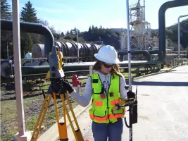
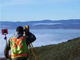
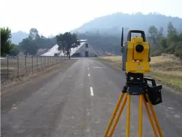
Conser Land Surveying has been serving Lake County and surrounding areas since 1999, providing professional land surveying and development consulting services. Founded by Michael W. Conser, our firm continues his legacy of integrity and precision under the leadership of his son, Michael S. Conser. Our team includes three licensed surveyors with 60 years of combined experience, supported by skilled technicians and administrators. We serve a diverse clientele including private landowners, engineering firms, legal professionals, and local municipalities. Our commitment to quality ensures every project calculation and measurement is performed by certified professionals.We offer free preliminary research and project estimates with no obligation, and maintain daily availability of licensed surveyors for client consultations. Our expertise spans boundary surveys, topographic mapping, construction staking, and boundary dispute mediation. We utilize modern technology while maintaining traditional values of professionalism and client-focused service. Our team's extensive experience includes projects in both California and Nevada, with affiliations to professional organizations like the California Land Surveyors Association. We pride ourselves on delivering accurate, timely solutions tailored to each client's unique needs.
Services
Boundary Surveys
Topographic Surveys
Construction Staking
GPS Surveys
Land Subdivisions
ALTA Surveys
FEMA Elevation Certificates
Boundary Dispute Mediation
Development Consulting
Title Searches
Details
- Year established: 1999
Highlights and features
- We have 60 years of combined experience in land surveying
- All calculations performed by licensed surveyors or certified professionals
- Daily availability of licensed surveyors for project consultations
- Expertise in both California and Nevada surveying requirements
- Free preliminary research and project estimates with no obligation
Services
Boundary Surveys
Our boundary surveys precisely determine property lines using advanced technology and legal documentation. We provide accurate measurements for land transactions, disputes, and development projects. Our licensed surveyors ensure compliance with California and Nevada regulations while maintaining detailed records for future reference.
Topographic Surveys
We create detailed topographic maps showing natural and man-made features for construction and development planning. Our surveys include elevation data, vegetation, and water bodies. This information supports engineering designs and environmental assessments with high-accuracy field measurements.
Construction Staking
Our construction staking services guide building projects with precise location markers for foundations and infrastructure. We work closely with contractors to ensure accurate implementation of design plans. Our team provides ongoing support throughout the construction process to maintain dimensional integrity.
ALTA Surveys
We conduct ALTA/ACSM land title surveys meeting national standards for commercial property transactions. Our surveys identify boundary details, easements, and improvements with title company collaboration. These comprehensive assessments minimize legal risks for property buyers and lenders.
Development Consulting
Our development consulting services assist with land use planning and regulatory compliance. We provide feasibility studies, zoning analysis, and subdivision strategies. Our expertise streamlines the approval process for residential, commercial, and industrial projects while addressing environmental considerations.
People
Michael S. Conser
Owner, PLS 8383
With 18 years of surveying experience, Michael S. Conser has led Conser Land Surveying since 2008. He specializes in Lake County projects and maintains his father's legacy of professional integrity while incorporating modern surveying technologies.
Stephen J. Bellah
Project Surveyor, PLS 13383 (Nevada)
Stephen Bellah brings 35+ years of surveying expertise to our team. A Nevada licensed surveyor since 1998, he specializes in project management and cross-state boundary analysis while preparing for California licensure.
Questions
What land surveying services do you offer?
We provide boundary surveys, topographic mapping, construction staking, ALTA surveys, land subdivisions, and development consulting services for residential, commercial, and industrial projects.
Do you serve areas outside Lake County?
While based in Lake County, we also serve surrounding regions and have experience with Nevada surveying requirements through our licensed professionals.
Are your surveyors licensed?
Yes, we employ three licensed surveyors including two California PLS and one Nevada PLS, with 60 years of combined professional experience.
How quickly can you start a project?
We typically begin projects within 3-5 business days after consultation, with licensed surveyors available daily for initial discussions and planning.
Do you offer free consultations?
Yes, we provide free preliminary research and project estimates with no obligation for all potential clients.
What technology do you use?
We utilize modern GPS and digital surveying equipment while maintaining traditional quality control through licensed professional oversight of all calculations.