Business Details
27 Years
experience
Professional Surveying Services in Brookville, PA
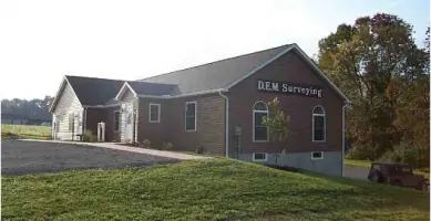
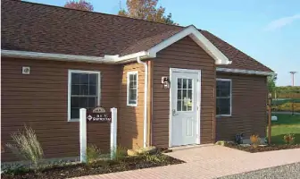
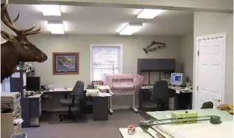
Since 1999, DEM Surveying has been dedicated to delivering high-quality professional surveying services to clients across Pennsylvania. Our team combines decades of industry experience with state-of-the-art technology, including GPS systems, AutoCAD mapping, and GIS software, to ensure precision and efficiency in every project. Certified as a Qualified HUBZone small business in 2006, we maintain rigorous safety and compliance standards, including EPA 40-hour hazardous training and DOT regulations for pipeline work.Our commitment to continuing education and membership in professional organizations like the Pennsylvania Society of Land Surveyors underscores our dedication to staying at the forefront of industry advancements. With a modern office in Brookville and a fleet of equipped vehicles, we provide tailored solutions for boundary surveys, construction stake-out, volumetric calculations, and more, ensuring client satisfaction through transparency, expertise, and reliable service delivery.
Services
Boundary Surveys
ALTA-ACSM Surveys
Topographic Surveys
Construction Stake-Out
Volumetric Surveys
Hazardous Site Surveys
Pipeline Surveys
Erosion Control Plans
AutoCAD Mapping
GPS Surveying
Details
- Year established: 1999
Highlights and features
- We have over 20 years of experience in professional land surveying.
- Our team uses state-of-the-art GPS and GIS mapping technologies.
- Certified HUBZone small business with federal contracting advantages.
- Maintain Professional Liability Insurance for client protection.
- Staff hold EPA 40-hour hazardous site training certifications.
Associations and certifications
- HUBZone
Services
Boundary Surveys
Our boundary surveys precisely define property lines using electronic total stations and GPS technology. We deliver detailed maps and legal documentation to resolve disputes or support real estate transactions. Clients receive color plots and digital files for easy integration with other project data.
Construction Stake-Out
We provide accurate construction stake-out services for infrastructure and building projects. Using advanced GPS systems, we mark critical points for foundations, utilities, and grading. Our team ensures compliance with project specifications and timelines for developments of all sizes.
Hazardous Site Surveys
Our hazardous site surveys follow EPA 40-hour training standards for Superfund and contaminated sites. We combine GPS mapping with safety protocols to collect data in high-risk environments. This service supports environmental remediation and regulatory compliance reporting.
Pipeline Surveys
We conduct pipeline surveys meeting DOT regulations for natural gas infrastructure. Our GPS systems ensure precise alignment documentation, while our drug-free workplace program maintains compliance. These surveys support pipeline maintenance, expansion, and safety audits.
Topographic Surveys
Our topographic surveys capture terrain features using GPS and total stations. We create detailed elevation models for engineering and land development projects. Deliverables include AutoCAD files and contour maps to support site planning and design decisions.
People
Daniel E. Moore
Founder / Professional Land Surveyor
Daniel E. Moore, PLS, established DEM Surveying in 1999 after earning his professional license. With over two decades of experience, he oversees project quality and technical standards while maintaining active involvement in field operations.
Steven T. Korchak
Surveyor
Steven T. Korchak brings extensive field expertise to DEM Surveying. Certified in hazardous site safety protocols, he specializes in construction stake-out and GPS data collection for complex infrastructure projects across Pennsylvania.
Questions
What types of surveying services does DEM Surveying offer?
We specialize in boundary surveys, ALTA-ACSM land title surveys, topographic mapping, construction stake-out, volumetric calculations, hazardous site assessments, pipeline surveys, and erosion control plans.
Is DEM Surveying certified for government contracts?
Yes, we are a Qualified HUBZone small business concern, providing federal contracting advantages and compliance with federal safety regulations.
What technology does DEM Surveying use?
We utilize GPS systems with 0.5 cm accuracy, AutoCAD mapping software, GIS tools, and Trimble equipment for precise data collection and digital deliverables.
Do you serve areas outside Pennsylvania?
Our primary service area is Pennsylvania, with a focus on western regions, though we may consider projects requiring specialized expertise beyond this region.
What safety certifications does your team hold?
Key personnel have EPA 40-hour hazardous site training, and we comply with DOT regulations for natural gas pipeline surveying.
Can you provide digital survey deliverables?
Yes, we offer digital plans via CD or diskette using AutoCAD software, ensuring compatibility with modern engineering and design workflows.