Business Details
30 Years
experience
Trusted Surveying, Engineering & Land Development Services in Southern Louisiana
Founded in 1996, we have dedicated ourselves to delivering exceptional surveying, engineering, and land development services across Southern Louisiana. Our growth from a small surveying firm to a trusted industry leader reflects our commitment to meeting evolving client needs while maintaining an employee-friendly culture that attracts top talent. Our team's expertise ensures clients receive tailored solutions for projects ranging from boundary surveys to complex land development.Strategically located in Livingston and Gonzales, we serve Livingston, Ascension, and Tangipahoa Parishes with precision and reliability. Recognized by organizations like the Louisiana Society of Professional Surveyors, we combine cutting-edge technology with decades of local experience to deliver results that stand the test of time. Our focus remains on empowering clients through transparent communication and comprehensive support from project inception to completion.

Services
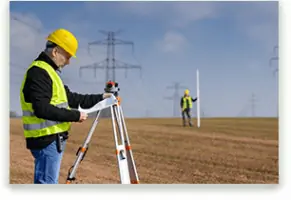
Surveying Services
Engineering Design
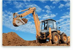
Land Development
Drainage Studies
Traffic Impact Analysis
Construction Plans
Details
- Year established: 1996
Highlights and features
- We offer 25+ years of localized surveying and engineering expertise
- Our team utilizes advanced technology for superior measurement accuracy
- Strategically located offices enable rapid response across three parishes
- Employee-centric culture ensures consistent high-quality service delivery
- Recognized industry leader with proven land development methodologies
Associations and certifications
- Louisiana Society of Professional Surveyors
- National Federation of Independent Business
Services
Surveying Services
We provide comprehensive boundary surveys, legal descriptions, and construction stakeouts using advanced GPS technology. Our services ensure property line accuracy and support infrastructure development projects. Clients benefit from precise data collection and legally compliant documentation for residential and commercial applications.
Engineering Design
Our engineering team creates detailed drainage plans, traffic studies, and utility layouts. We develop site-specific solutions for grading, sewer systems, and construction projects. Clients receive fully permitted plans that meet regulatory requirements while optimizing project feasibility and cost efficiency.
Land Development
We offer end-to-end land development consultation including feasibility analysis and cost projections. Our experts evaluate financial, environmental, and regulatory factors to create successful development strategies. Clients gain actionable plans that maximize property potential while minimizing long-term risks.
Drainage Impact Studies
Specialized drainage modeling using WaterCAD and PondPack software ensures optimal water management solutions. We assess flood risks and design stormwater systems for residential and commercial developments. Clients receive data-driven recommendations that enhance site safety and regulatory compliance.
Traffic Impact Analysis
We conduct comprehensive traffic assessments using HCS2000 and PetraPro software to evaluate development impacts. Our analyses inform road design and intersection improvements. Clients benefit from evidence-based solutions that address traffic flow and safety concerns for new construction projects.
Questions
What geographic areas do you serve?
We primarily serve Livingston, Ascension, and Tangipahoa Parishes in Southern Louisiana from our offices in Livingston and Gonzales.
What surveying services do you offer?
Our surveying services include boundary surveys, legal descriptions, lot stakeouts, construction stakeouts, and no-work affidavits for residential and commercial properties.
How long have you been in business?
We've provided engineering and surveying services since 1996, with our founding team maintaining continuous operations for over 25 years.
What technology do you use?
We utilize advanced tools like Trimble GPS, Autodesk software, and hydraulic modeling programs to ensure precision in all surveying and engineering projects.