Business Details
19 Years
experience
Professional Land Surveying & Design Services in Asheville
Since 2007, Cole Surveying & Design, PA has been delivering precise land surveying and comprehensive design solutions to clients in Asheville and throughout Western North Carolina. Originally established as Wes Cole Land Surveying, our firm expanded its service offerings in 2019 to include landscape architecture, historic preservation, and regulatory compliance assistance while maintaining our commitment to detailed, accurate surveying. Our team holds professional licenses in North Carolina, South Carolina, and Tennessee, with specialized certifications in floodplain surveying and construction documentation. We utilize advanced technologies like aerial drone/UAV surveying and specialize in ALTA surveys to meet complex project requirements. Founder J. Wes Cole, a licensed Professional Land Surveyor since 2007, personally oversees projects to ensure quality deliverables that stand the test of time.Director of Landscape Architecture Hillary Cole brings expertise in historic preservation and landscape planning, having worked with national firms and local engineering companies prior to joining CSD. Our approach combines technical expertise with personalized service, supporting clients from initial planning stages through project completion. We serve diverse sectors including construction, conservation, and government projects, with notable work on the Cherry Creek Greenway Extension and USDA Forest Service surveys. Our reputation for thoroughness has earned trusted partnerships with firms like Amarx Construction, where our attention to detail consistently exceeds client expectations.
Services
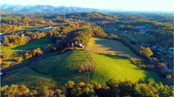
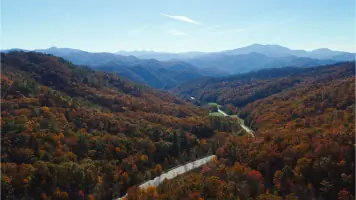
Aerial Drone Surveying
Land Planning
Landscape Architecture
ALTA Surveys
Historic Preservation
Details
- Year established: 2007
Highlights and features
- 15+ years of combined leadership experience in surveying and landscape architecture
- Licensed in three states for regional project flexibility
- Specialized UAV drone surveying capabilities
- Certified experts in floodplain and historic preservation services
- Client-focused approach with direct principal involvement
Associations and certifications
- NC PLS #L-4561
- TN RLS #2432
- SC PLS #27443
- NC Certified Floodplain Surveyor #150
- NC 1847 RLA
- SC 1272 RLA
What people say
Outstanding job
No detail overlooked
Services
Aerial Drone Surveying
Our aerial drone surveying service provides high-resolution topographic data using advanced UAV technology. This method offers faster data collection, reduced field time, and enhanced safety for complex sites. Clients receive accurate 3D models and GIS-ready deliverables for construction, land development, and environmental monitoring applications.
ALTA Surveys
We conduct comprehensive ALTA/NSPS land title surveys meeting strict insurance and lending requirements. Our process includes boundary verification, easement identification, and improvements mapping. Clients receive detailed reports that satisfy title companies and minimize legal risks during property transactions.
Landscape Architecture
Our landscape architecture service integrates functional design with environmental stewardship. We create site plans for residential, commercial, and public spaces while maintaining historic preservation standards. Clients benefit from code-compliant designs that balance aesthetics with practical land use requirements.
Historic Preservation
Specialized historic preservation services document architectural heritage and cultural landscapes. We conduct field surveys, prepare National Register nominations, and advise on preservation guidelines. Clients receive technical expertise that maintains historical integrity while meeting modern development needs.
Land Planning
Our land planning service transforms raw land into functional developments through strategic site analysis. We create conceptual layouts, zoning compliance strategies, and infrastructure plans. Clients receive feasible development frameworks that optimize land use while meeting regulatory requirements.
People
J. Wes Cole
Founder/Director of Surveying
Licensed surveyor since 2007 with NC, TN, and SC credentials. Holds floodplain certification #150. Graduated from East Tennessee State University with surveying degree while working in the field. Prior experience includes engineering firms in Winston-Salem and Asheville before founding CSD in 2007.
Hillary Cole
Director of Landscape Architecture
Registered Landscape Architect in NC (#1847) and SC (#1272). Holds certifications in plant science and construction documentation. Montana native with Master's in Landscape Architecture from University of Colorado at Denver. Seven years with national firm Design Workshop and prior experience in historic preservation work.
Questions
What geographic areas do you serve?
We primarily serve Asheville and Western North Carolina, with licensed operations extending to South Carolina and Tennessee.
What surveying technologies do you use?
We utilize traditional field equipment alongside UAV drone technology for aerial mapping and 3D modeling capabilities.
Are you qualified for historic preservation projects?
Yes, our Director of Landscape Architecture holds specialized certifications and has extensive experience in historic architectural surveys.
What types of clients do you work with?
We serve construction companies, government agencies, conservation organizations, and private landowners requiring surveying and design services.
How do you ensure survey accuracy?
Our licensed professionals follow strict quality control protocols, maintain current certifications, and use regularly calibrated equipment for all projects.