Business Details
21 Years
experience
Trusted Land Surveying & Geospatial Services in Asheville
Ed Holmes & Associates Land Surveyors has been a trusted leader in geospatial services since 2005, delivering precise data collection, analysis, and interpretation to map the Earth's surface and subsurface environments. Our team combines advanced technologies like 3D laser scanning, UAS, and GIS with traditional surveying methods, leveraging hundreds of years of collective experience to serve industries including construction, real estate, and infrastructure development. We specialize in boundary surveys, topographic assessments, subsurface utility investigations, and reality capture, ensuring clients receive accurate, actionable insights. Founded in Western North Carolina, our regional expertise extends across North Carolina, South Carolina, and Tennessee, where we maintain deep knowledge of local regulations and project requirements. Our commitment to innovation is reflected in our adoption of cutting-edge tools such as LiDAR drones and ground-penetrating radar, which enhance data precision and project efficiency.We prioritize client collaboration, offering tailored solutions that align with specific project goals while maintaining rigorous quality standards. Recognized with the Sky High Growth Award by the Asheville Area Chamber of Commerce, our team remains dedicated to professional excellence and client satisfaction. Our services support critical decision-making processes, from site planning to risk mitigation, ensuring project success across diverse industries. With offices in Asheville, Hickory, Cashiers, Greenville, and Fort Mill, we provide localized service backed by national-level expertise. Our core values emphasize integrity, technical proficiency, and a relentless focus on delivering unmatched geospatial solutions.

Services
Geomatics
Construction Surveying
GIS Mapping
Remote Sensing
Subsurface Utility Investigation
Reality Capture
ALTA Surveys
Topographic Surveys
Utility Locating
3D Laser Scanning
Details
- Year established: 2005
Highlights and features
- We offer 20 years of regional expertise in Southeastern land surveying regulations.
- Our team utilizes LiDAR drones and ground-penetrating radar for superior data accuracy.
- We provide end-to-end geospatial solutions from boundary surveys to 3D modeling.
- Our subsurface utility investigations mitigate risks for construction projects.
- We maintain four office locations across North and South Carolina for rapid response.
Services
Geomatics
Our geomatics services deliver precise boundary surveys, topographic assessments, and ALTA/land title surveys using advanced GPS and traditional surveying techniques. We provide critical data for property development, infrastructure projects, and legal documentation. Our team ensures compliance with regional regulations while maintaining sub-centimeter accuracy for engineering and construction applications.
Subsurface Utility Investigation
We employ ground-penetrating radar and electromagnetic tools to map underground utilities including gas lines, water mains, and electrical conduits. Our investigations prevent costly damages during excavation by identifying both public and private utility systems. This service supports safe, code-compliant project execution across commercial and industrial sites.
Remote Sensing
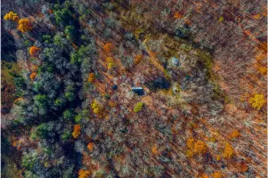
Using UAS drones and 3D laser scanning, we capture high-resolution topographic data for site analysis and progress monitoring. Our remote sensing solutions generate detailed orthoimagery and volumetric calculations to support construction management and environmental assessments. This technology enables efficient data collection in challenging terrain.
GIS Mapping
Our GIS services transform spatial data into interactive maps and analytical dashboards for urban planning and infrastructure management. We create customized geodatabases that integrate with client workflows to improve decision-making. This includes utility mapping, market analysis, and emergency response planning applications.
Construction Surveying
We provide construction staking, machine control, and as-built surveys to ensure projects align with design specifications. Our team uses robotic total stations and 3D modeling to guide earthwork, foundation placement, and structural installations. This service guarantees dimensional accuracy throughout the building process.
People
Joshua E. Holmes
President
Joshua E. Holmes leads Ed Holmes & Associates Land Surveyors with a focus on technical innovation and client relationships. He oversees strategic growth while maintaining hands-on involvement in complex surveying projects.
Jason N. Gasperson
Director of Business Development
Jason N. Gasperson drives business growth by connecting clients with tailored geospatial solutions. He focuses on expanding service offerings while maintaining regional market expertise.
Svitlana Eadie
Human Resources Director
Svitlana Eadie manages talent acquisition and employee development programs. She ensures the company attracts qualified surveyors and maintains a culture aligned with core values.
Logan Woodie
Construction Team Lead
Logan Woodie supervises construction surveying operations, implementing machine control systems and layout verification processes. He ensures field data accuracy for infrastructure and building projects.
J. Dallas Gordon
Geomatics Team Leader
J. Dallas Gordon directs boundary surveys and topographic mapping projects. He specializes in ALTA surveys and legal documentation, ensuring compliance with state-specific land surveying standards.
Questions
What geospatial services do you offer?
We provide land surveying, GIS mapping, remote sensing, subsurface utility investigations, and construction surveying services for commercial and infrastructure projects.
Which states do you serve?
Our primary service areas include North Carolina, South Carolina, and Tennessee, with offices in Asheville, Greenville, Hickory, Cashiers, and Fort Mill.
What technologies do you use?
We utilize LiDAR drones, 3D laser scanners, ground-penetrating radar, and GIS software to deliver accurate spatial data and analysis.
How long have you been in business?
Founded in 2005 as Ed Holmes & Associates, we've provided geospatial services for 20 years under our current leadership team.
Can you handle large-scale infrastructure projects?
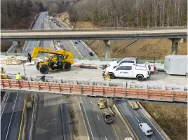
Yes, our team has experience supporting highway expansions, utility corridor mapping, and major development projects requiring precise spatial data.
Do you offer emergency surveying services?
We prioritize scheduled projects but maintain field crews for urgent requests related to construction delays or regulatory compliance issues.