Business Details
35 Years
experience
Your Trusted Partner for Professional Land Surveying Services
Founded in 1991, Berding Surveying has established itself as a leader in professional land surveying services. Located in Milford, Ohio, we operate as a Service Disabled Veteran Owned Small Business, combining military precision with technical expertise. Our team leverages cutting-edge technology including 3D laser scanning, UAVs, and GNSS systems to deliver accurate data for complex projects. With over 30 years of experience, we've completed thousands of surveys for infrastructure, construction, and legal applications across the Midwest. Our specialized focus on surveying-only services eliminates overhead costs while maintaining field-to-office efficiency. We maintain prequalification for ODOT and KYTC projects through rigorous technical training and proven performance.Our five survey crews operate daily throughout the Greater Cincinnati area, with capabilities extending to national projects. Investment in advanced equipment like NavVis VLX scanning systems ensures data integrity for diverse applications from geological formations to industrial facilities. Our 15-20 person team maintains an average tenure of 15 years, ensuring continuity of expertise. Under new leadership transitioning to Dan Berding, a Vanderbilt-educated engineer with field experience since 2012, we continue advancing surveying methodologies while maintaining our commitment to precision and client satisfaction.
Services
3D Laser Scanning
Unmanned Aerial Vehicles
Boundary Surveys
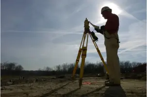
Construction Layout
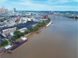
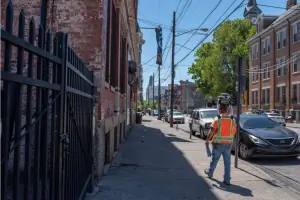
Infrastructure Surveying
ALTA Surveys
Terrestrial Scanning
Details
- Year established: 1991
Highlights and features
- 30+ years of specialized land surveying experience
- Advanced technology including 3D laser scanning and UAVs
- FAA-licensed UAS pilots for aerial photogrammetry
- Prequalified for ODOT and KYTC transportation projects
- Team with 15-year average industry tenure
Associations and certifications
- Service Disabled Veteran Owned Small Business (SDVOSB)
Services
3D Laser Scanning
Our 3D laser scanning captures precise 360-degree measurements of structures and landscapes. Using NavVis VLX wearable systems and tripod-mounted scanners, we create detailed digital twins for engineering analysis. This technology supports applications from geological surveys to industrial facility documentation while maintaining data integrity through cross-checking with traditional benchmarks.
Unmanned Aerial Vehicles
UAV-based photogrammetry provides aerial data collection for large-scale mapping projects. Our FAA-licensed pilots operate drones to capture elevation data and feature locations for base maps. This method enhances traditional surveying by efficiently covering extensive areas while maintaining centimeter-level accuracy for infrastructure planning and monitoring.
Boundary Surveys
We conduct precise boundary determination using advanced GNSS technology and historical record analysis. Our ALTA-compliant surveys meet legal requirements for property transactions and development projects. Surveyors establish clear property lines while identifying encroachments, providing critical data for real estate and construction professionals.
Construction Layout
Our construction layout services translate design plans into physical markers for accurate building implementation. Using robotic total stations and digital data, we stake critical points for foundations, utilities, and infrastructure. This ensures projects maintain dimensional accuracy from design through completion, reducing costly rework.
Infrastructure Surveying
We support transportation projects with right-of-way mapping and corridor analysis. Our team has completed surveys for highway expansions, rail systems, and utility corridors. Specialized experience includes ODOT prequalified projects, providing precise data for roadways, bridges, and public transit infrastructure development.
People
Dan Berding
Owner & Project Manager
Dan Berding leads survey operations with engineering expertise from Vanderbilt University and advanced studies at Virginia Tech. With over a decade of field experience since 2012, he oversees technical execution while managing the firm's transition to new ownership. His background combines civil engineering principles with practical surveying applications for complex infrastructure projects.
Questions
What surveying services do you specialize in?
We specialize in boundary surveys, 3D laser scanning, UAV photogrammetry, construction layout, and infrastructure surveying for transportation and development projects.
What geographic areas do you serve?
We primarily serve Greater Cincinnati, Northern Kentucky, and the I-71/I-75 corridor, with project capabilities extending throughout the Midwest and nationally.
What technology do you use for surveys?
We utilize GNSS systems, terrestrial and aerial LiDAR, 3D laser scanning (including NavVis VLX), and UAV-based photogrammetry for accurate data collection.
Are you certified for government projects?
Yes, we're prequalified for Ohio Department of Transportation and Kentucky Transportation Cabinet projects through technical training and proven performance.
How experienced is your team?
Our team maintains an average tenure of 15 years, with FAA-licensed UAS pilots and surveyors experienced in complex infrastructure projects.