Business Details
37 Years
experience
Keystone Precision Solutions: Expert Surveying Services
Keystone Precision Solutions has been a trusted partner in the surveying, construction, and engineering industries for 35 years. We specialize in providing state-of-the-art GPS systems, laser scanning technology, drones, and precision measurement equipment to enhance workflow, productivity, and profitability for our clients. Our comprehensive services include equipment calibration, preventative maintenance, and repair through a Trimble Certified Repair facility, ensuring minimal downtime for our customers.Our team of expert support specialists guides clients through cutting-edge technologies and tailored solutions. With a transition from equipment provider to solutions partner, we prioritize understanding and addressing unique client needs while maintaining a steadfast commitment to the geospatial industry and project success.
Services
3D Laser Scanning
GPS Survey Solutions
Drone Mapping
GNSS Systems
Total Station Repair
Mobile Mapping
Hydrographic Surveying
Field Software
Equipment Calibration
Certified Training
Details
- Year established: 1989
Highlights and features
- 35 years of specialized experience in surveying and construction technology
- Comprehensive solutions from equipment sales to certified repair services
- Trimble Certified Repair facility for precision instrument maintenance
- Proactive support for emerging technologies and workflow optimization
- Dedicated to client success through tailored equipment and training
Services
3D Laser Scanning
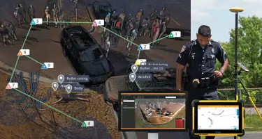
Our 3D laser scanning solutions capture precise spatial data for complex projects. Using Trimble SX12 and X7 systems, we enable detailed modeling of infrastructure, buildings, and terrain. This technology improves accuracy and reduces field time for surveying and construction professionals.
Drone Mapping
Wingtra drone solutions provide high-resolution aerial mapping for construction and land surveying. These unmanned systems offer efficient data collection over large areas while maintaining survey-grade accuracy for topographic mapping and volume calculations.
GNSS Systems
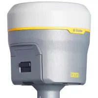
We supply advanced GNSS receivers like Trimble R750 and Spectra Precision SP60 for real-time positioning. These systems deliver centimeter-level accuracy for boundary surveys, construction layout, and geodetic applications in challenging environments.
Total Station Repair
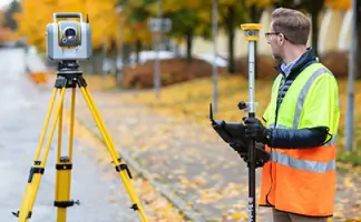
Our Trimble Certified Repair facility services robotic and conventional total stations. We perform precision calibration and component replacement to maintain measurement accuracy for S-series and SX12 models.
Mobile Mapping
Trimble MX60 mobile mapping systems combine LiDAR and imaging for roadway and utility corridor documentation. This technology enables rapid data collection while maintaining high positional accuracy for infrastructure projects.
Questions
What geographic areas do you serve?
We primarily serve the Northeastern United States with equipment sales, training, and support services.
Do you offer equipment repair services?
Yes, we operate a Trimble Certified Repair facility for total stations, GNSS receivers, and laser scanners.
What surveying technologies do you specialize in?
We specialize in 3D laser scanning, drone mapping, GNSS systems, and mobile mapping solutions.
Are training services available?
Yes, we provide comprehensive training for equipment operation and software applications.
What brands do you carry?
We offer Trimble, Spectra Precision, Exyn, Wingtra, and other leading geospatial technology brands.