
Business Details
17 Years
experience
Professional Land Surveying Services in Austin, TX
4Ward Land Surveying was founded in 2009 with a commitment to delivering exceptional land surveying and geospatial solutions. Our team combines advanced technology with traditional methods to provide accurate data for landowners, developers, and public entities. With over two decades of collective experience, our project managers specialize in holistic project analysis, ensuring clients receive tailored solutions that optimize time and budget efficiency. We maintain a culture of innovation, investing in cutting-edge tools like LiDAR drones and proprietary client portals to enhance service delivery. Our reputation for quality, responsiveness, and accountability has been built through partnerships with architects, engineers, and contractors across Texas.By fostering transparent communication and collaborative workflows between field crews, CAD technicians, and clients, we ensure precision at every project stage. Our expertise spans boundary surveys, construction layout, aerial mapping, and GIS data management, supporting both private and public sector needs. As a TBPELS-registered firm, we adhere to rigorous professional standards while continuously refining processes to exceed industry expectations. Our client-centric approach prioritizes long-term relationships over transactional interactions, demonstrated through customized deliverables and proactive problem-solving. This dedication to excellence has positioned us as a trusted partner in shaping Texas communities through reliable surveying services.
Services
Land Surveying
Construction Layout
Geospatial Solutions
ALTA Surveys
Utility Mapping
Details
- Year established: 2009
Highlights and features
- We combine traditional surveying with cutting-edge LiDAR and GIS technology
- Our proprietary client portal enables interactive survey data access
- Project managers collaborate directly with field crews for quality control
- 24/7 communication availability for urgent project needs
- Registered professionals with combined 50+ years of Texas-specific experience
Associations and certifications
- Texas Board of Professional Engineers and Land Surveyors (TBPELS)
What people say
Exceptional accuracy
Cutting-edge technology
Responsive team
Detailed deliverables
Expert analysis
Services
Land Surveying
Our land surveying services combine traditional methods with modern technology to deliver precise boundary determinations. We execute ALTA/Title Surveys, subdivision plats, and elevation certificates for residential and commercial developments. Our team ensures compliance with Texas survey standards while providing data-driven insights for property transactions and development planning.
Construction Layout
We provide comprehensive construction layout services for vertical and horizontal developments. Our team delivers accurate staking for building foundations, roadways, and utility installations. Using robotic total stations and GPS technology, we ensure precise implementation of engineering plans across projects ranging from small pads to high-rise complexes.
Geospatial Solutions
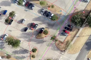
Our geospatial division utilizes drones and terrestrial scanners to create detailed 3D models and topographic maps. We offer aerial LiDAR mapping, bathymetric surveys, and GIS data management services. These technologies support infrastructure planning, asset management, and environmental assessments with actionable spatial data.
People
Carey Johnson
Senior Project Manager
Third-generation land surveyor with 16 years of experience specializing in geospatial solutions. Develops cutting-edge GIS deliverables while maintaining workflow compatibility with traditional engineering practices.
Paul Guerrero
Project Manager
Registered Professional Land Surveyor with 23 years of experience managing large-scale development and renewable energy projects. Expert in ALTA surveys and subsurface utility investigations across Texas.
Drew Vandiver
Project Manager
Surveyor In Training with 7 years of experience overseeing boundary and topographic surveys. Focuses on innovation adoption and process optimization to enhance service quality and client satisfaction.
Jason Osborne
Field Crew Manager
17-year industry veteran managing field operations for diverse survey types including hydrographic, boundary, and construction staking projects. Ensures technical excellence through rigorous crew training and quality control protocols.
Questions
What geographic areas do you serve?
We primarily serve Texas with land surveying projects, while our GIS mapping capabilities extend nationwide for utility and infrastructure clients.
What technologies do you use?
Our toolkit includes LiDAR drones, terrestrial scanners, GPS systems, and proprietary software for data visualization and client collaboration.
How do you ensure survey accuracy?
We implement multi-stage quality checks with field-to-office verification, using calibrated equipment and cross-trained professionals at every project phase.
What project types do you handle?
Our experience spans residential developments, commercial sites, transportation corridors, renewable energy facilities, and municipal infrastructure projects.
How can clients access survey data?
Our proprietary client portal provides secure, interactive access to survey deliverables including digital maps, 3D models, and GIS datasets.