Business Details
50+ Years
experience
Your Trusted Partner for Geospatial Surveying Solutions
GdB Geospatial has dedicated six decades to delivering precise geospatial data solutions for infrastructure, property, and energy sectors across the Northeast. Founded as a small civil engineering firm on Long Island, our evolution into a team of over 100 professionals across three offices reflects our commitment to innovation and technical excellence. Our leadership, including licensed surveyors Christine Gayron and Jason Graf, prioritizes collaboration with client teams to develop tailored solutions that balance speed, quality, and cost-effectiveness. With expertise in advanced technologies like LiDAR, GIS, and machine control modeling, we provide actionable data that informs critical design, construction, and real estate decisions.Our work with prominent clients such as SAM, PSEG LI, and Amtrak demonstrates our ability to tackle complex projects while maintaining rigorous accuracy standards. As a WBE-certified firm, we combine 60 years of regional experience with cutting-edge methodologies to address subsurface utility challenges, topographic mapping, and large-scale infrastructure needs. Our focus remains on answering the fundamental question for every client: where? This clarity of purpose drives our dedication to precision, client partnerships, and sustainable growth in the geospatial industry.
Services
Survey and Mapping
GIS Services
Construction Surveying
LiDAR Scanning
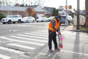
Subsurface Utility Exploration
Remote Sensing
Corridor Mapping
Machine Control Modeling
Details
- Year established: 1964
Highlights and features
- We offer 60 years of combined experience in geospatial services for infrastructure projects.
- Our team includes licensed surveyors with expertise in LiDAR, GIS, and machine control modeling.
- We utilize advanced technologies for subsurface utility exploration and 3D laser scanning.
- Our staff collaborates directly with AEC firms to develop project-specific solutions.
- We maintain rigorous accuracy standards for topographic and utility surveys.
Associations and certifications
- WBE Certified
Services
Survey and Mapping
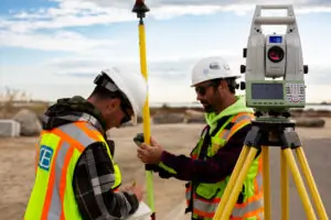
Our survey and mapping services provide precise spatial data for infrastructure and real estate projects. Using robotic total stations and LiDAR, we deliver topographic maps, boundary surveys, and utility location data. This foundational information supports design, construction, and regulatory compliance for clients across the Northeast.
Subsurface Utility Exploration
Subsurface Utility Exploration (SUE) identifies underground utilities to mitigate excavation risks. We combine ground-penetrating radar, vacuum excavation, and record research to create accurate utility maps. This service prevents costly damages and ensures safety for infrastructure projects like roadway upgrades and transmission lines.
LiDAR 3D Laser Scanning
LiDAR 3D laser scanning captures detailed as-built conditions for complex structures. We use this technology for bridge rehabilitation, airport modeling, and corridor mapping projects. The resulting point clouds enable precise measurements and clash detection in BIM workflows for improved construction outcomes.
GIS Services
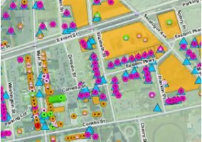
GIS services integrate spatial data for asset management and planning. We create standardized GIS databases for counties and utilities, enabling data-driven decisions. Our work includes drone data processing, watershed mapping, and needs assessments to optimize geospatial workflows for public agencies.
Machine Control Modeling
Machine control modeling guides construction equipment with real-time GPS data. We develop 3D models for grading, paving, and excavation projects. This service improves efficiency and accuracy for infrastructure work like intersection improvements and pipeline installations.
People
Christine Gayron
President & Visionary
Licensed in New York and Florida, Christine leads GdB's strategic direction with 20+ years of surveying experience. She champions team development and client collaboration while advocating for outdoor recreation and STEM education.
Jason Graf
Executive Vice President
A NYS Licensed Land Surveyor and drone pilot, Jason oversees operations with 21 years of expertise. He specializes in integrating UAV technology for large-scale mapping projects across transportation and utility sectors.
Dennis Owen Jr.
Director of Operations
With a geography background, Dennis manages Melville operations and team-building initiatives. His surveying career spans decades, focusing on innovative geospatial workflows and client relationship management.
Scott Smith
Director of Operations
Licensed in NY and PA, Scott leads Rochester operations with 33 years of field experience. He specializes in utility surveys and boundary resolution, applying technical expertise to complex infrastructure projects.
Jennifer Esposito
Finance Director
Jennifer manages financial operations with a BBA in Finance from Hofstra University. Her decade-long tenure ensures fiscal accountability while balancing client needs and operational growth.
Questions
What geospatial services does GdB offer?
We provide surveying, GIS, LiDAR scanning, subsurface utility exploration, machine control modeling, and corridor mapping for infrastructure and energy projects.
Which areas do you serve?
We primarily serve the Northeast, including New York and New Jersey, with projects spanning utility, transportation, and infrastructure sectors.
How do you ensure survey accuracy?
We use robotic total stations, LiDAR, and GPS with licensed surveyors to maintain precision within industry standards for all deliverables.
Can you handle large-scale projects?
Yes, our team of 100+ professionals has completed major projects like HVDC transmission cables and Amtrak bridge replacements within tight deadlines.
Are you WBE-certified?
Yes, we hold WBE certification and have served as a subcontractor for utility and transportation projects across the Northeast.
What industries do you work with?
We specialize in infrastructure, energy, and real estate sectors, supporting AEC firms with geospatial data for design and construction.