
Business Details
28 Years
experience
Your Trusted Partner for Aerial Surveying and LiDAR Solutions
Aerial Surveys International has been a leader in aerial imagery and LiDAR acquisition since 1998. Our team combines over 130 years of collective experience in aerial surveying, ensuring precise and timely delivery of high-quality data. We specialize in LiDAR, digital aerial imagery, and GIS mapping for industries including government, energy, transportation, and resource management. Our team concept approach guarantees projects are completed on time and within budget, with a focus on client satisfaction. We operate from the Colorado Air and Space Port, enabling rapid response nationwide.Our staff includes full-time pilots, sensor operators, project managers, and data processing experts dedicated to meeting client needs. We invest in state-of-the-art equipment to maintain our reputation for accuracy and dependability. Our commitment to quality is reflected in our proven track record and long-standing relationships with mapping organizations. We serve clients across the United States, adapting our aircraft to meet specific project requirements. Our goal remains to provide superior aerial data solutions while upholding the highest standards of professionalism.
Services
LiDAR Scanning
Aerial Imagery
GIS Mapping
Platforming Equipment
Aircraft Services
Details
- Year established: 1998
Highlights and features
- We have over 130 years of combined experience in aerial surveying.
- Our team includes certified pilots, sensor operators, and data experts.
- We guarantee timely delivery of accurate geospatial data.
- We offer customized aircraft modifications for specialized projects.
- We serve clients in diverse industries nationwide.
Services
LiDAR Scanning
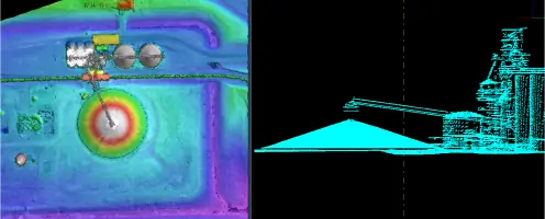
LiDAR scanning captures precise three-dimensional data of terrain using laser pulses. Our advanced systems provide high-altitude wide-area mapping for applications in infrastructure, environmental monitoring, and resource management. Clients receive accurate elevation models and detailed point clouds for informed decision-making.
Aerial Imagery
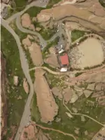
We deliver high-resolution aerial imagery using state-of-the-art cameras. Our services support urban planning, agricultural analysis, and disaster response. Images are processed to ensure clarity and precision for clients requiring visual data for large-scale projects.
GIS Mapping
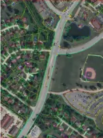
GIS mapping integrates layered data to create actionable maps for industries like transportation and energy. Our solutions enable clients to visualize spatial relationships, monitor changes, and solve location-based challenges with accurate, up-to-date information.
Platforming Equipment
We modify aircraft to host client-specific sensors and cameras. This service supports specialized data collection needs, including environmental research and industrial monitoring. Our team ensures equipment is optimized for performance during aerial surveys.
Aircraft Services
Our fleet provides reliable aerial platforms for surveying and data collection. Services include aircraft maintenance, flight planning, and logistics coordination. Clients benefit from our expertise in adapting aircraft to meet unique project requirements across the United States.
Questions
What services does Aerial Surveys International offer?
We specialize in LiDAR scanning, aerial imagery, GIS mapping, platforming equipment, and aircraft services for geospatial data collection.
Which industries do you serve?
We support government agencies, oil & gas, transportation, agriculture, forestry, energy, and mining sectors with tailored surveying solutions.
How long has your company been in business?
We were founded in 1998 and have over 130 years of combined experience in aerial surveying.
Where are you located?
Our headquarters are at the Colorado Air and Space Port in Watkins, CO, with nationwide service capabilities.
How do you ensure data accuracy?
We use advanced LiDAR and camera systems operated by experienced professionals to guarantee precise and reliable results.