Business Details
17 Years
experience
Your Trusted Land Surveying Partner in Connecticut
Advanced Surveying has been delivering precise land surveying solutions since 2009. Our team of licensed professionals brings over three decades of combined expertise to every project, utilizing cutting-edge robotic technology and GPS systems to ensure unmatched accuracy. We specialize in boundary surveys, property line staking, construction surveying, and topographical mapping for residential and commercial clients across Connecticut. Our commitment to quality is reflected in our direct supervision by experienced surveyors and our guarantee of reliable data collection. We balance traditional surveying methods with modern innovations to meet diverse client needs efficiently.Clients consistently praise our responsive service, competitive pricing, and ability to handle projects of any scale. Our focus remains on delivering actionable survey data that supports real estate transactions, construction planning, and property management decisions. With operations spanning Stamford, Greenwich, Norwalk, and all Connecticut communities, we maintain industry-leading standards while keeping costs accessible. Our reputation for technical excellence and client satisfaction has made us a trusted partner for property professionals statewide.

Services
Boundary Surveys
Property Line Staking
Construction Surveying
Topographical Mapping
As-Built Surveys
Elevation Certificates
Details
- Year established: 2009
Highlights and features
- We have over 30 years of experience in land surveying
- Our surveys are conducted by licensed professionals
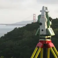
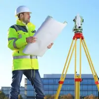
- We utilize advanced robotic technology and GPS systems
- We guarantee accurate data collection and reliable results
- We offer competitive pricing with quick turnaround times
Services
Boundary Surveys
Our boundary surveys precisely define property lines using licensed surveyor oversight and advanced GPS equipment. This service supports real estate transactions, legal documentation, and land development projects across Connecticut. Clients receive detailed maps and measurements that meet state regulatory standards while preventing future property disputes.
Construction Surveying
We provide construction surveying services that ensure accurate layout for building projects. Our team marks precise locations for foundations, utilities, and structures using robotic technology. This service helps contractors maintain compliance with architectural plans and zoning requirements throughout Connecticut's diverse terrain.
Topographical Mapping
Our topographical surveys create detailed elevation models of land surfaces. This service documents natural features and man-made structures to support engineering designs and land development. Clients receive digital and printed maps that combine traditional survey methods with modern GPS accuracy for Connecticut properties.
Elevation Certificates
We produce elevation certificates that document building elevations relative to flood zones. This FEMA-compliant service supports flood insurance requirements and risk assessments. Our licensed surveyors deliver certified documentation quickly for Connecticut homeowners and commercial property owners in flood-prone areas.
As-Built Surveys
Our as-built surveys verify completed construction against original plans. This service documents final structures' exact positions for municipal approvals and future renovations. Using precision equipment, we ensure Connecticut commercial developers and homeowners receive accurate records that reflect actual construction outcomes.
Questions
What surveying services do you offer?
We provide boundary surveys, property line staking, construction surveying, topographical mapping, as-built surveys, and elevation certificates for Connecticut properties.
Which areas do you serve?
We operate throughout Connecticut including Stamford, Norwalk, Greenwich, Westport, and all Fairfield County communities.
How do you ensure survey accuracy?
Our licensed surveyors use advanced GPS and robotic technology under direct supervision, combining traditional methods with modern precision tools.
What payment methods do you accept?
We process payments through PayPal, which accepts major credit cards without requiring a PayPal account. Payments include a 3.5% processing fee.
How quickly can you complete a survey?
Most standard surveys are completed within 3-5 business days, with urgent requests accommodated based on project complexity and location.
Are your surveyors licensed?
Yes, all surveys are conducted by or under supervision of Connecticut-licensed land surveyors with over 30 years combined experience.