Business Details
41 Years
experience
Emergency
services
Expert Surveying Services in Vero Beach, FL
Founded in 1985, Morgan & Eklund has established itself as a leader in land and hydrographic surveying. Our team of certified professionals brings decades of experience to complex projects across Florida and beyond. We specialize in boundary, topographic, GPS, and hydrographic surveys, utilizing cutting-edge technology to deliver precise data. With four registered land surveyors and advanced equipment, we serve government agencies, engineering firms, and construction contractors. Our integration with sister company CSA Ocean Sciences expands our capabilities to include geophysical and oceanographic services.We maintain rigorous quality control while meeting tight deadlines for critical infrastructure projects. Our fleet includes specialized vessels and tools like RTK/GPS and multibeam sonar systems. We've completed thousands of projects supporting beach restoration, water management, and coastal development. Our leadership team combines technical expertise with deep industry knowledge to ensure client success. For over four decades, we've built trust through accuracy, reliability, and commitment to professional excellence.
Services
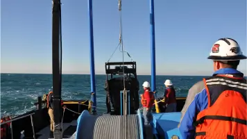
Hydrographic Surveys
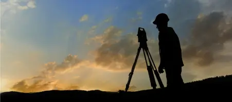
Topographic Surveys
GPS Surveys
Computer-Aided Drafting
Autonomous Remote Surveys
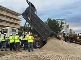
Beach Restoration Surveys
Coastal Monitoring
Water Management Surveys
Sub-bottom Profiling
Digital Terrain Modeling
Details
- Year established: 1985
Highlights and features
- 40+ years of experience in hydrographic and land surveying
- Certified by Florida Department of Environmental Protection in multiple survey types
- Own state-of-the-art survey equipment including RTK/GPS and multibeam sonar
- Specialized in complex coastal infrastructure and beach restoration projects
- Integrated with CSA Ocean Sciences for expanded geophysical capabilities
Associations and certifications
- Florida Department of Environmental Protection
Services
Hydrographic Surveys
We conduct comprehensive hydrographic surveys using multibeam sonar, side scan sonar, and ADCP technology. Our experts map underwater topography for coastal infrastructure, beach restoration, and navigation channel projects. With specialized vessels and advanced processing software, we deliver precise bathymetric data meeting strict engineering standards.
Topographic Surveys
Our topographic surveys capture detailed land features using RTK/GPS and total stations. We create digital terrain models for engineering design, canal cross-sections, and beach profile analysis. With automated data collection and 36+ years of CAD expertise, we produce accurate elevation models supporting construction and environmental projects.
GPS Surveys
We perform GPS surveys using static, fast static, and real-time kinematic methods. Our Trimble and Leica systems collect precise geospatial data for control networks and construction staking. With expertise in GP Survey and Trimble Business Center software, we deliver reliable positioning solutions for large-scale infrastructure projects.
Computer-Aided Drafting
Our CAD team converts survey data into actionable engineering documents using AutoCAD Civil 3D and Bentley Open Roads Designer. We create detailed plans from millions of data points, supporting environmental analysis and construction planning. With 36+ years of experience, we ensure accurate visual representations meeting industry standards.
Autonomous Remote Surveys
We deploy autonomous surface vehicles for efficient hydrographic data collection. Our custom ASVs reduce field time while maintaining precision for sediment mapping and channel surveys. This technology enhances safety and accuracy in challenging environments, providing cost-effective solutions for large-scale coastal projects.
People
David W. Coggin
Vice President
Co-founder with 46+ years of survey experience, managing daily operations and hydrographic projects. Expert in marine operations and coastal surveys, ensuring quality control and client satisfaction through technical leadership.
Chris A. Gammon
Project Manager
42+ years of expertise in boundary and topographic surveys using conventional and GPS technologies. Proficient in CAD software and survey data processing, delivering accurate engineering documentation for complex infrastructure projects.
Paul C. Voute
Field Supervisor
Experienced field supervisor with extensive knowledge of land and hydrographic surveys. Skilled in GPS systems and survey equipment, managing coastal monitoring projects and ensuring precise data collection for environmental and infrastructure applications.
Matt A. Barker
Field Supervisor
32+ years of surveying experience specializing in beach nourishment and geodetic surveys. Trains field crews and operates survey vessels, combining technical expertise with safety leadership for coastal and land projects.
Don Donaldson
Hydrographic Project Manager
13+ years of hydrographic survey experience, managing dredging and environmental projects. Expert in hydrographic software and field equipment troubleshooting, delivering precise data for coastal engineering and FEMA documentation.
Questions
What survey technologies does Morgan & Eklund use?
We use RTK/GPS, multibeam sonar, side scan sonar, ADCP, and autonomous surface vehicles. Our CAD team utilizes AutoCAD Civil 3D and Bentley Open Roads Designer for data processing and visualization.
How long has Morgan & Eklund been in business?
We've provided surveying services since 1985, with our founding team establishing expertise in Florida's coastal engineering sector before forming the company.
What geographic areas do you serve?
Primarily Florida's coastal counties including Miami-Dade, Palm Beach, and Brevard. We also support nationwide projects through our equipment resources and sister company partnerships.
What certifications do your surveyors hold?
Our team includes four registered professional surveyors certified by the Florida Department of Environmental Protection in boundary, topographic, control, and hydrographic surveys.
What project types do you specialize in?
We focus on beach restoration, coastal monitoring, water management, port improvements, and environmental resource mapping projects requiring precise hydrographic and topographic data.
Can you handle emergency survey needs?
Yes, we provide post-hurricane emergency survey services for damage assessment and restoration planning using our rapid deployment equipment and experienced field crews.