
Business Details
Your Trusted Land Surveying Partner in Boise, Idaho
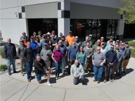
Idaho Survey Group has been a trusted leader in land surveying and construction staking for over two decades. Our commitment to precision, cutting-edge technology, and client satisfaction has solidified our reputation as the premier surveying firm in southern Idaho. With a team of skilled professionals, including licensed land surveyors, survey technicians, and 22 dedicated field crews, we deliver accurate and timely results tailored to each client's unique needs. Our expertise spans subdivision platting, commercial projects, public works, telecommunications, and mixed-use developments, ensuring comprehensive solutions for architects, engineers, developers, and government agencies. We prioritize attention to detail, legal compliance, and advanced methodologies to address complex boundary challenges and terrain analysis.Our annual completion of over 300 projects, including more than 800 platted lots, demonstrates our capacity to handle large-scale developments with efficiency and reliability. From topographic surveys to elevation certificates and drone-based aerial mapping, we integrate innovation with traditional expertise to meet evolving industry standards. Our client-focused approach ensures transparent communication, adherence to regulatory requirements, and support throughout every project phase. With offices in Boise, we serve the Treasure Valley and surrounding regions, providing dependable surveying services that empower informed decision-making and successful project outcomes.

Services
Subdivision Platting
Commercial Land Surveys
Public Works Surveying
Telecommunications Surveys
Topographic Surveying
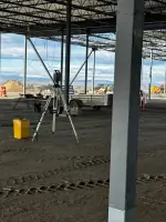
Construction Layout Staking
Elevation Certificates
Aerial Drone Mapping
Highlights and features
- We have over 20 years of experience in Idaho land surveying.
- Our team includes licensed surveyors and 22 dedicated field crews.
- We complete 300+ projects annually with advanced technology.
- Our surveys ensure legal compliance and precise boundary documentation.
- We provide tailored solutions for commercial, residential, and public works projects.
Services
Subdivision Platting
Subdivision platting services transform large land tracts into legally compliant parcels with precise boundary documentation. Our team navigates zoning regulations, prepares metes-and-bounds or lot-and-block descriptions, and ensures adherence to municipal requirements for easements, utilities, and infrastructure. This service supports residential communities, commercial developments, and large-scale planned projects across Idaho.
Commercial Land Surveys
Commercial land surveys provide detailed measurements and legal descriptions for property transactions, development, and construction. We assess terrain, utilities, and boundary conditions to support architects, engineers, and title companies. Our surveys facilitate grading plans, drainage solutions, and regulatory compliance for commercial properties throughout southern Idaho.
Public Works Surveying
Public works surveying supports government projects including roads, parks, utilities, and transportation systems. We deliver boundary verification, easement documentation, and environmental impact assessments. Our independent surveys assist municipalities and contractors in meeting regulatory standards and policy requirements for federally funded infrastructure initiatives.
Telecommunications Surveys
Telecommunications surveys ensure compliance for cell tower installations and expansions. We conduct boundary and topographic surveys, FAA certification, zoning analysis, and easement documentation. Our services address federal, state, and local regulations for tower height, setbacks, and utility access across Idaho's growing telecom infrastructure.
Aerial Drone Mapping
Aerial drone mapping captures high-resolution topographic data using lidar and photogrammetry. This technology enables efficient site analysis for large or complex terrains, supporting construction planning, environmental assessments, and land development projects with rapid, accurate data collection across southern Idaho.
Questions
What types of land surveying services do you offer?
We provide subdivision platting, commercial land surveys, public works mapping, telecommunications surveys, topographic analysis, construction staking, and aerial drone mapping.
Which areas do you serve?
We primarily serve southern Idaho, including the Treasure Valley, Boise Metro Area, and surrounding regions for all surveying needs.
How experienced is your team?
Our team includes licensed surveyors, technicians, and 22 field crews with over 20 years of combined experience in Idaho land surveying.
Can you handle large-scale development projects?
Yes, we manage complex projects annually, including 300+ surveys and 800+ platted lots for residential, commercial, and infrastructure developments.
What technology do you use?
We utilize advanced tools including drones for aerial mapping, lidar for topographic surveys, and precision equipment for boundary and construction staking.