Business Details
Professional Land Surveying & 3D Laser Scanning Services in Utah
Diamond Land Surveying has been serving clients across Utah and the Western United States for over two decades. Our team of professional land surveyors combines advanced technology with time-tested methodologies to deliver precise and reliable solutions for commercial, residential, and industrial projects. With expertise in 3D laser scanning, boundary surveys, and construction staking, we prioritize client collaboration to align our services with specific project goals. Our commitment to innovation ensures we remain at the forefront of surveying technology, including drone-based data collection and digital modeling. We emphasize transparency, ethical practices, and personalized support to build lasting client relationships.Our professionals bring over 15 years of specialized experience in laser scanning and 3D modeling, ensuring high-quality deliverables for complex projects. By focusing on accuracy and efficiency, we help clients mitigate risks and streamline decision-making processes. Our dedication to continuous learning allows us to adapt to evolving industry standards and regulatory requirements. We serve as a trusted partner for land developers, architects, and homeowners seeking expert surveying solutions. With offices in Salt Lake City, we remain deeply invested in understanding local land use challenges while delivering nationwide expertise.
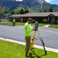
Services
3D Laser Scanning
Boundary Survey
Construction Staking
ALTA Survey
Subdivision Survey
Topography Survey
UAV Aerial Surveying
Easement Drafting
BIM Survey
Lot Consolidation Plat
Highlights and features
- We offer over 20 years of experience in land surveying and 3D modeling.
- Our team uses leading technology like UAV aerial surveying and 3D laser scanning.
- We specialize in complex commercial and industrial surveying projects.
- Our client-centric approach ensures tailored solutions for every project.
- We maintain deep expertise in Utah's land use regulations and boundary laws.
Services
3D Laser Scanning
Our 3D laser scanning services capture precise spatial data for industrial plants, buildings, and infrastructure projects. Using advanced equipment, we convert real-world environments into detailed digital models for engineers and architects. This technology supports redesigns, renovations, and construction planning with millimeter accuracy across Utah and the Western U.S.
Boundary Survey
We conduct boundary surveys to establish legal property lines for residential, commercial, and industrial landowners. Our licensed surveyors analyze historical records and field data to resolve disputes and ensure compliance with Utah regulations. Clients receive certified documentation for real estate transactions or development projects.
Construction Staking
Our construction staking services guide infrastructure projects with exact elevation and alignment markers. We collaborate with contractors to translate blueprints into physical site layouts for roads, utilities, and buildings. This ensures adherence to design specifications and minimizes costly errors during development.
ALTA Survey
We perform ALTA/NSPS land title surveys meeting national standards for commercial property transactions. These detailed surveys identify easements, encroachments, and improvements to satisfy lenders and title companies. Our reports include certifications for risk assessment during real estate acquisitions.
Subdivision Survey
Our subdivision surveys partition large tracts into smaller lots while complying with local zoning laws. We design road access, utility corridors, and green spaces to maximize land value. Clients receive plat maps approved by municipal authorities for residential or commercial developments.
Questions
What surveying services do you offer?
We provide 3D laser scanning, boundary surveys, construction staking, ALTA surveys, subdivision plats, and UAV aerial surveying for commercial, residential, and industrial clients.
Which areas do you serve?
We operate throughout Utah, including Salt Lake City, Provo, Ogden, and St. George, as well as neighboring Western states.
How experienced is your team?
Our surveyors have over 20 years of combined experience, with 15+ years specializing in 3D laser scanning and digital modeling technologies.
What makes you different from competitors?
We combine advanced tools like drones and laser scanners with deep knowledge of Utah's land regulations to deliver faster, more accurate results.
Can you handle complex projects?
Yes, we specialize in challenging assignments for industrial facilities, large-scale developments, and infrastructure projects requiring high-precision data.
How do I request a quote?
Contact us at 801-266-5099 or through our website to discuss your project details and receive a customized cost estimate.