Business Details
49 Years
experience
Your Trusted Land Surveying Partner in Centerville, Utah
At REDCON, we have dedicated ourselves to delivering precise and reliable land surveying services since 1977. Our team of licensed professionals brings over 76 years of combined experience, ensuring projects are completed on time and within budget while adhering to strict legal and technical standards. We specialize in boundary surveys, construction surveys, and high-definition 3D scanning, utilizing cutting-edge technology to enhance accuracy and efficiency. Our commitment to innovation is demonstrated through our use of advanced tools like the Leica ScanStation C10, which reduces field time and improves data quality. As a certified Disadvantaged Business Enterprise (DBE) in Utah, we support contractors in meeting federal DBE requirements through our extensive involvement in infrastructure projects.Our clients include government agencies, commercial contractors, and utility companies across Utah and the Intermountain West. We prioritize safety, transparency, and client collaboration, ensuring every project meets the highest standards of quality and compliance. Our expertise extends to forensic surveys, ALTA/NSPS land title surveys, and flood elevation certifications, addressing diverse industry needs. With a focus on technological advancement and client satisfaction, REDCON remains a trusted partner for surveying solutions in complex environments.
Services
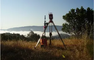
Land Mapping
Property Boundary Surveying
Right-of-Way Services
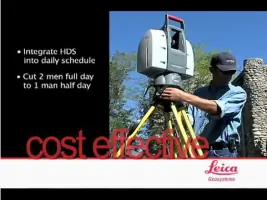
High Definition 3D Scanning
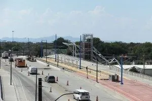
Construction Surveying
ALTA Survey
Forensic Surveying
Flood Elevation Certificate
Details
- Year established: 1977
Highlights and features
- We have 35 years of experience in land surveying and mapping.
- Our staff holds 76 combined years of professional surveying expertise.
- We utilize high-definition 3D laser scanning to improve accuracy and efficiency.
- We are a certified DBE minority-owned business in Utah.
- We serve government agencies, commercial contractors, and utility companies across five western states.
Associations and certifications
- Disadvantaged Business Enterprise (DBE)
Services
Land Mapping
REDCON provides comprehensive land mapping services using advanced GPS and 3D scanning technology. Our solutions support infrastructure development, environmental planning, and legal documentation. Clients benefit from precise topographic data and efficient project execution.
Property Boundary Surveying
Our property boundary surveys establish accurate land ownership lines through title research and field measurements. This service ensures legal compliance for real estate transactions, construction projects, and dispute resolution across Utah and surrounding states.
High Definition 3D Scanning
Using the Leica ScanStation C10, we capture detailed 3D models of structures and landscapes. This technology reduces field time by up to 10x while providing photo-realistic data for forensic analysis, construction planning, and asset management.
Construction Surveying
REDCON's construction surveys guide infrastructure projects with precise staking and elevation data. Our team supports highway, bridge, and utility projects, ensuring alignment with design specifications and minimizing costly rework.
Forensic Surveying
We conduct forensic surveys for accident and crime scene documentation, producing court-admissible 3D models and plats. Our data supports legal proceedings with accurate spatial analysis and expert testimony.
Questions
What surveying services does REDCON offer?
REDCON provides land mapping, boundary surveys, 3D scanning, construction surveys, ALTA surveys, forensic surveys, and flood elevation certificates.
Is REDCON a certified DBE business?
Yes, we are a certified Disadvantaged Business Enterprise in Utah, helping contractors meet federal DBE requirements.
What technology does REDCON use?
We use the Leica ScanStation C10, Trimble GPS rovers, robotic total stations, and advanced software for accurate, efficient surveys.
Which areas does REDCON serve?
We operate in Utah, Idaho, Wyoming, Nevada, and Arizona, focusing on government and infrastructure projects.
How does REDCON ensure survey accuracy?
Our licensed surveyors follow strict standards and use cutting-edge technology to deliver legally compliant, precise results.