Business Details
Precision Aerial Survey & Mapping Services in Costa Mesa, CA
Geospatial Professional Solutions, Inc. (Geospatial Professional Solutions) delivers precision aerial survey and mapping services for engineering firms, municipalities, and government agencies. Founded with a legacy rooted in photogrammetric expertise dating back to the 1970s, our certified small woman-owned minority business combines decades of experience with cutting-edge technology. Our team of certified photogrammetrists and GIS professionals specializes in aerial triangulation, Lidar, orthophotography, and rigorous quality control standards. With a 30-year track record of exceeding client expectations, we serve diverse sectors including transportation, utilities, and land development.Our investment in advanced tools like the UltraCam Falcon camera and RIEGL LMS-Q780 Lidar sensor ensures high-accuracy deliverables. We maintain a high client retention rate through technical excellence, transparent communication, and tailored project management. Our leadership team remains directly involved in daily operations, ensuring seamless execution of mission-critical projects. By blending the stability of an established firm with the agility of a small business, we provide innovative geospatial solutions that meet evolving industry demands.

Services
Aerial Survey
Lidar Services
Photogrammetric Mapping
Digital Orthophotography
GIS Integration
Highlights and features
- 30-year legacy of delivering mission-critical geospatial solutions
- Certified photogrammetrists and GIS professionals on staff
- First in North America to deploy UltraCam Falcon digital aerial camera
- Pioneering West Coast provider of full waveform Lidar services
- Rigorous adherence to industry mapping and quality control standards
What people say
Extraordinary service
High quality products
Top-notch service
Outstanding work
Responsive throughout
Services
Aerial Survey
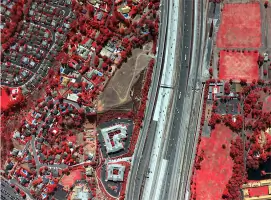
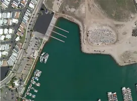
Our aerial survey services utilize advanced digital cameras and GPS technology to capture precise geospatial data. We deliver high-resolution orthophotography and topographic maps for infrastructure planning and environmental monitoring. Clients benefit from our expertise in meeting rigorous engineering and municipal project requirements.
Lidar Services
Full waveform Lidar data acquisition and processing using RIEGL LMS-Q780 technology. We provide detailed terrain models and feature classifications for complex projects. Our services support accurate volumetric calculations and infrastructure analysis in challenging environments.
Photogrammetric Mapping
Precision photogrammetric mapping combines stereo imagery with ground control for accurate spatial data. We produce detailed topographic maps and digital elevation models. This service supports engineering design and land development projects requiring exacting specifications.
Digital Orthophotography
High-resolution digital orthophotography with multiple ground sample distance options. We create georeferenced image mosaics for urban planning and environmental applications. Our calibrated imaging systems ensure consistent radiometric quality across large project areas.
GIS Integration
GIS data integration and analysis services support comprehensive project planning. We combine mapping data with attribute databases for asset management and decision-making. Our solutions maintain compatibility with industry-standard GIS platforms.
People
Alice Ramos
Chief Executive Officer/President
Certified photogrammetrist and GIS professional with university-level teaching experience. Specializes in aerial triangulation, orthophotography, and quality control. Former ASPRS Southwest Regional Director with extensive project management expertise.
Paul Rivers
Chief Operating Officer
30-year photogrammetry expert with deep project management and client relations experience. Manages sales initiatives and technical operations. Maintains long-standing client partnerships through tailored service delivery.
Ramon Ramos
Executive Vice President
California Licensed Land Surveyor and ASPRS-certified photogrammetrist. Technical lead with 35 years of mapping and QA/QC expertise. Former ASPRS Southwest Regional Director with strong client relations focus.
Deborah Ninow
Head of Photogrammetric Operation
Quality control specialist managing digital photogrammetry operations. Trains stereo-compilation teams and ensures compliance with strict production standards. Expert in digital aerial triangulation and map finishing.
Questions
What industries do you serve?
We serve transportation, utilities, municipalities, land development, and environmental sectors with specialized geospatial solutions.
What technologies do you use?
We employ UltraCam Falcon digital cameras, RIEGL LMS-Q780 Lidar sensors, and advanced photogrammetric software for precise data capture.
Are your team members certified?
Yes, our principals are ASPRS-certified photogrammetrists with decades of combined industry experience.
How do you ensure project quality?
We maintain rigorous QA/QC standards through certified processes, experienced personnel, and advanced calibration techniques.
Can you handle large-scale projects?
Yes, we've completed projects spanning thousands of acres with complex deliverables for major infrastructure developments.
How do you support client communication?
We provide regular project updates and maintain direct communication channels with dedicated project managers.